Maps of Merrick
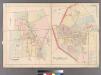
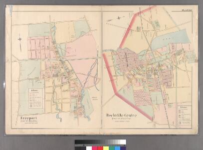
Plate 15: Freeport, Town of Hempstead - Rockville Centre, Town of Hempstead.
from Atlas of Queens Co., Long Island, New York / compiled from official records, private plans & actual surveys by and under the direction of Chester Wolverton.
Merrick
from Atlas of Nassau County, Long Island, N.Y. Complete in one volume. Historical, statistical. Based upon maps on file at the county seat in Mineola and upon private plans and surveys furnished by surveyors and individual owners. Supplemented by careful measurements & field observations by our own corps of engineers.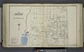
Section 1 of Freeport
from Atlas of Nassau County, Long Island, N.Y. Complete in one volume. Historical, statistical. Based upon maps on file at the county seat in Mineola and upon private plans and surveys furnished by surveyors and individual owners. Supplemented by careful measurements & field observations by our own corps of engineers.
Section 6 of Freeport
from Atlas of Nassau County, Long Island, N.Y. Complete in one volume. Historical, statistical. Based upon maps on file at the county seat in Mineola and upon private plans and surveys furnished by surveyors and individual owners. Supplemented by careful measurements & field observations by our own corps of engineers.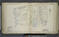
Section 5 of Freeport
from Atlas of Nassau County, Long Island, N.Y. Complete in one volume. Historical, statistical. Based upon maps on file at the county seat in Mineola and upon private plans and surveys furnished by surveyors and individual owners. Supplemented by careful measurements & field observations by our own corps of engineers.
Woodcleft
from Atlas of Nassau County, Long Island, N.Y. Complete in one volume. Historical, statistical. Based upon maps on file at the county seat in Mineola and upon private plans and surveys furnished by surveyors and individual owners. Supplemented by careful measurements & field observations by our own corps of engineers.
Freeport
1 : 24000
Freeport
1 : 24000
Freeport
1 : 24000
Freeport
1 : 24000
Freeport
1 : 24000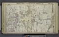
Freeport, Merrick, Belimore, Wantagh, Massapequa, Etc.
from Atlas of Nassau County, Long Island, N.Y. Complete in one volume. Historical, statistical. Based upon maps on file at the county seat in Mineola and upon private plans and surveys furnished by surveyors and individual owners. Supplemented by careful measurements & field observations by our own corps of engineers.
Bellmore
from Atlas of Nassau County, Long Island, N.Y. Complete in one volume. Historical, statistical. Based upon maps on file at the county seat in Mineola and upon private plans and surveys furnished by surveyors and individual owners. Supplemented by careful measurements & field observations by our own corps of engineers.
Hempstead
1 : 62500
Hempstead
1 : 62500
Hempstead
1 : 62500
Hempstead
1 : 62500
Hempstead
1 : 62500
Hempstead
1 : 62500
Hempstead
1 : 62500
Hempstead
1 : 62500
Hempstead
1 : 62500
Hempstead
1 : 62500
Hempstead
1 : 62500
Hempstead
1 : 62500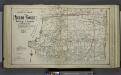
Lower section Index Map of Nassau County Long Island Published by E. Belcher Hype. 97 Liberty St. Brooklyn, 5 Beekman St. Manhattan. 1914.
from Atlas of Nassau County, Long Island, N.Y. Complete in one volume. Historical, statistical. Based upon maps on file at the county seat in Mineola and upon private plans and surveys furnished by surveyors and individual owners. Supplemented by careful measurements & field observations by our own corps of engineers.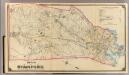
9 Stamford.
1 : 18000 Hyde & Company
Panorama of the Borough of the Bronx issued by the Bronx Home News.
From Bronx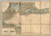
New York Bay And Harbor.
1 : 79200 United States Coast Survey