Mapa catalogado
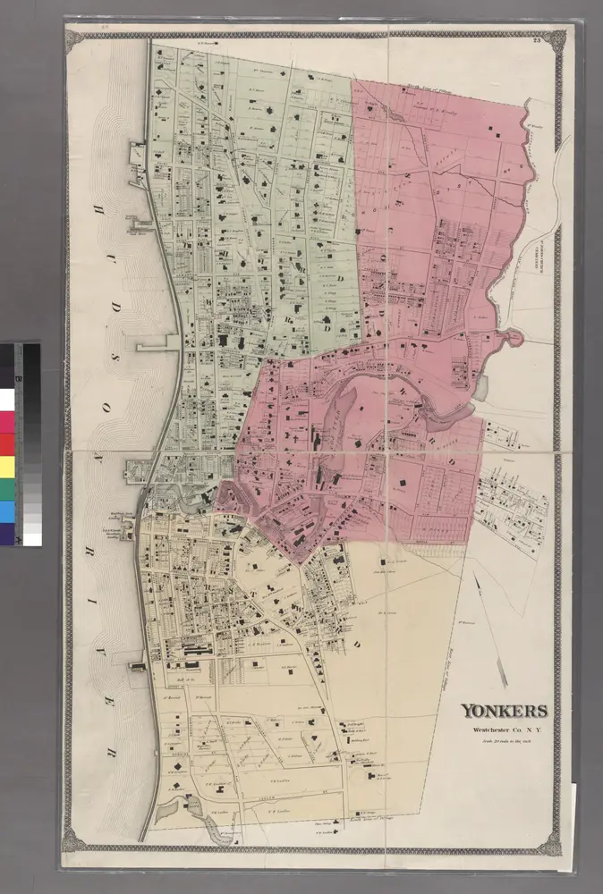
Plates 28 & 29: Portions of 2nd, 3rd and 4th Wards of the City of Yonkers, Westchester Co. N.Y.
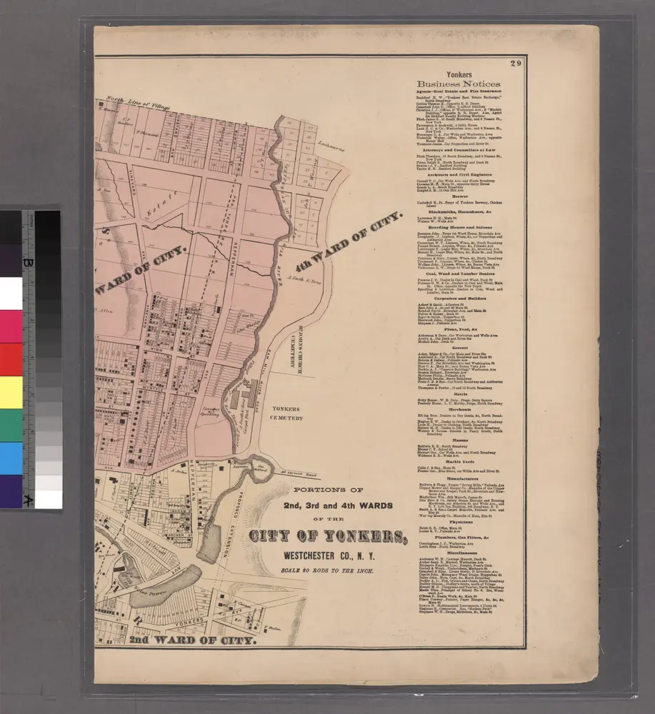

Título completo:Plates 28 & 29: Portions of 2nd, 3rd and 4th Wards of the City of Yonkers, Westchester Co. N.Y.
Año de ilustración:1872
Tamaño físico:20 x 30 cm
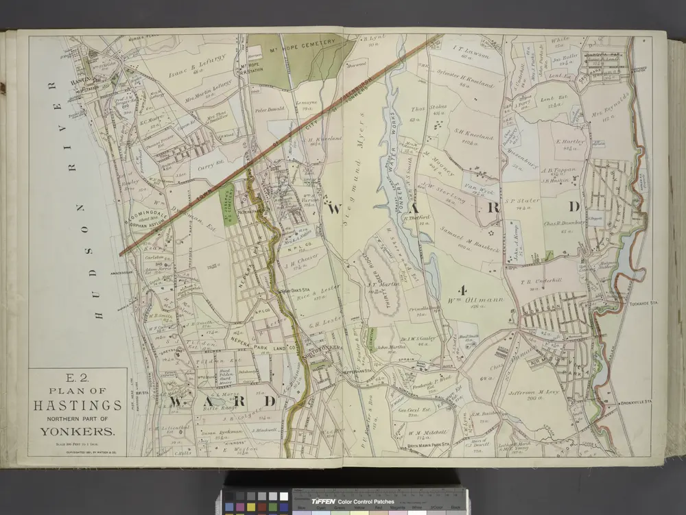
Plan of Hastings Northern part of Yonkers.
1891
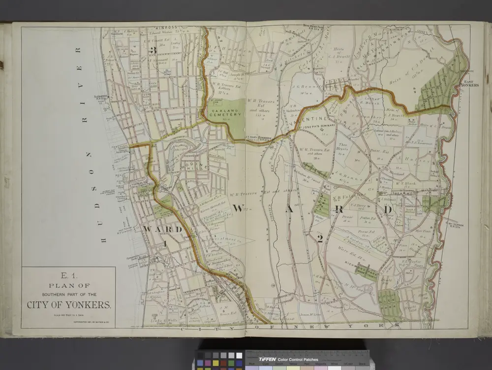
Plan of Southern part of the City of Yonkers.
1891
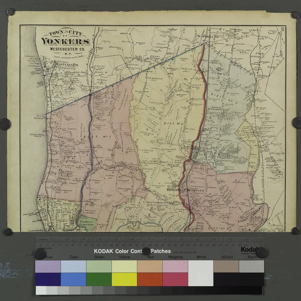
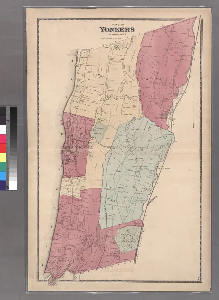
Plates 21 & 22: Town and City of Yonkers, Westchester Co. N.Y. - Town of East Chester, Westchester Co. N.Y.
1872
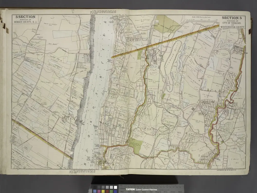
Portion of Bergen County, N.J.; Portion of City of Yonkers. And Westchester County
1891
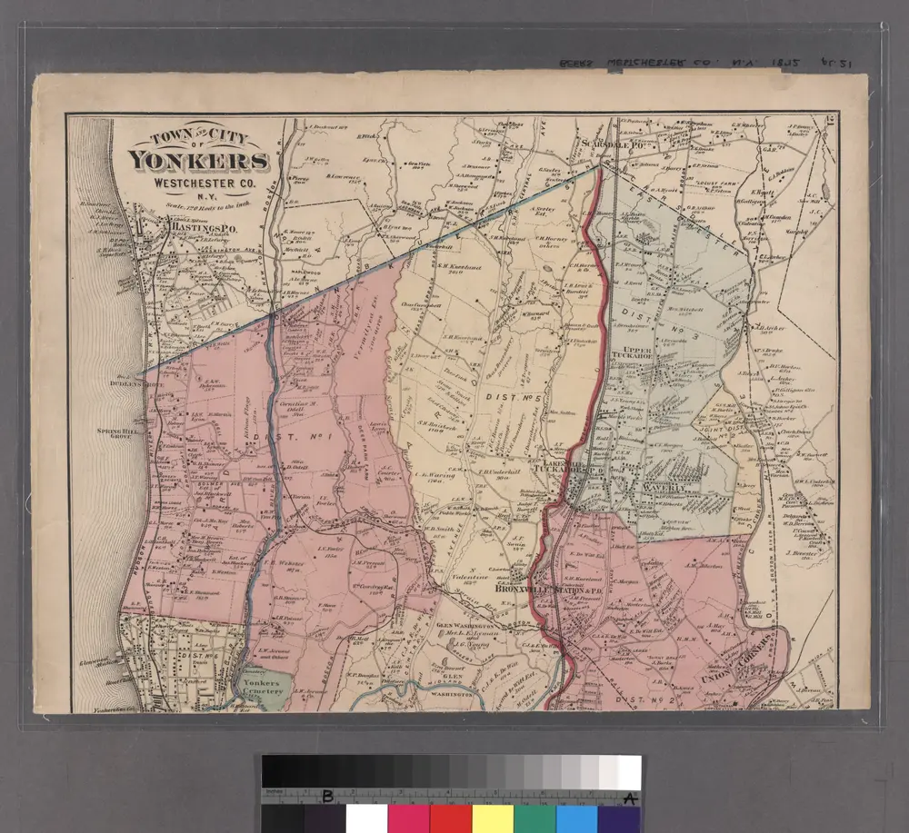
Plates 21 & 22: Town and City of Yonkers, Westchester Co. N.Y. - Town of East Chester, Westchester Co. N.Y.
1872
Large folder - L1
1868
Large folder - L1
1868
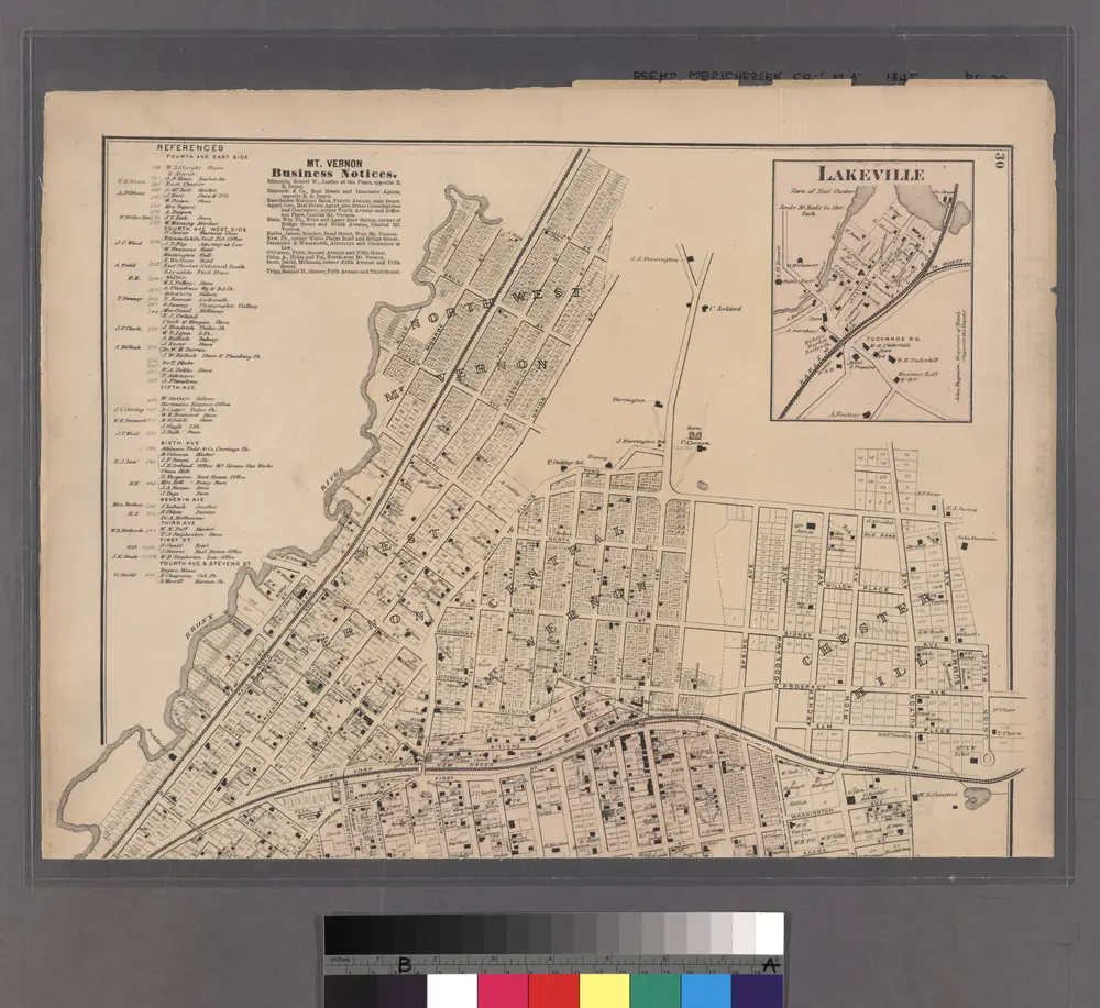
Lakeville - Washingtonville - East Chester.
1872
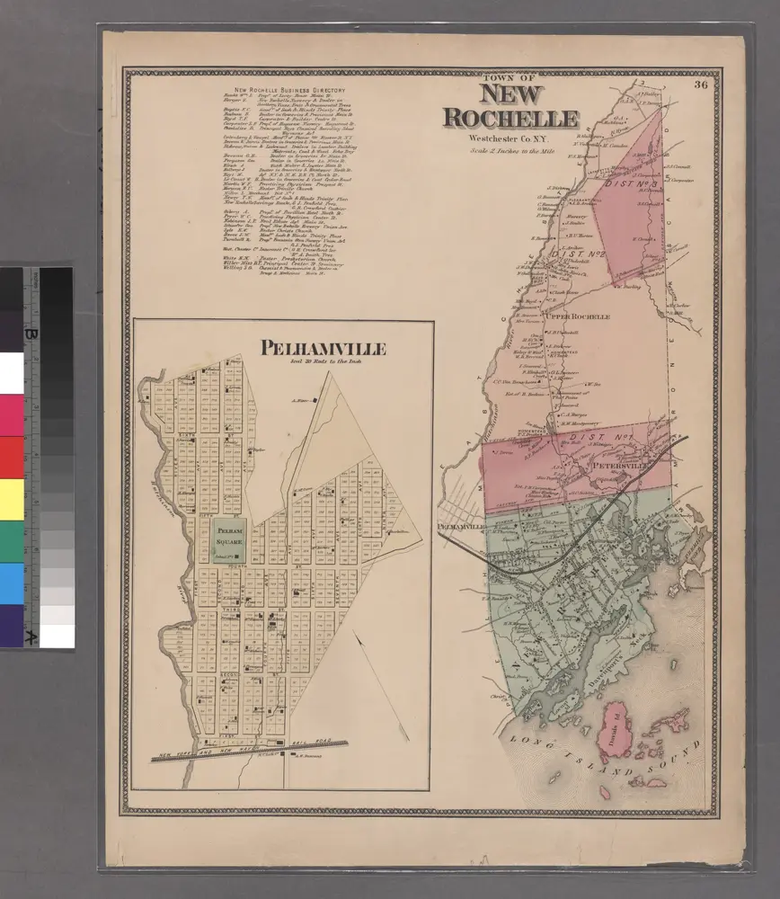
Plate 36: Town of New Rochelle, Westchester Co. N.Y.
1868
Mount Vernon
1995
1:24k
Mount Vernon
1966
1:24k
Mount Vernon
1966
1:24k
Mount Vernon
1966
1:24k
Mount Vernon
1966
1:24k
Mount Vernon
1956
1:24k
Mount Vernon
1956
1:24k
Mt Vernon
1947
1:24k