Mapa catalogado
Plates 42 & 43: Tarrytown Heights Land Company, Plan of the Land, belonging to the Company.
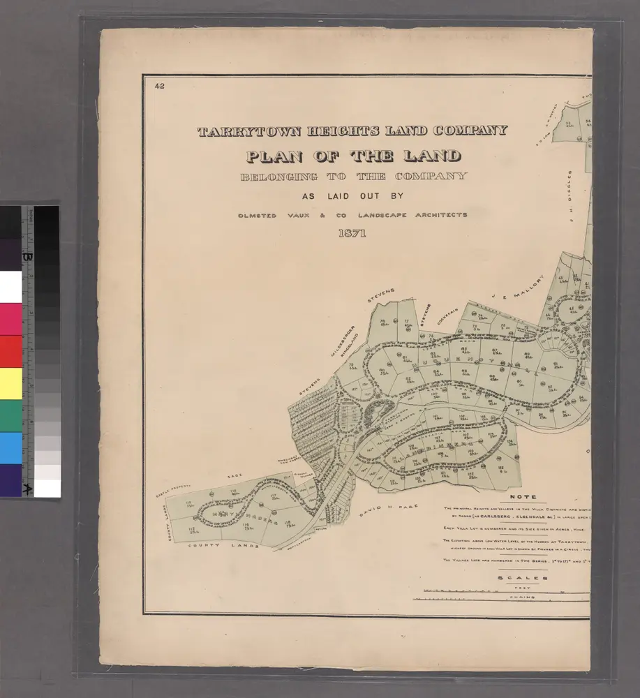

Título completo:Plates 42 & 43: Tarrytown Heights Land Company, Plan of the Land, belonging to the Company.
Año de ilustración:1872
Tamaño físico:20 x 30 cm
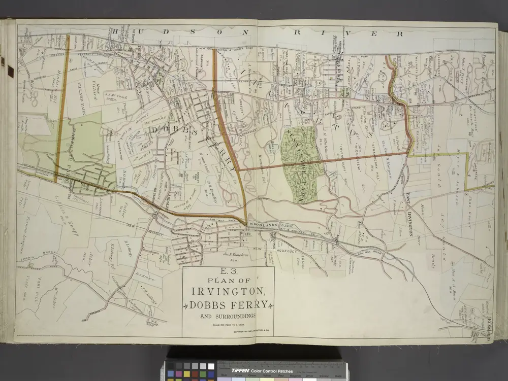
Plan of Irvington, Dobbs Ferry and Surroundings.
1891
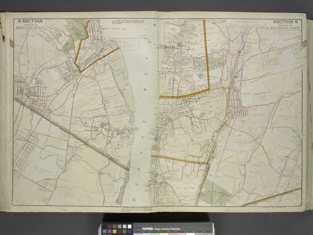
Portion of Rockland County. ; Portion of Westchester County.
1891
White Plains
1967
1:24k
White Plains
1967
1:24k
White Plains
1967
1:24k
White Plains
1957
1:24k
White Plains
1957
1:24k
White Plains
1947
1:24k
White Plains
1938
1:32k
White Plains
1938
1:32k
White Plains
1932
1:24k