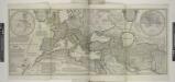
Maps of Europe

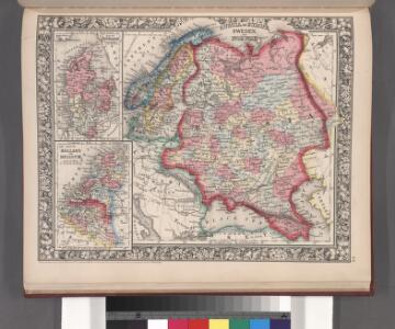
Russia in Europe, Sweden, and Norway ; Map of Denmark; Map of Holland and Belgium.
from New general atlas.
Nuove scoperte de'russi al nord del mare del Sud sí nell'Asia, che nell'America
1 Karte : Kupferdruck ; 30 x 39 cm Zatta presso Antonio Zatta
Europe.
from Carey's general atlas, improved and enlarged : being a collection of maps of the world and quarters, their principal empires, kingdoms, &c.
Discoveries made by Captains Cook & Clerke.
1 : 43000000 Carey, Mathew
Map of the Discoveries made by Captn Cook & Clerke.
1 : 42000000 Carey, Mathew
Map of the Discoveries made by Capts. Cook & Clarke in the Years 1778 & 1779.
1 : 43000000 Carey, Mathew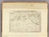
Map of the Discoveries made by Capts. Cook & Clerke.
1 : 43000000 Carey, Mathew
Map of the Discoveries made by Capts. Cook & Clerke.
1 : 43000000 Carey, Mathew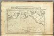
Map of the Discoveries made by Capts. Cook & Clerk.
1 : 30000000 Carey, Mathew
E. Asia, W. North America.
1 : 41000000 Seaman, James V.
State of Nations at the Christian aera From Pinkerton on the Goths.
1 : 40000000 Finley, Anthony
Verbreitung und Vertheilung der Europaischen Vogel.
1 : 20000000 Berghaus, Heinrich
Der noerdliche Theil des grossen Welt Meeres
1 Karte : Kupferdruck ; 48 x 65 cm Reichard im Verlage d. Industrie Comptoirs
North America.
1 : 7500000 Tanner, Henry S.
North America.
1 : 7500000 Tanner, Henry S.
Composite: North America.
1 : 7500000 Tanner, Henry S.
Composite: North America.
1 : 7500000 Tanner, Henry S.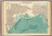
North Pacific Ocean.
1 : 25000000 John Bartholomew & Co.
Ethnographische Karte von Nordamerika.
1 : 28000000 Humboldt, Alexander von, 1769-1859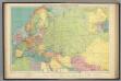
Europe's overland, sea communications.
1 : 20000000 Philip, George
Dated events, World War map, by Stanley Turner
1 : 13000000 Turner, Stanley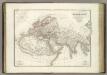
Carte du Monde connu des anciens.
1 : 26000000 Lapie, M. (Pierre), 1779-1850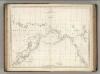
Chart of the Coasts of America and Asia.
1 : 19500000 La Perouse, Jean-Francois de Galaup, comte de, 1741-1788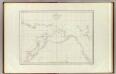
Cotes, l'Amerique, l'Asie.
1 : 25000000 La Perouse, Jean-Francois de Galaup, comte de, 1741-1788
Die Kaspi-Volga-Weißmeer/Ostseeroute im 17. Jahrhundert
Russland Handelsstraße
[Übersicht von Europa mit ethnograph. Begränzung der einzelnen Staaten, und den Völker-Sitzen in der Mitte des 19ten Jahrhunderts]
Zweiter Band, enthaltend in vier Abtheilungen die Vertheilung der Organismen: 5. Pflanzen-Geographie, 6. Thier-Geographie, 7. Anthropographie, 8. Ethnographie Humboldt, Alexander von Verlag von Justus Perthes
Carte des nouvelles decouvertes au nord de la mer du Sud
1 Karte : Kupferdruck ; 37 x 62 cm Santini; Remondini chez François Santini rue S.te Justine près de l'eglise, chez M. Remondini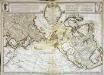
Carte des nouvelles découvertes au nord de la mer du Sud
1 Karte : Kupferdruck ; 37 x 62 cm Delisle; L'Isle; Buache s.n.
Europa zur Uebersicht der Flussgebiete und Höhenzüge
Hand-Atlas über alle Theile der Erde nach dem neuesten Zustande und über das Weltgebäude Stieler, Adolf bei Justus Perthes