编目地图
County map California; Map of the settlements in the Great Salt Lake country, Utah [inset] ; San Francisco Bay and vicinity [inset].

完整标题:County map California; Map of the settlements in the Great Salt Lake country, Utah [inset] ; San Francisco Bay and vicinity [inset].
描述:1860
物理尺寸:20 x 30 cm
Map of California and Nevada, with parts of Utah & Arizona
1879
United States. Army. Corps of Engineers
1:2m
Principal gas transmission, production, and distribution trunk lines with major gas and oil fields and manufactured gas plants : October 1, 1944
1944
Railroad Commission of the State of California
1:2m
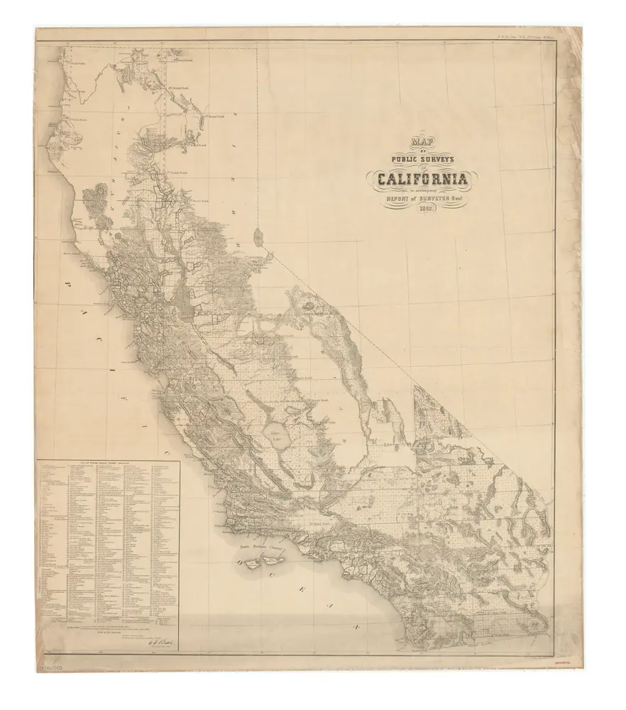
Map of public surveys in California : to accompany report of Surveyor Genl., 1862.
1862
Bien, Julius, 1826-1909.
1:1m
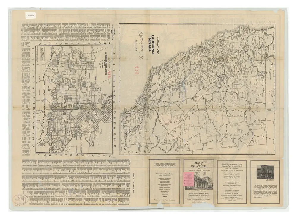
Map of Los Angeles, California Presented with Compliments of The Farmers and Merchants National Bank
1938
Hill, E.F. / Farmers and Merchants National Bank of Los Angeles
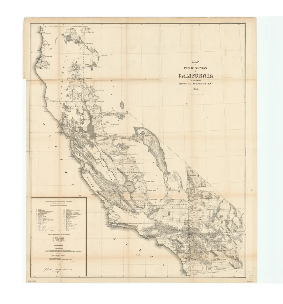
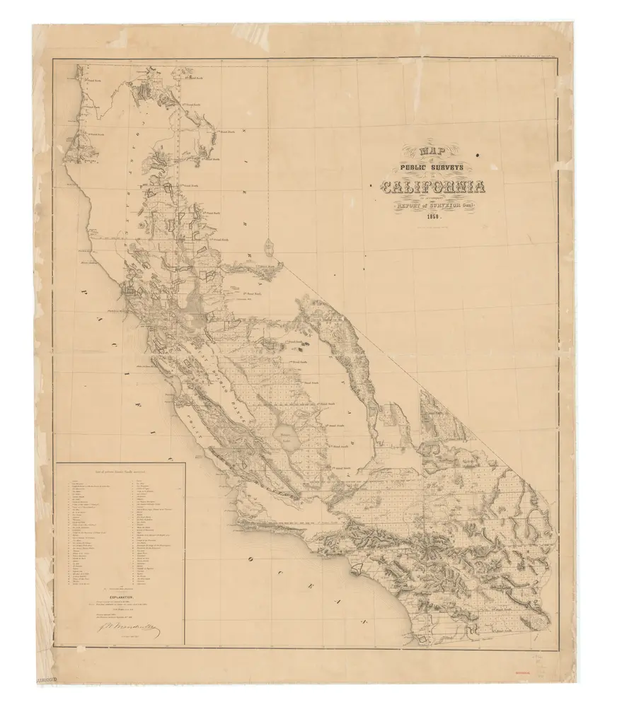
Map of public surveys in California : to accompany report of Surveyor Genl., 1857.
1857
United States. Surveyor General.
1:1m
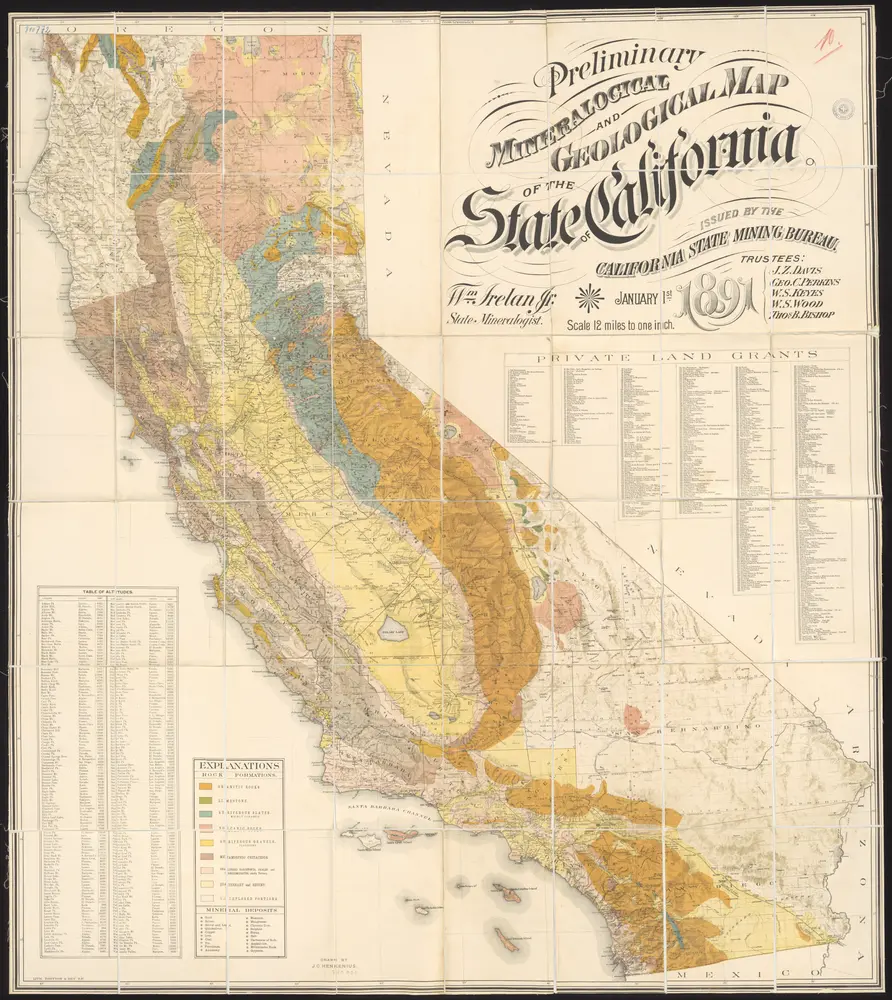
Preliminary mineralogical and geological map of the State of California
1891
Henkenius, J.C.
1:760k
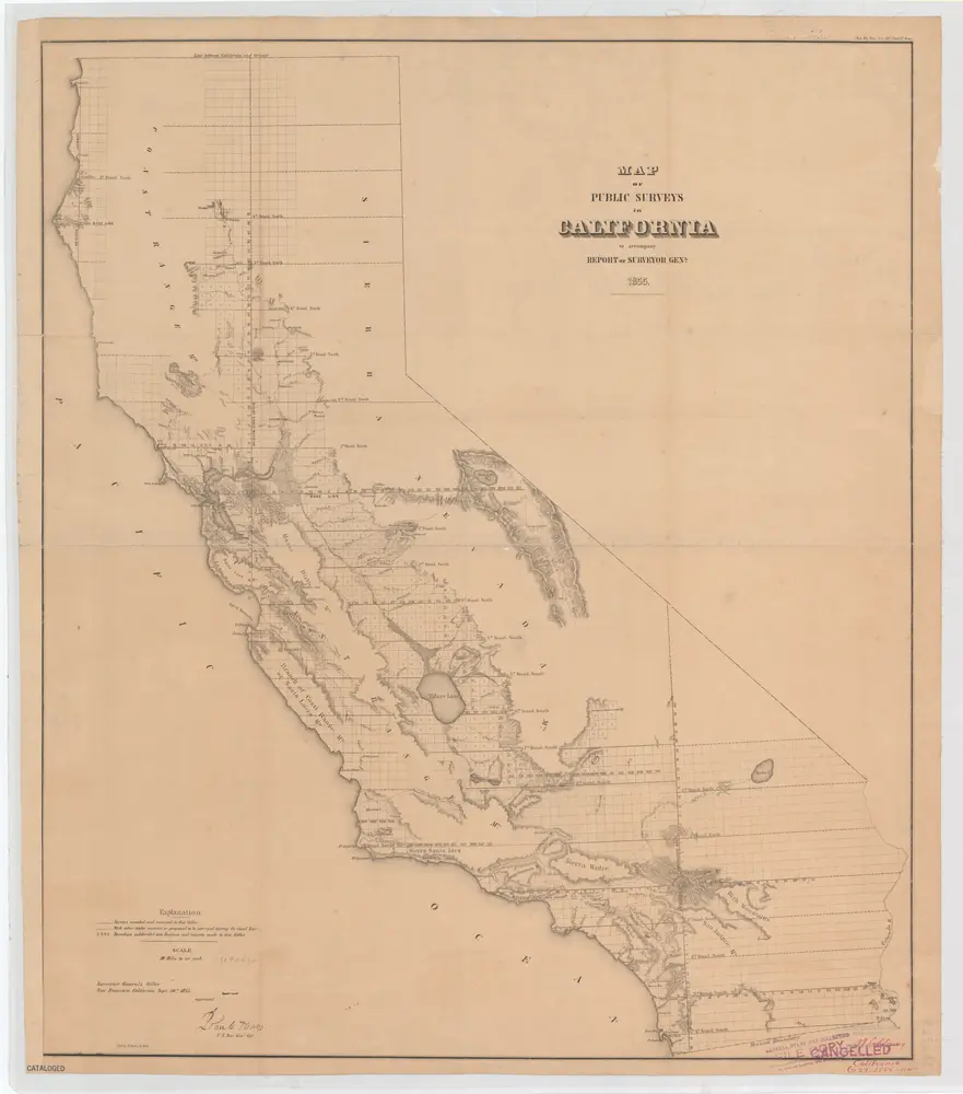
Map of public surveys in California : to accompany report of Surveyor Genl., 1855
1855
A. Hoen & Co.
1:1m
Map of public surveys in California : to accompany report of Surveyor Genl., 1858
1858
San Francisco, Calif. : Surveyor General's Office
1:1m
State of California : value of farm lands and buildings per acre
1936
Resettlement Administration, Land Utilization Division, Land-Use Planning Section, California Unit.
1:1m
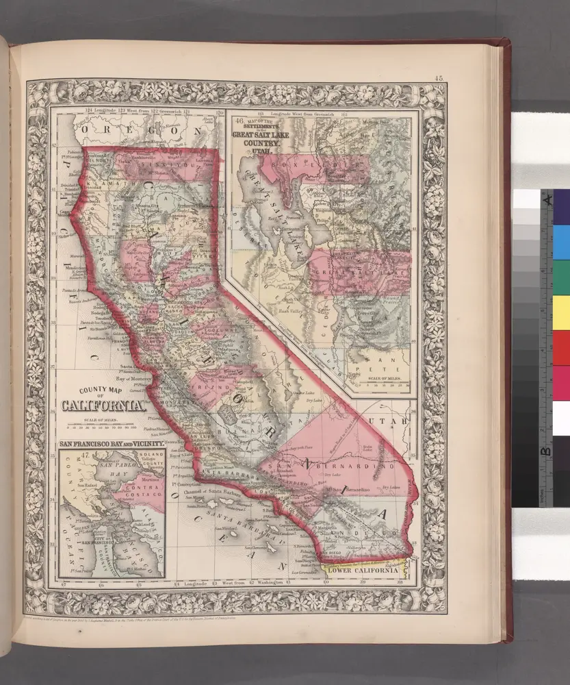
County map California; Map of the settlements in the Great Salt Lake country, Utah [inset] ; San Francisco Bay and vicinity [inset].
1860