Carte cataloguée
County map of Kentucky and Tennessee.

Titre complet:County map of Kentucky and Tennessee.
Année de l'image:1860
Taille physique:20 x 30 cm
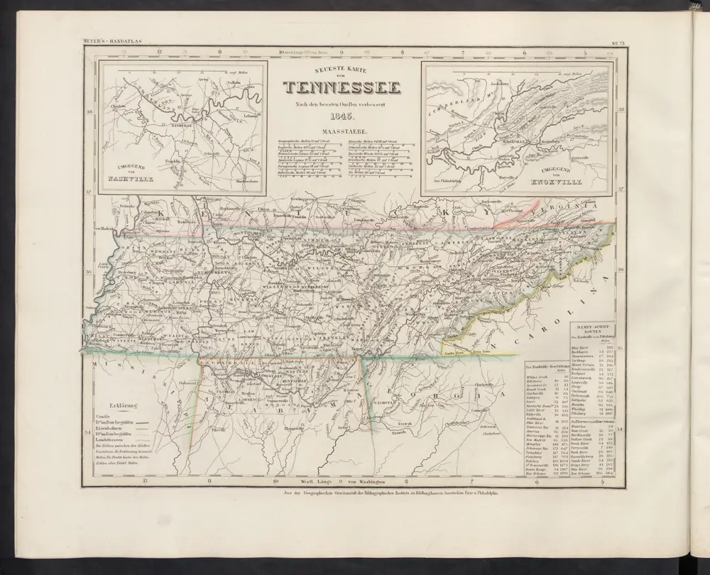
Neueste Karte von Tennessee
1860
Meyer, J.
Map of Tennessee
1818
Melish, John
1:1m
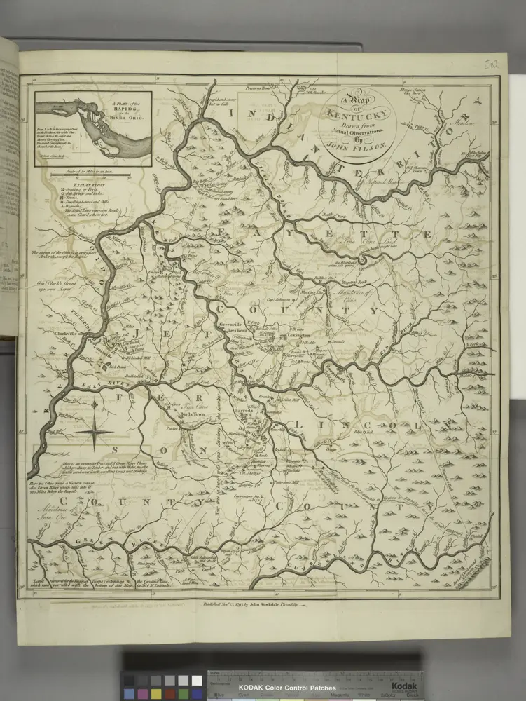
A map of Kentucky, drawn from actual observations by John Filson.
1794
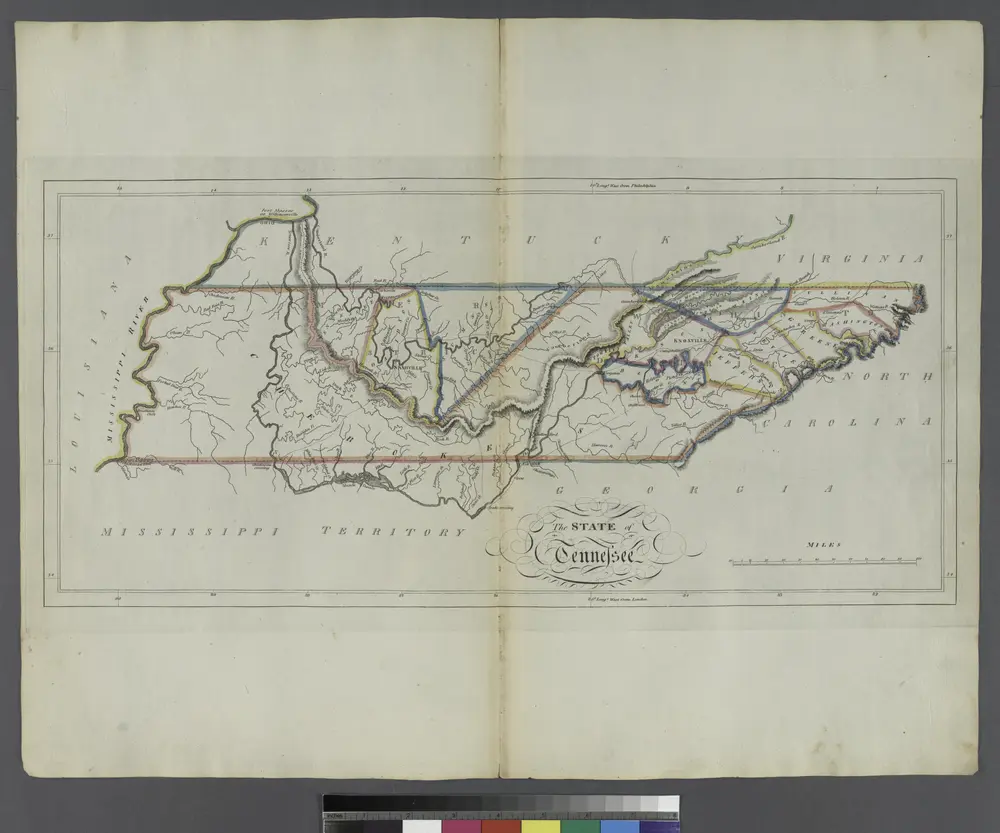
The State of Tennessee.
1814
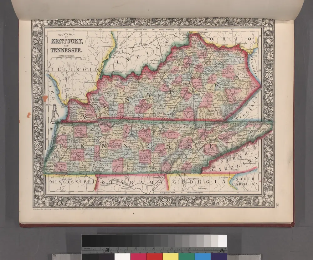
County map of Kentucky and Tennessee.
1860
Georgia, from the latest authorities
1796
Tanner, Benjamin
1:3m
Map of the south western part of the United States
1864
Virtue, Yorston & Co.
1:5m
A New map of the province of Maryland in North America
1780
Hinton, John
1:1m
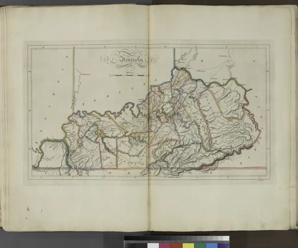
Kentucky.
1814
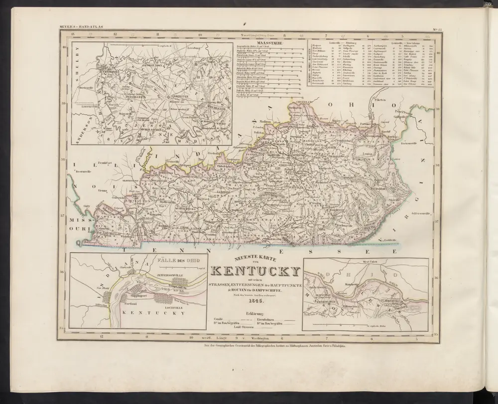
Neueste Karte von Kentucky mit seinen Strassen, Entfernungen der Hauptpunkte & Routen für Dampfschiffe
1860
Meyer, J.