Cataloged map
County map of Pennsylvania, New Jersey, Maryland and Delaware ; City of Philadelphia [inset]; City of Baltimore [inset].
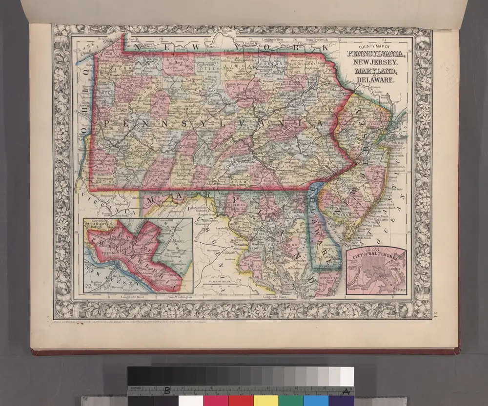

Full title:County map of Pennsylvania, New Jersey, Maryland and Delaware ; City of Philadelphia [inset]; City of Baltimore [inset].
Depicted:1860
Physical Size:20 x 30 cm
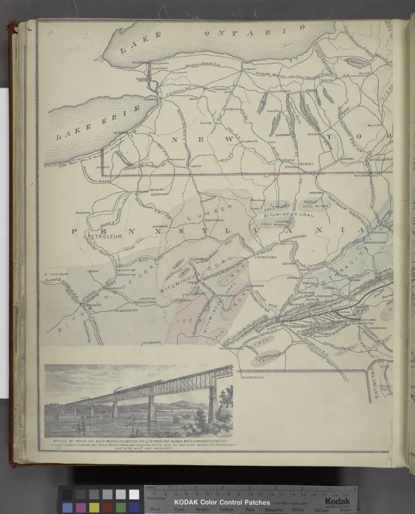
Bridge by which the South Mountain & Boston R.R. is to cross the Hudson River at Poughkeepsie, N.Y. ; The Map of South Mountain and Boston
1876
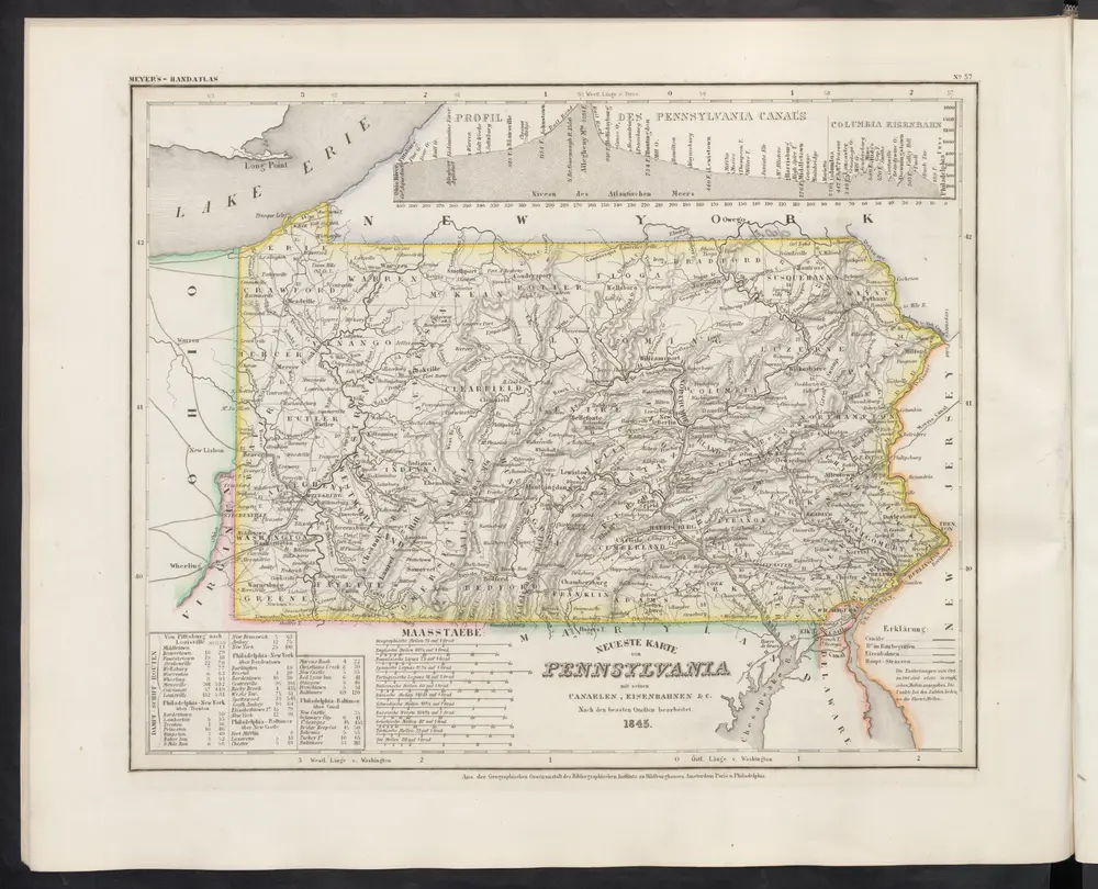
[Neueste Karte von Pennsylvania mit seinen Canaelen, Eisenbahnen und c.]
1860
Meyer, J.
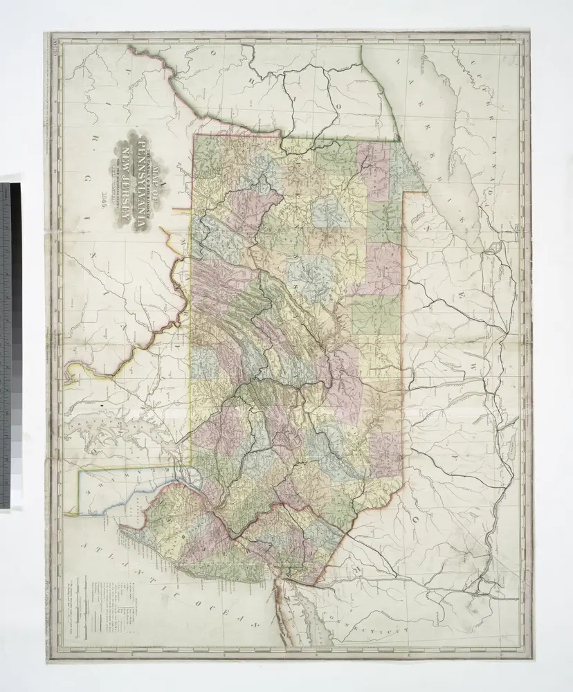
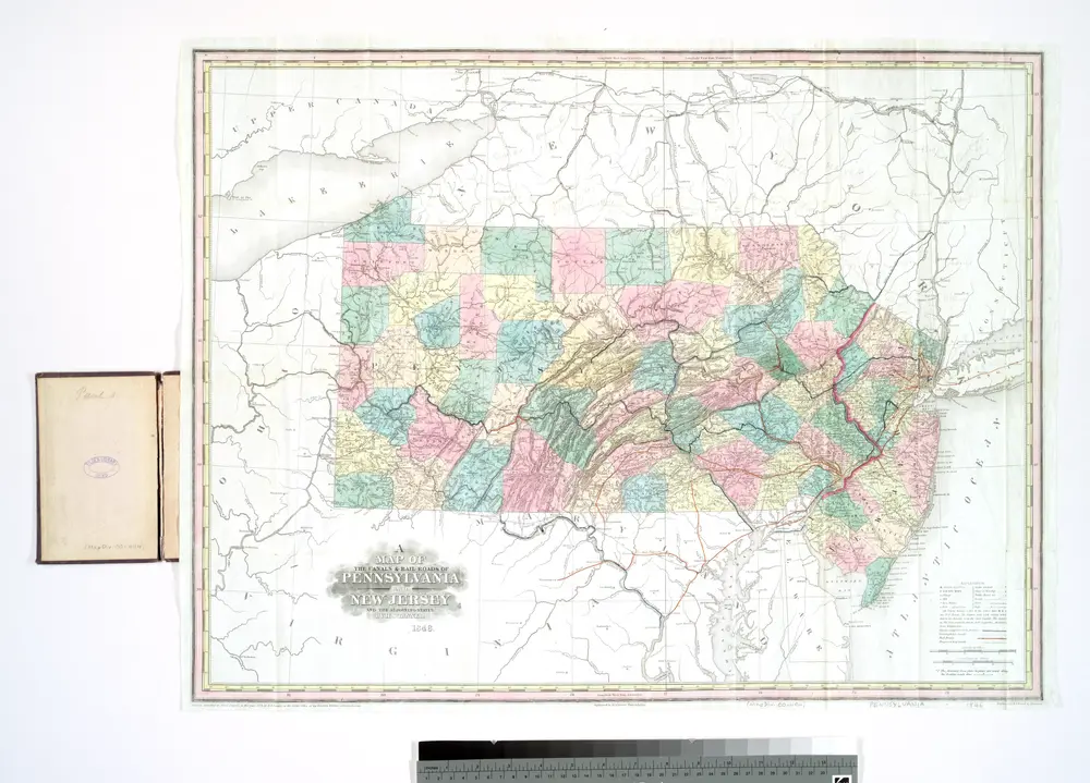
A map of the canals & rail roads of Pennsylvania and New Jersey, and the adjoining states / by H.S. Tanner; engraved by H.S. Tanner & assistants.
1845
A map of the canals & rail roads of Pennsylvania and New Jersey and the adjoining states / by H. S. Tanner; engraved by H.S. Tanner & assistants.
1839
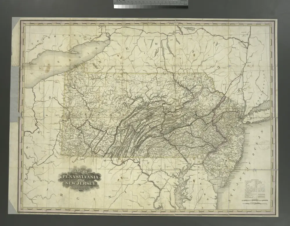
Map of Pennsylvania and New Jersey / by H.S. Tanner; engraved by H.S. Tanner & assistants.
1829
Pennsylvania
1797
Sotzmann, D. F
1:750k
The State of Pennsylvania
1795
Lewis, Samuel
1:1m
A map of Pennsylvania exhibiting not only the improved parts of that Province, but also its extensive frontiers
1775
Robert Sayer & John Bennett (Firm)
1:365k
A map of the state of Pennsylvania
1817
Howell, Reading
1:653k
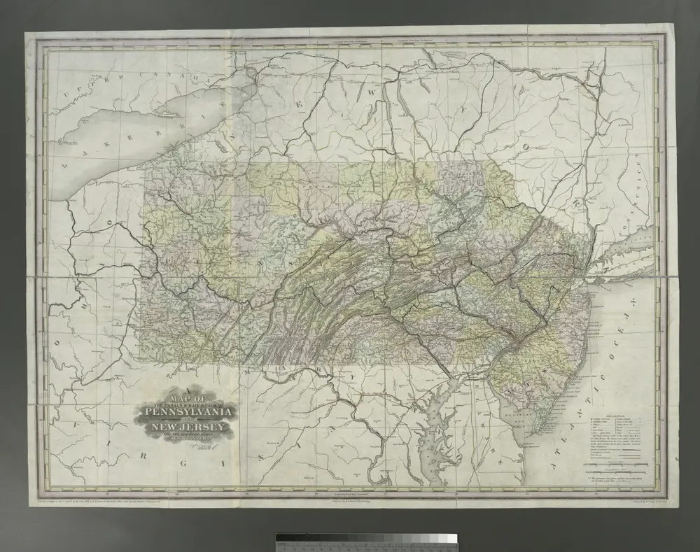
A map of the canals & rail roads of Pennsylvania and New Jersey, and the adjoining states / by H.S. Tanner; engraved by H.S. Tanner & assistants.
1846