Maps of Europe

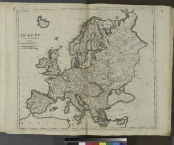
Europe.
from Carey's general atlas, improved and enlarged : being a collection of maps of the world and quarters, their principal empires, kingdoms, &c.
Carte du Monde connu des anciens.
1 : 26000000 Lapie, M. (Pierre), 1779-1850
North America.
1 : 7500000 Tanner, Henry S.
North America.
1 : 7500000 Tanner, Henry S.
Composite: North America.
1 : 7500000 Tanner, Henry S.
Composite: North America.
1 : 7500000 Tanner, Henry S.
Nuove scoperte de'russi al nord del mare del Sud sí nell'Asia, che nell'America
1 Karte : Kupferdruck ; 30 x 39 cm Zatta presso Antonio Zatta
North America.
1 : 18500000 Playfair, Principal
Ethnographische Karte von Nordamerika.
1 : 28000000 Humboldt, Alexander von, 1769-1859
Die den Alten bekannte Erde
1 : 48910000 Afrika severní Leutemann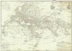
Orbis veteribus notus
1 : 17000000 Afrika Anville, Jean-Baptiste Bourguinon d' Delahaye, Guillaume-Nicolas D'Anville
Turkey. Middle East. Ancient World.
Schonberg & Co.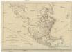
NORTH AMERICA, AS DIVIDED amongst THE EUROPEAN POWERS
Severní Amerika Dunn, Samuel
Nord America.
1 : 26500000 Flemming, Carl
Der noerdliche Theil des grossen Welt Meeres
1 Karte : Kupferdruck ; 48 x 65 cm Reichard im Verlage d. Industrie Comptoirs
Nord America
Malé Antily (souostroví)
Russia in Europe, Sweden, and Norway ; Map of Denmark; Map of Holland and Belgium.
from New general atlas.
Discoveries made by Captains Cook & Clerke.
1 : 43000000 Carey, Mathew
Map of the Discoveries made by Captn Cook & Clerke.
1 : 42000000 Carey, Mathew
Map of the Discoveries made by Capts. Cook & Clarke in the Years 1778 & 1779.
1 : 43000000 Carey, Mathew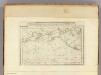
Map of the Discoveries made by Capts. Cook & Clerke.
1 : 43000000 Carey, Mathew
Map of the Discoveries made by Capts. Cook & Clerke.
1 : 43000000 Carey, Mathew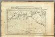
Map of the Discoveries made by Capts. Cook & Clerk.
1 : 30000000 Carey, Mathew
Migrations des Peuples.
Andriveau-Goujon, J.
Partis Orbis Veteribus Groecis Romanisque.
1 : 34000000 Vivien de St Martin, L.
E. Asia, W. North America.
1 : 41000000 Seaman, James V.
North America. Pergamon World Atlas.
1 : 45000000 Polish Army Topography Service
Stromgebiet, Nordamerica.
1 : 31000000 Radefeld, Carl Christian Franz, 1788-1874
Orbis veteribus notus
Afrika