Maps of Kings County

Volume 1 Index Map
from Maps of the city of Brooklyn
Insurance maps of the borough of Brooklyn city of New York. V.1. Published by the Sanborn Map Co., 11 Broadway, New York. 1886.
From Atlas 63. Vol. 1, 1886.
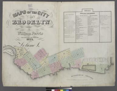
Plan of the city of Brooklyn, L.I. / by William Perris.
from Brooklyn
[Volume 2 Index Map]
from Maps of the city of Brooklyn
Height District Map Section No. 16; Height district map / City of New York, Board of Estimate and Apportionment.
from Height district map / City of New York, Board of Estimate and Apportionment. New York (N.Y.). Board of Estimate and Apportionment,
Plan of the city of New York in North America : surveyed in the years 1766 & 1767 / B. Ratzer, lieutt. in His Majestys 60th or Royal American Regt. ; Thos. Kitchin, sculpt., engraver to His Late Royal Highness, the Duke of York, &c.
From Manhattan
Use District Map Section No. 16
from Use district map / City of New York, Board of Estimate and Apportionment.
Area District Map Section No. 16
from Area district map / City of New York, Board of Estimate and Apportionment.
Brooklyn, Double Page Section 2; [Including Wards 1, 2, 3, 4, 5, 6, 10 ,11, 20, 22]
from Farm line map of the city of Brooklyn, from official records and surveys; comp. and drawn by Henry Fulton.
Insurance Maps of Brooklyn New York V. 2, Published by the Sanborn map co. 113Broadway, New York. 1887.
From Atlas 66. Vol. 2, 1887.
Plan of the city of New York in North America : surveyed in the years 1766 & 1767 / B. Ratzer, lieutt. in His Majestys 60th or Royal American Regt. ; Thos. Kitchin, sculpt., engraver to His Late Royal Highness, the Duke of York, &c.
From Manhattan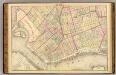
Sec. 2. Brooklyn map.
1 : 6000 Fulton, Henry; J.B. Beers & Co.
Sheet 5: Map encompassing Red Hook, Cobble Hill, Carroll Gardens and Gowanus Canal.
from Map of the city of Brooklyn : being the former cities of Brooklyn & Williamsburgh and the town of Bushwick, as consolidated January 1st, 1855 by an act of the legislature of the State of New York ... showing also a part of the City of New York.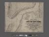
New map of the part of New York City 20th St. on the Hudson and 35th St. on the East River
From Manhattan
Plan of the city of Brooklyn, L.I. / by William Perris.
from Brooklyn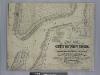
New map of that part of the city of New York south from 20th Street on the Hudson & 35th Street on the East River : showing the position of Greenwich, Washington and West Streets on the Hudson River, and Pearl, Water, Front, Cherry & Tompkins Sts. on the
from Manhattan
[Volume 2 Index Map]
from Maps of the city of New York.
Brooklyn, Section 3; [Including Wards 12, 22]
from Farm line map of the city of Brooklyn, from official records and surveys; comp. and drawn by Henry Fulton.
Downtown Brooklyn, Fort Greene, Clinton Hill. (cont.)
From District 2
Data for population from census of 1910, Borough of Manhattan
From Manhattan
Sheet 6: Map encompassing Boerum Hill, Cobble Hill, Brooklyn Heights, Downtown Brooklyn, Vinegar Hill, Fort Greene, Clinton Hill, Brooklyn Navy Yard and South Williamsburg.
from Map of the city of Brooklyn : being the former cities of Brooklyn & Williamsburgh and the town of Bushwick, as consolidated January 1st, 1855 by an act of the legislature of the State of New York ... showing also a part of the City of New York.
Plan of the city of Brooklyn, L.I. / by William Perris.
from Brooklyn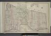
Brooklyn, Double Page Section 6; [Including Wards 8, 22]
from Farm line map of the city of Brooklyn, from official records and surveys; comp. and drawn by Henry Fulton.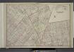
Brooklyn, Double Page Section 5; [Including Wards 7, 9, 20, 22, 23]
from Farm line map of the city of Brooklyn, from official records and surveys; comp. and drawn by Henry Fulton.
Plan of the city of Brooklyn, L.I. / by William Perris.
from Brooklyn
[Map bounded by Pier - Line 39-46, King St, Washington Street, Vestry St; Including West Street, Canal St, Desbrosses St, Watts St, Hoboken St, Spring St, Charlton St]
from Maps of the wharves & piers from the Battery to 61st street on the Hudson river and from the Battery to 41st street on the East river, New York. Surveyed by I.C. Buckhout, city surveyor.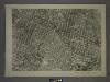
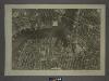
16B - N.Y. City (Aerial Set).
from Sectional aerial maps of the City of New York / [photographed and assembled under the direction of the chief engineer, July 1st, 1924].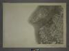
16A - N.Y. City (Aerial Set).
from Sectional aerial maps of the City of New York / [photographed and assembled under the direction of the chief engineer, July 1st, 1924].
[Sheet 2: Map encompassing Prospect Park, Windsor Terrace, Park Slope, Carroll Gardens, Gowanus Canal, Fort Greene, Clinton Hill and Prospect Heights.]
from Map of the city of Brooklyn : being the former cities of Brooklyn & Williamsburgh and the town of Bushwick, as consolidated January 1st, 1855 by an act of the legislature of the State of New York ... showing also a part of the City of New York.