Cataloged map
Ètats-Unis de l'Amérique septentrionale avec les Isles Royale, de Terre Neuve, de St. Jean, l'Acadie &c.
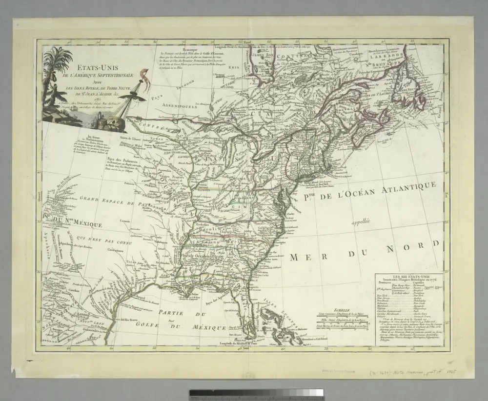

Full title:Ètats-Unis de l'Amérique septentrionale avec les Isles Royale, de Terre Neuve, de St. Jean, l'Acadie &c.
Depicted:1785
Physical Size:20 x 30 cm
La Floride, suivant les nouvelles observations de Messrs. de l'Academie des Sciences, etc.
1713
Aa, Pieter van der
1:9m
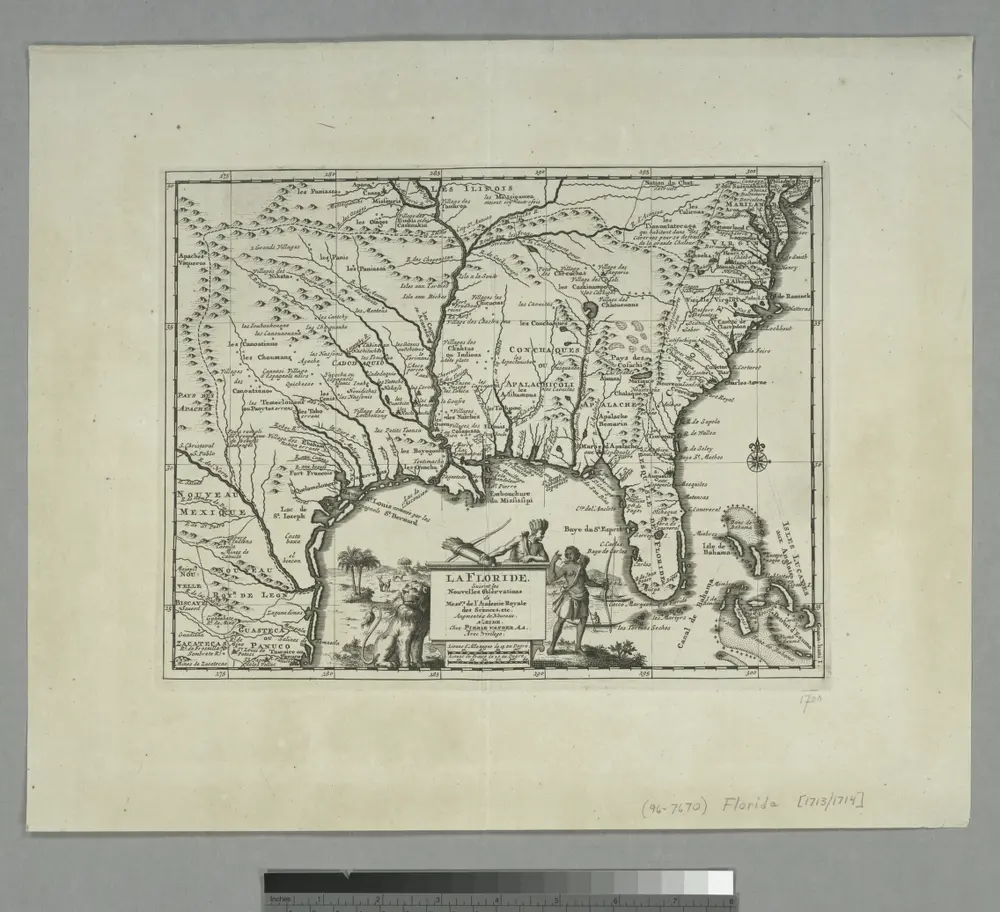
La Floride: suivant les nouvelles observations de Messrs. de l'Academie royale des sciences, etc. augmentées de nouveau. / A Leide, Chez Pierre Vander A.A., avec privilege.
1729
Perrine's new topographical war map of the southern states, taken from the latest government surveys and official reports
1863
Perrine, Charles O.
1:2m
Map of the seat of war
1866
Lloyd's new military map of the border & southern states
1865
Johnson's new rail road & county copper plate map of the Southern States from the latest and best information
1860
Johnson, A. J.
1:3m
Frank Leslie's war maps
1861
Leslie, Frank
The model war map giving the southern & middle states, with all their water & railroad connections
1862
The historical war map
1862
War chart of the Southern States showing the towns, rivers, rail-roads and common roads
1862
B.B. Russell & Co.