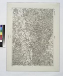
Maps of Timiș

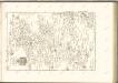
Facset.; Spezialkarte der osterreichisch-ungarischen Monarchie.
from Spezialkarte der osterreichisch-ungarischen Monarchie. Austro-Hungarian Monarchy. Militärgeographisches Institut.,
Facset
1 : 75000 Făget
Lambert-Cholesky sheet 2160 (Dubeşti)
1 : 20000 Romanian military topographic map sheet under Lambert-Cholensky projection Serviciul Geografic al Armatei geo-spatial.org Serviciul Geografic al Armatei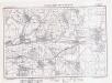
Lambert-Cholesky sheet 2159 (Leucuşeşti)
1 : 20000 Romanian military topographic map sheet under Lambert-Cholensky projection Institutul Geografic Militar geo-spatial.org Institutul Geografic Militar
Lambert-Cholesky sheet 2260 (Birchiş)
1 : 20000 Romanian military topographic map sheet under Lambert-Cholensky projection Serviciul Geografic al Armatei geo-spatial.org Serviciul Geografic al Armatei
Lambert-Cholesky sheet 2259 (Făget)
1 : 20000 Romanian military topographic map sheet under Lambert-Cholensky projection Direcția Topografică Militară geo-spatial.org Direcția Topografică Militară
Bataille de Kossova
Nouvel atlas physique politique et historique de l'Empire ottoman et des états limitrophes en Europe, en Asie et en Afrique, en quarante feuilles Hellert, J.J. Bellizard, Dufour et Cie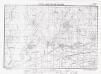
Lambert-Cholesky sheet 2059 (Balinţi)
1 : 20000 Romanian military topographic map sheet under Lambert-Cholensky projection Direcția Topografică Militară geo-spatial.org Direcția Topografică Militară
Lambert-Cholesky sheet 2060 (Bara)
1 : 20000 Romanian military topographic map sheet under Lambert-Cholensky projection Serviciul Geografic al Armatei geo-spatial.org Serviciul Geografic al Armatei
Lambert-Cholesky sheet 2258 (Gladna Română)
1 : 20000 Romanian military topographic map sheet under Lambert-Cholensky projection Institutul Geografic Militar geo-spatial.org Institutul Geografic Militar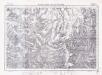
Lambert-Cholesky sheet 2158 (Szarazani)
1 : 20000 Romanian military topographic map sheet under Lambert-Cholensky projection Institutul Geografic Militar geo-spatial.org Institutul Geografic Militar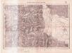
Lambert-Cholesky sheet 2161 (Bata)
1 : 20000 Romanian military topographic map sheet under Lambert-Cholensky projection Serviciul Geografic al Armatei geo-spatial.org Serviciul Geografic al Armatei
Lambert-Cholesky sheet 2261 (Şoborşin)
1 : 20000 Romanian military topographic map sheet under Lambert-Cholensky projection Serviciul Geografic al Armatei geo-spatial.org Serviciul Geografic al Armatei
Nada und Soborsin.
from Spezialkarte der osterreichisch-ungarischen Monarchie.
Maros-Illye.
from Spezialkarte der osterreichisch-ungarischen Monarchie.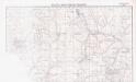
Lambert-Cholesky sheet 2061 (Şiştarovăţ)
1 : 20000 Romanian military topographic map sheet under Lambert-Cholensky projection Neprecizat geo-spatial.org Neprecizat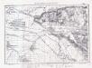
Lambert-Cholesky sheet 2058 (Ţipari)
1 : 20000 Romanian military topographic map sheet under Lambert-Cholensky projection Institutul Geografic Militar geo-spatial.org Institutul Geografic Militar
Lambert-Cholesky sheet 2360 (Coşteiu de Sus)
1 : 20000 Romanian military topographic map sheet under Lambert-Cholensky projection Direcția Topografică Militară geo-spatial.org Direcția Topografică Militară
Lambert-Cholesky sheet 2359 (Crivina de Sus)
1 : 20000 Romanian military topographic map sheet under Lambert-Cholensky projection Direcția Topografică Militară geo-spatial.org Direcția Topografică Militară
Süd-Ost-Ungarn
1 : 600000 Österreich-Ungarn (Südost), Banat
C. Krassó
Rumänien Komitat Caraşova
Generalkarte von Zentraleuropa

Krassó - Szörény Vármegye

Plan von Bergwerg Laposneck
Mollova mapová sbírka Geyer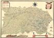
Mappa Der Grenz Scheidung Des Banat Temeswar Von Anno 1749 Mit Den Türken Geschlosen Von Herren General Feldmarschaů Lieutinont Freiheren Frantz Von Engelshofen A. 1749
Mollova mapová sbírka Geyer
Eigendliche Vorstellung des zwischen denen Key; und ein Corpo von 30000 Turken unter anführung des Seras Kiers von Widdin den 29. Jull. 1739 in dem Banat von Temeswar unweit Banzova glüklich vorbey gegangenen treffen nebst beygefugter Karten des aldortigen Terrain auf 14 Meilen
Mollova mapová sbírka
Théatre de la Guerre dans le Bannat de Temeswar
1 : 510000 Mollova mapová sbírka Briffaut, Etienne Briffaut, Etienne
Das Temeschwarer Bannat
1 : 389000 Banát Güssefeld, Franz L. Liesganig, Joseph von den Homann. Erben