Cataloged map
Belbor (Rumanien).

Full title:Belbor (Rumanien).
Depicted:1914
Physical Size:20 x 30 cm
Lambert-Cholesky sheet 3971 (Borsecul Gherghiului (Gyergyo-Borzek))
1918
Serviciul Geografic al Armatei
1:20k
Lambert-Cholesky sheet 3972 (Grigoraș)
1931
Serviciul Geografic al Armatei
1:20k
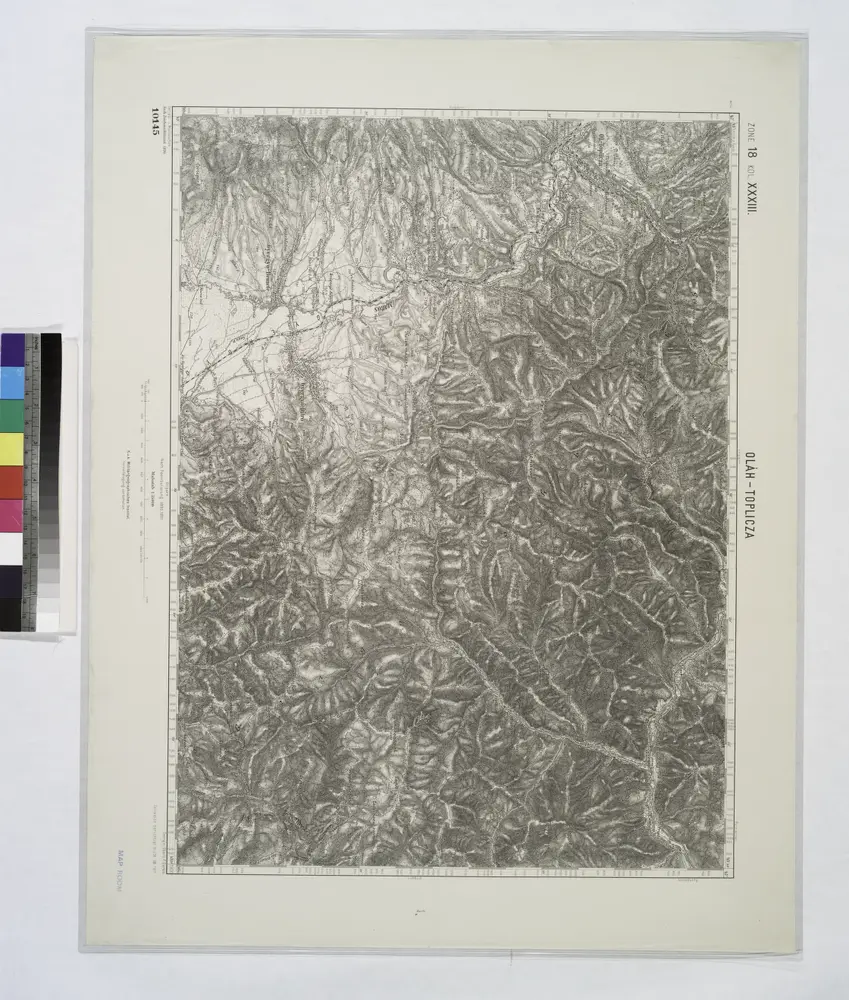
Olah-Toplicza.; Spezialkarte der osterreichisch-ungarischen Monarchie.
1911

Belbor (Rumanien).
1914
n/a
1800
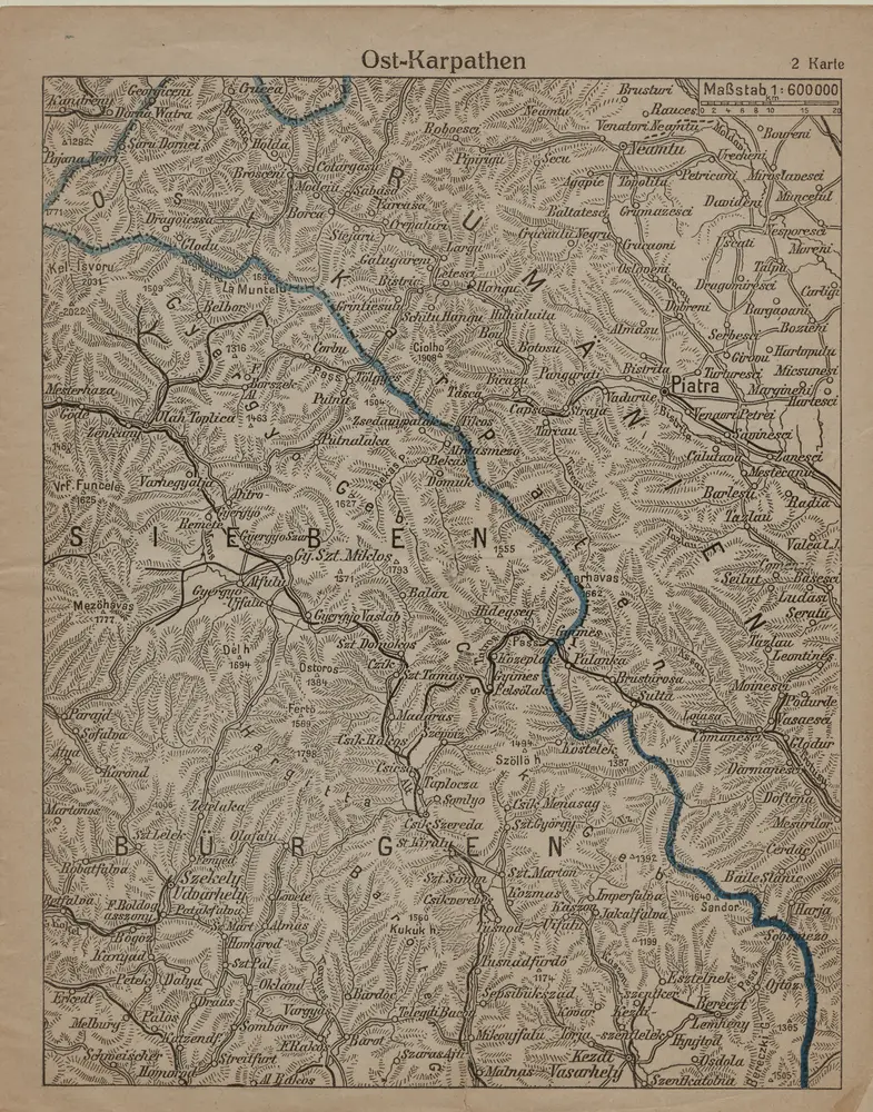
Ost-Karpathen
1916
1:600k
Bukowina oder oestreich'scher Antheil der Moldau
1818
Küstel, Aloys J.
1:580k
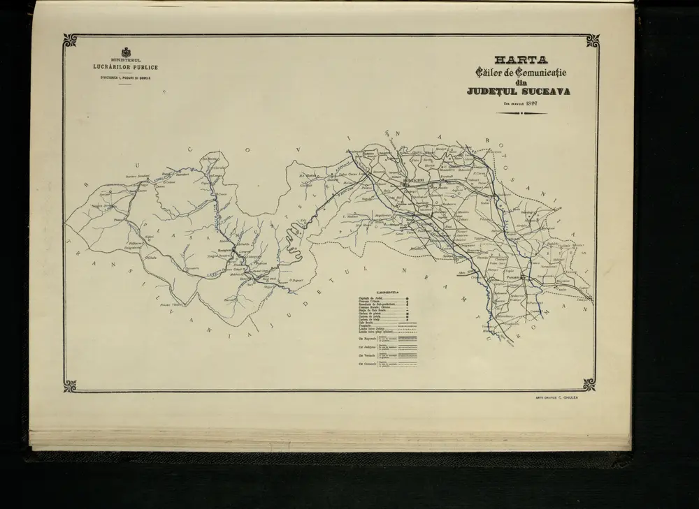
Harta Cailor de Comunicatie din Judetul Suceava
1897
Kolozsvár (Klausenburg), Máramaros-Sziget, Tölgyes
1918
K. u. k. Militärgeographisches Institut
1:750k
Kolozsvár (Klausenburg), Máramaros-Sziget, Tölgyes
1916
K. u. k. Militärgeographisches Institut
1:750k
Klausenburg, Máramaros-Sziget, Tölgyes
1892
K. u. k. militär-geographisches Institut
1:750k