Katalogisierte Karte
Polgar (Ungarn).

Vollständiger Titel:Polgar (Ungarn).
Jahr der Abbildung:1914
Physische Größe:20 x 30 cm
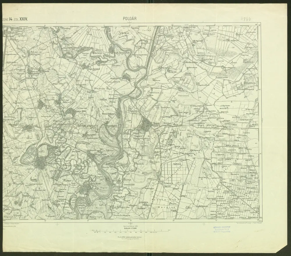
Polgár
1910
Schrift und Gerippe v. Feldw. Rücker. Terrainschraffirung v. Fwkr. Nowak
1:75k

Polgar (Ungarn).
1914
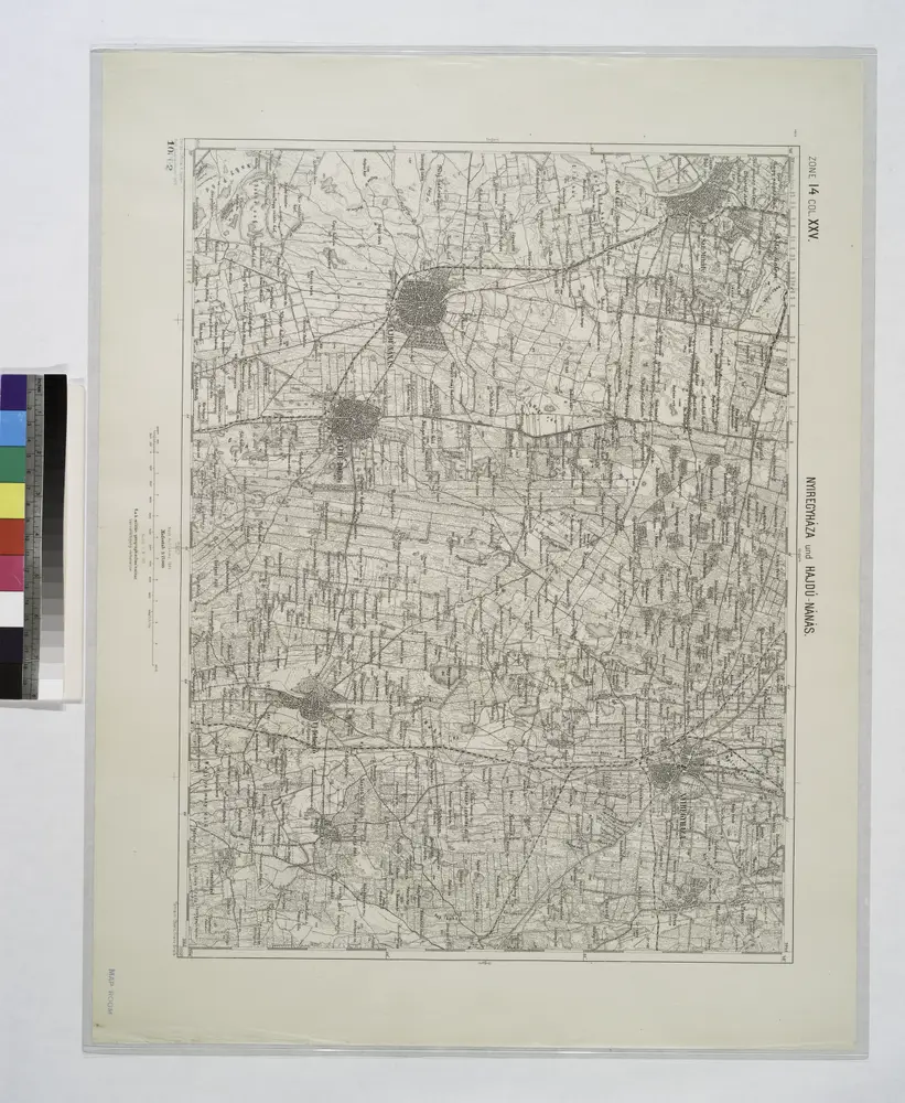
Nyiregyhaza und Hajdu-Nans.
1914
Nyirecyháza und Hajdú-Nánás
1898
Geripp: Official K. Höller
1:75k
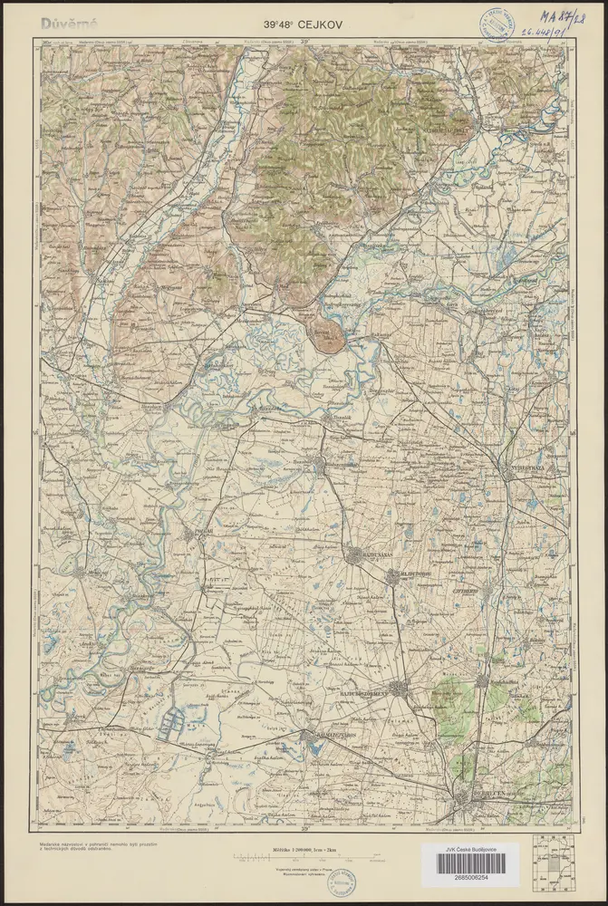
39°48° Cejkov
1946
Vojenský zeměpisný ústav
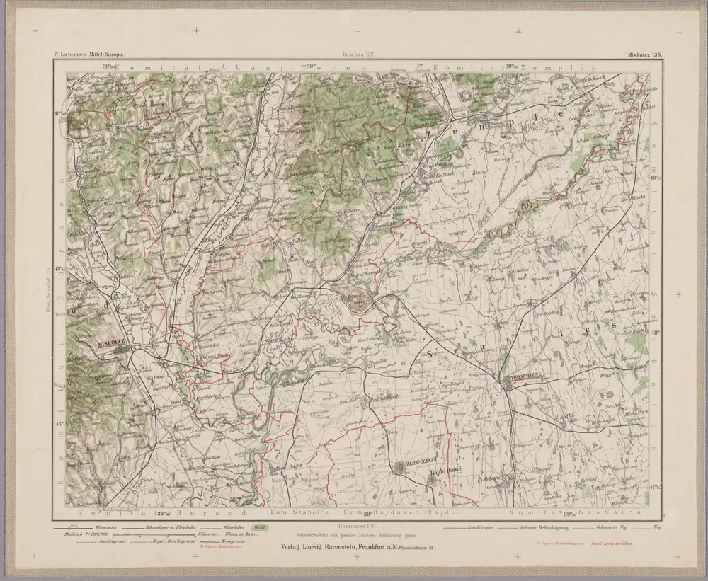
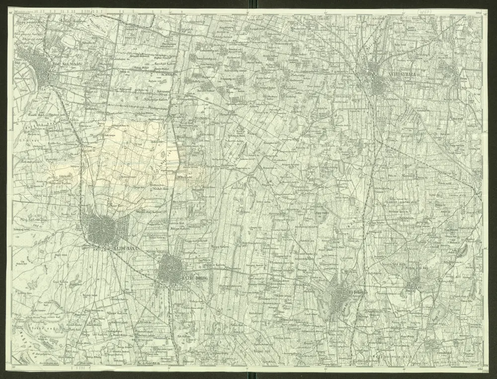
Miskolcz 136, uit: Special-Karte von Mittel-Europa / nach amtlichen Quellen bearbeitet von W. Liebenow
1899
Johannes Wilhelm Liebenow 1822-1897
1:300k
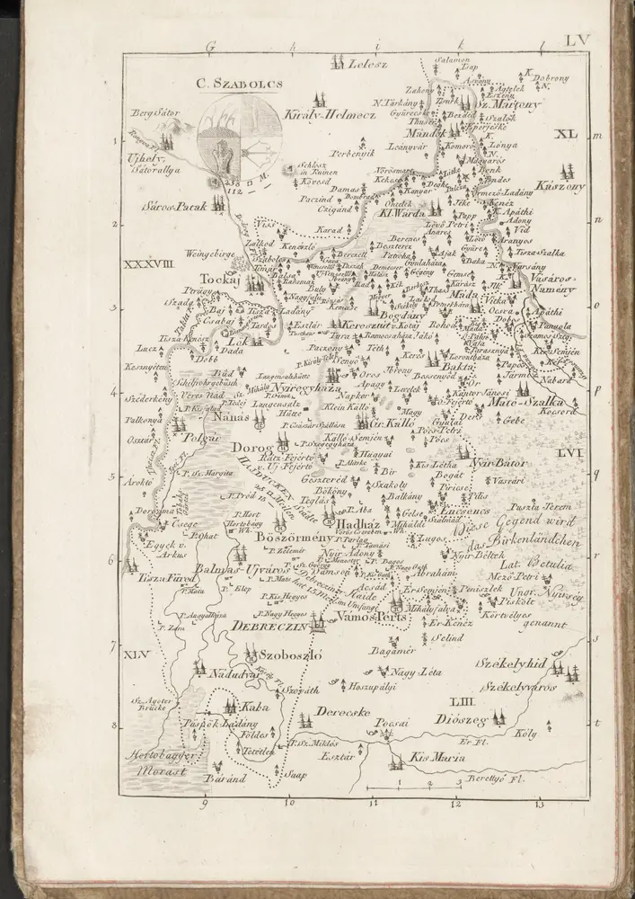
C. Szabolcs
1804
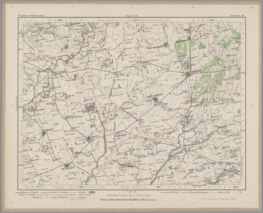
Debreczen 150, uit: Special-Karte von Mittel-Europa / nach amtlichen Quellen bearbeitet von W. Liebenow
1899
Johannes Wilhelm Liebenow 1822-1897
1:300k
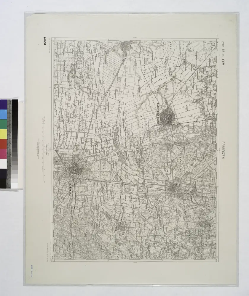
Debreczen.
1914
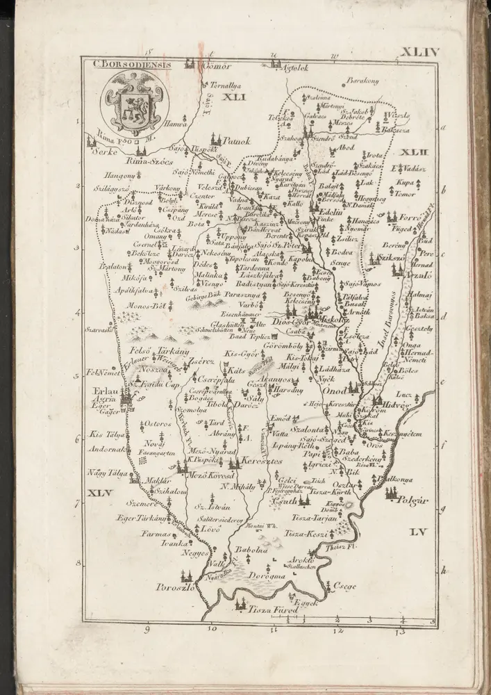
C. Borsodiensis
1804