Maps of Bezirk Scheibbs

Gaming und Mariazell.
from Spezialkarte der osterreichisch-ungarischen Monarchie.
Karte der Hochschwab und Oetcher-Gruppe

Zone 14, Col. XII, Gaming und Mariazell, uit: Geologische Karte der im Reichsrathe vertretenen Königreiche und Länder der Österreich-Ungarischen Monarchie : auf Grundlage der Specialkarte i.M. 1:75.000 des k.u.k. Militär-geographischen Institutes / neu bearb. und als Kartenwerk von 341 Blattnummern in zwanglosen Lfg. hrsg. durch die k.k. Geologische Reichsanstalt in Wien
1 : 75000 titelvariant: Geologische Spezialkarte der im Reichsrate vertretenen Königreiche und Länder der Österreichisch-Ungarischen Monarchie; Geologische Specialkarte der im Reichsrathe vertretenen Königreiche und Länder der Österreichisch-Ungarischen Monarchie; Annotatie: Titel bovenaan kaartblad: Geologische Spezialkarte der im Reichsrate vertretenen Königreiche und Länder der Österreichisch-Ungarischen Monarchie en Geologische Specialkarte der im Reichsrathe vertretenen Königreiche und Länder der Österreichisch-Ungarischen Monarchie; Annotatie geografische gegevens: Coördinaten gebaseerd op nulmeridiaan van Ferro (Hierro) Kaiserlich-Königliche Geologische Reichsanstalt, Wenen Wien : K.K. Geologische Reichsanstalt
Oetscher
1 : 60000 R. Lechner's k. u. k. Hof- u. Univ.-Buchhandlung
Umgebungskarte von Mariazell
1 : 30000 Ullman Kartographischen Institute
Umgebungskarte von Mariazell
1 : 30000 Ullmann vom Kartographischen, früher Militärgeographischen Institute
Das Geldloch oder Die Seelucken
Rakousko
Umgebung von Maria Zell - Weichselboden - Eisenerz
1 : 129600 Eisenerz (Rakousko) Maschek, Rudolf Artaria
Ybbs.
from Spezialkarte der osterreichisch-ungarischen Monarchie.
Eisenerz, Wildalpe und Aflenz.
from Spezialkarte der osterreichisch-ungarischen Monarchie.
Weyer.
from Spezialkarte der osterreichisch-ungarischen Monarchie.
Schneeberg und St. Aegyd.
from Spezialkarte der osterreichisch-ungarischen Monarchie.
Umgebungskarte von St. Pölten und Scheibbs
1 : 75000 R. Lechner

Der oestlicher Theil von Obersteyermark oder der Brucker Kreis
1 : 250000 Horní Rakousko (Rakousko) Kindermann, Joseph Karl Junker, Christoph Franz Xaver Miller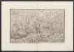
Militair Karte von Süd-Deutschland in 20 Sectionen
1 : 400000 16. Section Coulon, Alois von A. von Coulon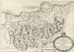
Des Ertzhertzigtumbs Viertl ob Wiener wald. Dis Viertl hat weid und Vich Zucht Auch vil weins und traides frucht
Mollova mapová sbírka Vischer, Georg Matthaeus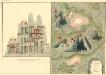
Plan des Bergwergs Nabloch und Hirn
Mollova mapová sbírka Geyer
Das in dem Ertzhertzogtumb Vnter Osterreich.
1 : 250000 Mollova mapová sbírka Vischer, Georg Matthaeus Hoffmann, Jakob
Das in dem Ertzhertzogtumb Vnter Osterreich.
1 : 250000 Mollova mapová sbírka Vischer, Georg Matthaeus Hoffmann, Jakob
Tabula Austriae Inferioris
1 : 680000 Mollova mapová sbírka Insprugger, Sebastianus Voigt, Maria Theresia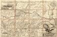
Archiducatus Austriae Inferioris Accuratissima Geographica Descriptio
1 : 320000 Mollova mapová sbírka Vischer, Georg Matthaeus
Archiducatus Austriae Inferioris
1 : 435000 Mollova mapová sbírka Seutter, Matthäus Seutter, Matthäus
Avstria Inf.
1 : 790000 Mollova mapová sbírka Weigel, Christoph Weigel, Christoph I.
Archiducatus Austriae Inferioris
1 : 435000 Mollova mapová sbírka Homann, Johann Baptist Homann, Johann Baptista
Archiducatus Austriae Inferioris In omnes suas Quadrantes Ditiones divisi. Nova et exacta Tabula è conatibus
1 : 435000 Mollova mapová sbírka Homann, Johann Baptist Homann, Johann Baptista
Archiducatus Austriae inferioris in omnes suas quadrantes ditiones divisi nova et exacta tabula
1 : 440000 Rakousko Homann, Johann Baptist J. B. Homann
Archiducatus Austriae inferioris in omnes suas quadrantes ditiones divisi nova et exacta tabula
1 : 440000 Rakousko Homann, Johann Baptist Io. Baptistae Homanni
Archiducatus Austriae inferioris in omnes suas quadrantes ditiones divisi nova et exacta tabula
1 : 440000 Rakousko Homann, Johann Baptist J. B. Homann
Archiducatus Austriae inferioris in omnes suas quadrantes ditiones divisi nova et exacta tabula
1 : 440000 Rakousko Homann, Johann Baptist Io. Baptistae Homanni