Maps of gmina Solina

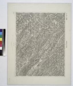
Ustrzyki Dolne.; Spezialkarte der osterreichisch-ungarischen Monarchie.
from Spezialkarte der osterreichisch-ungarischen Monarchie. Austro-Hungarian Monarchy. Militärgeographisches Institut.,
Ustrzyki Dolne
1 : 75000 Polsko jihovýchodní Adler K. u. k. Militärgeographisches Institut
Normální mezinárodní letecká mapa.


Stary Sambor (Galizien).
from Spezialkarte der osterreichisch-ungarischen Monarchie.
Zemplénoroszi und Dydiowa
1 : 75000 Chlum K. u. k. Militärgeographisches Institut
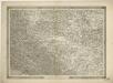
General-Karte des Königreiches Galizien und des Herzogthumes Bukovina

Generalkarte von Zentraleuropa
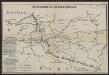
Übersichtskarte des Kampfgeländes
1 : 650000 Polen Tarnów Weltkrieg <1914-1918> Verl. Gerhard Stalling, Oldenburg
Slovensko

Ost-Galizien
Halič (Polsko a Ukrajina) Liesganig, Joseph im Verlage des Kunst und Industrie Comptoirs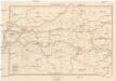
Galizien, Westlicher Theil
1 : 700000 Halič (Polsko a Ukrajina) Karl Fr. Pfau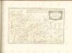

Übrige Länder der ehemaligen Österreich-Ung. Monarchie
1 : 900000 Halič (Polsko a Ukrajina) Koch, Wilhelm Opitz, Carl Arnd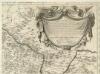
Augustissimo Romanor. Imperatori Iosepho I. Hungaria Regi Invictissimo Mappam Hanc Regni Hungariae
1 : 540000 Mollova mapová sbírka Müller, Johann Christoph
Carte de la Roumanie et pays limitrophes. Cracovie
1 : 500000 France. Service géographique de l'armée [Paris] : Service géographique de l'armée
Krakau, Przemysl, Jaroslau, Kaschau, Leutschau
1 : 750000 Krakov (Polsko : oblast) Geng, K. K. u. k. Militärgeographisches Institut
Krakau, Przemysl, Jaroslau, Kaschau, Leutschau
1 : 750000 Krakov (Polsko : oblast) Geng, K. K. u. k. Militärgeographisches Institut
Krakau, Przemyśl, Jaroslau, Kaschau, Leutschau
1 : 750000 Jarosław (Polsko) R. Lechner
Krakau, Przemyśl, Jaroslau, Kaschau, Leutschau
1 : 750000 Jarosław (Polsko) K. k. militär-geographisches Institut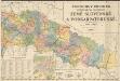
Podrobný přehled politického rozdělení země Slovenské a Podkarpatoruské
Vojenský zeměpisný ústav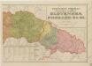
Podrobný přehled politického rozdělení Slovenska a Podkarpatské Rusi
Podrobný přehled politického rozdělení Slovenska a Podkarp. Rusi
Vojenský zeměpisný ústav
Bez titulu: Šest listů speciálních map Ukrajiny
Podrobný přehled politického rozdělení Slovenska
Vojenský zeměpisný ústav
Übersichtskarte von Mittel - Europa

IV, uit: General-Karte des oesterreichischen Kaiserstaates mit einem grossen Theile der angrenzenden Länder / durch Josef Scheda ... bearb. und hrsg
1 : 576000 Annotatie geografische gegevens: Maatstokken: oesterreichische Meilen, geografische oder deutsche Meilen, preussische Meilen, türkische Berri, französische Lieues, russische Werste; Maatstok per blad: wiener Klafter, öster. Meilen; Blad XIX: statistische en taalkundige informatie; Blad XIX: legenda [Wien : K.K. Militärisch-Geografisches Institut]