Maps of powiat dzierżoniowski

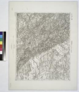
Schonau Bei Bhm. Braunau.
from Spezialkarte der osterreichisch-ungarischen Monarchie.
170 Glatz, uit: Topographische Special-Karte von Deutschland (von Central-Europa) / begründet von D.G. Reymann ; [entworfen und gezeichn. von Heinrich Berghaus... [et al.]]
1 : 200000 Annotatie: Lit.: Daniel Gottlob Reymann und die "Topographische Special-Karte von Deutschland" / von Wolfgang Scharfe, in: Kartographische Nachrichten, 39 (1989), Heft I, p. 1-10; Handgeschreven titel: Reymann's Deutschland : 24 Sectionen: Jena, Penig, Dresden, Zittau, Hirschberg, Breslau, Brieg, Andernach, Coblenz, Giessen, Fulda, Schleusingen, Plauen, Zwickau, Teplitz, Jung Bunzlau, Hohenelbe, Glatz, Neisse, Simmern, Prag, Luxemburg, Birkenfeld; Aanwezig: 23 bladen Reymann, Daniel Gottlob; Berghaus, Heinrich [Berlin : 2. Departement des Kriegsministeriums, Bureau für Plan- und Kartenzeichnung]
Schönau bei Bhm. Braunau
1 : 75000 Broumov (Náchod, Česko : oblast) Bloschitz, R. K. u. k. Militärgeographisches Institut
Schönau bei B[ö]hm[isch] Branau
1 : 75000 Čechy (Česko) K. u. k. Militärgeographisches Institut
III. vojenské mapování 3757
1 : 75000
III. vojenské mapování 3757
1 : 75000
Šonov
1 : 75000 Čechy (Česko) Vojenský zeměpisný ústav
Broumov a Reichenbach i. Schles
1 : 75000 Broumov (Náchod, Česko : oblast) Vojenský zeměpisný ústav
Mapa okresního hejtmanství Broumovského

Karte der Bezirkshauptmannschaft Braunau
1 : 100000 Broumov-oblast (Náchod, Česko) Erben, Josef Karl Janský
[Kartenblatt]
1 : 25000 Broumov (Náchod, Česko : oblast) Reichsamt für Landesaufnahme

[Kartenblatt]
1 : 25000 Božanov (Česko) Reichsamt für Landesaufnahme

Meßtischblatt 3189 : Neurode, 1934
1 : 250000 Neurode. - Aufn. 1929, hrsg. 1934. - 1:25000. - [Berlin]: Reichsamt für Landesaufnahme, 1934. - 1 Kt.
Meßtischblatt 3188 : Wünschelburg, 1937
1 : 250000 Wünschelburg. - Hrsg. 1936, einz. Nachtr. 1937. - 1:25000. - [Berlin]: Reichsamt für Landesaufnahme, 1937. - 1 Kt.
Meßtischblatt 3188 : Wünschelburg, 1919
1 : 250000 Wünschelburg. - Aufn. 1881, bericht. 1919. - 1:25000. - [Berlin]: Preuss. Landesaufnahme, 1919. - 1 Kt.
Meßtischblatt 3188 : Wünschelburg, 1883
1 : 250000 Wünschelburg. - Aufn. 1881. - 1:25000. - [Berlin]: Kgl. Preuss. Landesaufnahme, 1883. - 1 Kt.
Meßtischblatt 3190 : Frankenstein, 1932
1 : 250000 Frankenstein. - Hrsg. 1883, bericht. 1919, einz. Nachtr. 1926, gedr. [19]32. - 1:25000. - [Berlin]: Reichsamt für Landesaufnahme, 1932. - 1 Kt.
Meßtischblatt 3190 : Frankenstein, 1919
1 : 250000 Frankenstein. - Aufn. 1881, bericht. 1919. - 1:25000. - [Berlin]: Preuss. Landesaufnahme, 1919. - 1 Kt.
Meßtischblatt 5365 : Langenbielau, 1937
1 : 250000 Langenbielau. - Aufn. 1928/29, hrsg. 1936, einz. Nachtr. 1937. - 1:25000. - [Berlin]: Reichsamt für Landesaufnahme, 1937. - 1 Kt.
Meßtischblatt 5364 : Wüstegiersdorf, 1937
1 : 250000 Wüstegiersdorf. - Aufn. 1930, hrsg. 1934, einz. Nachtr. 1937. - 1:25000. - [Berlin]: Reichsamt für Landesaufnahme, 1937. - 1 Kt.
Meßtischblatt 3135 : Gnadenfrei, 1933
1 : 250000 Gnadenfrei. - Hrsg. 1883, bericht. 1926, gedr. [19]33. - 1:25000. - [Berlin]: Reichsamt für Landesaufnahme, 1933. - 1 Kt.
[Kartenblatt]
1 : 25000 Broumov (Náchod, Česko : oblast) Reichsamt für Landesaufnahme
III. vojenské mapování 3757/3
1 : 25000
[Gradkartenblatt]
1 : 25000 Broumov-oblast (Náchod, Česko) Vojenský zeměpisný ústav
Meßtischblatt 3074, neue Nr. 5264 : Bad Charlottenbrunn, 1939
1 : 250000 Bad Charlottenbrunn. - Aufn. 1881, hrsg. 1883, bericht. 1937, redakt. Änd. [19]38. - 1:25000. - [Berlin]: Reichsamt für Landesaufnahme, 1939. - 1 Kt.
Meßtischblatt 3075 : Reichenbach, Eulengebirge, 1932
1 : 250000 Reichenbach, Eulengebirge. - Hrsg. 1883, bericht. 1926, einz. Nachtr. 1932. - 1:25000. - [Berlin]: Reichsamt für Landesaufnahme, 1932. - 1 Kt.
Meßtischblatt 5266 : Lauterbach, Schlesien, 1938
1 : 250000 Lauterbach, Schlesien. - Aufn. 1881, hrsg. 1883, bericht. 1926/37/38, letzte Nachtr. 1932, Ausg. 1938. - 1:25000. - [Berlin]: Reichsamt für Landesaufnahme, 1938. - 1 Kt.
Schönau (Ssonow) - c7754-1-002 - Kaiserpflichtexemplar der Landkarten des stabilen Katasters
1 : 2880
Schönau (Ssonow) - c7754-1-011 - Kaiserpflichtexemplar der Landkarten des stabilen Katasters
1 : 2880
Schönau (Ssonow) - c7754-1-006 - Kaiserpflichtexemplar der Landkarten des stabilen Katasters
1 : 2880
Schönau (Ssonow) - c7754-1-001 - Kaiserpflichtexemplar der Landkarten des stabilen Katasters
1 : 2880
Schönau (Ssonow) - c7754-1-005 - Kaiserpflichtexemplar der Landkarten des stabilen Katasters
1 : 2880
Schönau (Ssonow) - c7754-1-008 - Kaiserpflichtexemplar der Landkarten des stabilen Katasters
1 : 2880
Schönau (Ssonow) - c7754-1-007 - Kaiserpflichtexemplar der Landkarten des stabilen Katasters
1 : 2880
Schönau (Ssonow) - c7754-1-004 - Kaiserpflichtexemplar der Landkarten des stabilen Katasters
1 : 2880
Schönau (Ssonow) - c7754-1-010 - Kaiserpflichtexemplar der Landkarten des stabilen Katasters
1 : 2880
Schönau (Ssonow) - c7754-1-003 - Kaiserpflichtexemplar der Landkarten des stabilen Katasters
1 : 2880