Mapa catalogado
A new map of part of the United States of North America : containing those of New York, Vermont, New Hampshire, Massachusets, Connecticut, Rhode Island, Pennsylvania, New Jersey, Delaware, Maryland and Virginia from the latest authorities / by John Cary,
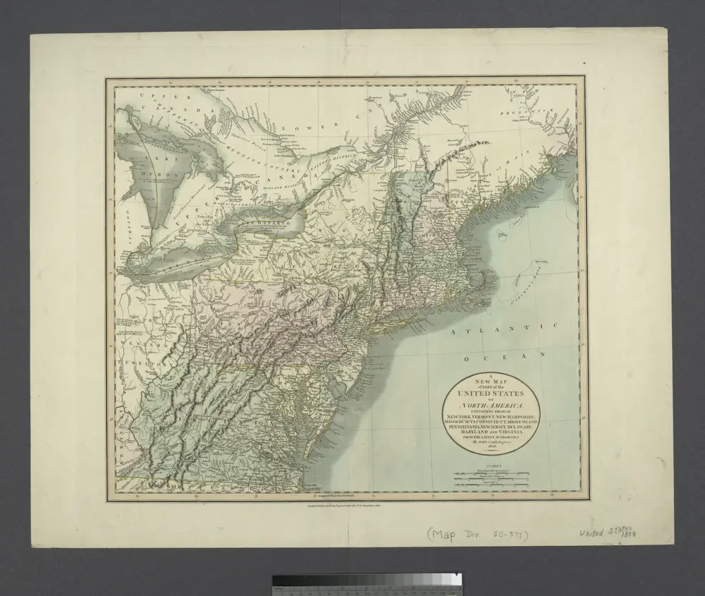

Título completo:A new map of part of the United States of North America : containing those of New York, Vermont, New Hampshire, Massachusets, Connecticut, Rhode Island, Pennsylvania, New Jersey, Delaware, Maryland and Virginia from the latest authorities / by John Cary,
Tamaño físico:20 x 30 cm
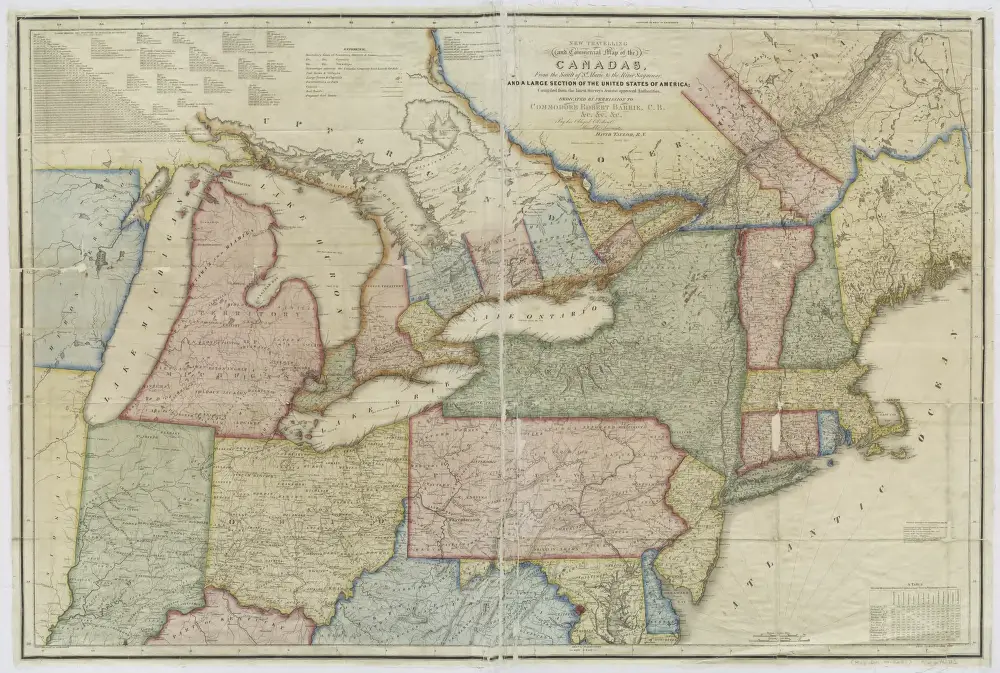
New travelling and commercial map of the Canadas: from the Sault of St. Marie to the river Saguenay, and a large section of the United States of America / compiled from the latest surveys and most approved authorities ... by his obliged obedient humble servant David Taylor, R.N., March 1834; engraved by S. Stiles & Co.
1834
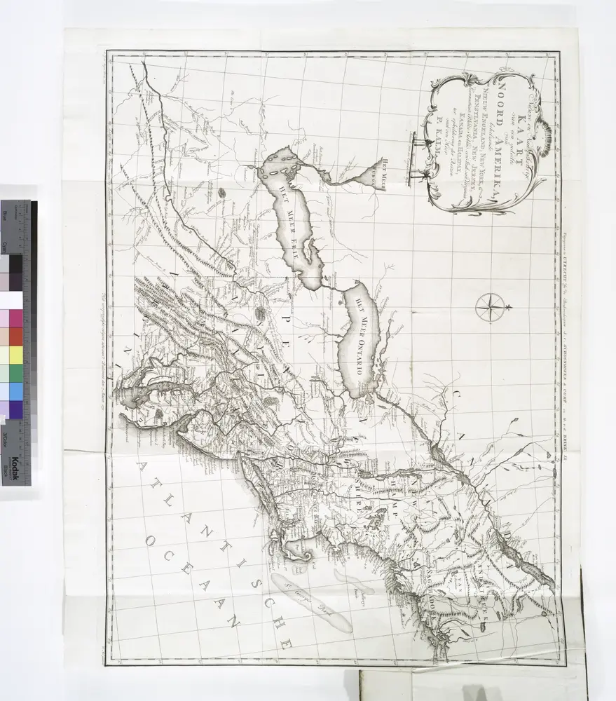
Nieuwe en nauwkeurige kaart van een gedeelte van Noord Amerika : behelzende Nieuw Engeland, New York, Pennsylvania, New Jersey, Connecticut, Rhode Island, een stuk van Virginia, Kanada en Halifax, ter opheldering der reizen van den Heer P. Kalm / C.J. de
1772
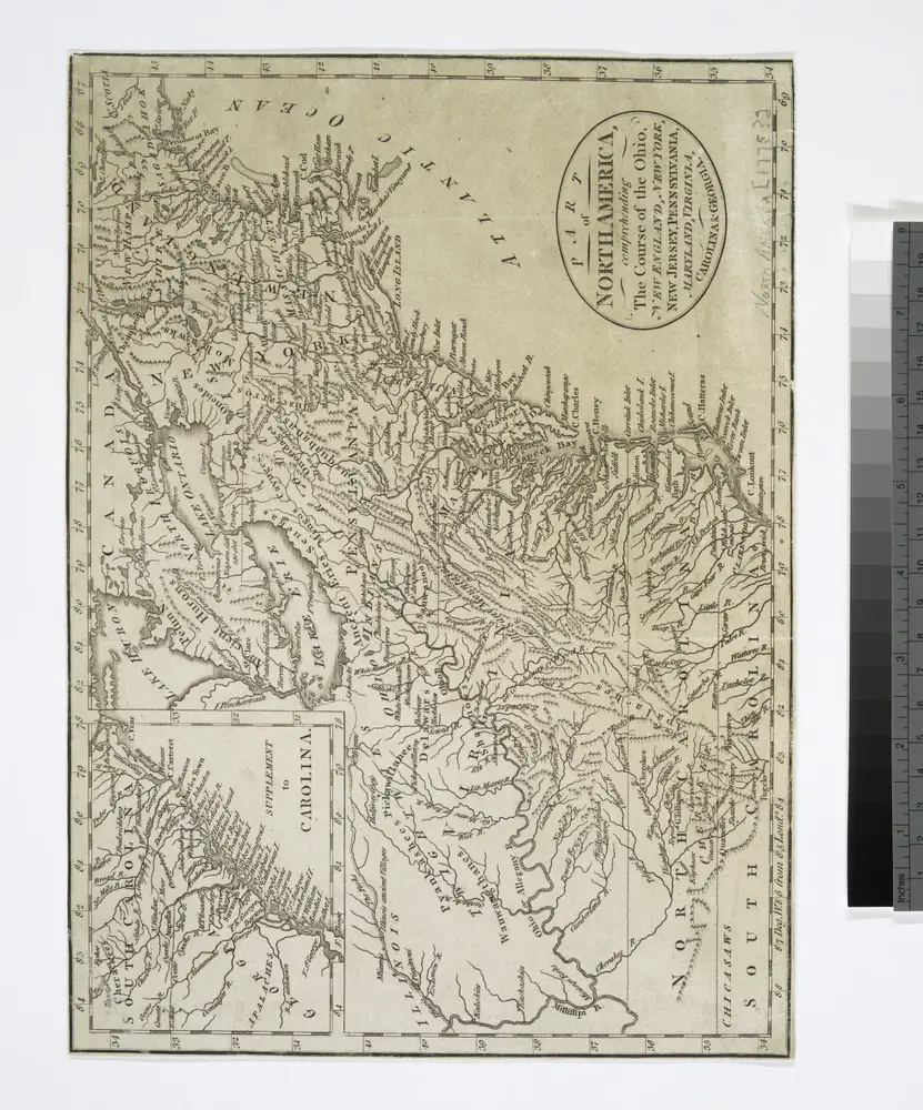
Part of North America: comprehending the course of Ohio, New England, New York, New Jersey, Pennsylvania, Maryland, Virginia, Carolina & Georgia.
1775
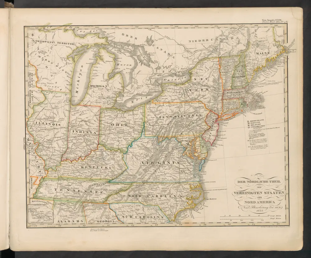
Der Nördliche Theil der Vereinigten Staaten von Nord America
1845
Stieler, Adolf
Vereinigte Staaten von Nord-Amerika in 6 blattern, bl. 3
1876
Novi Belgii, quod nunc Novi Jorck vocatur, Novae q[ue] Angliae & partis Virginiae : accuratissima et novissima delineatio
1671
Montanus, Arnoldus, 1625?-1683
1:4m
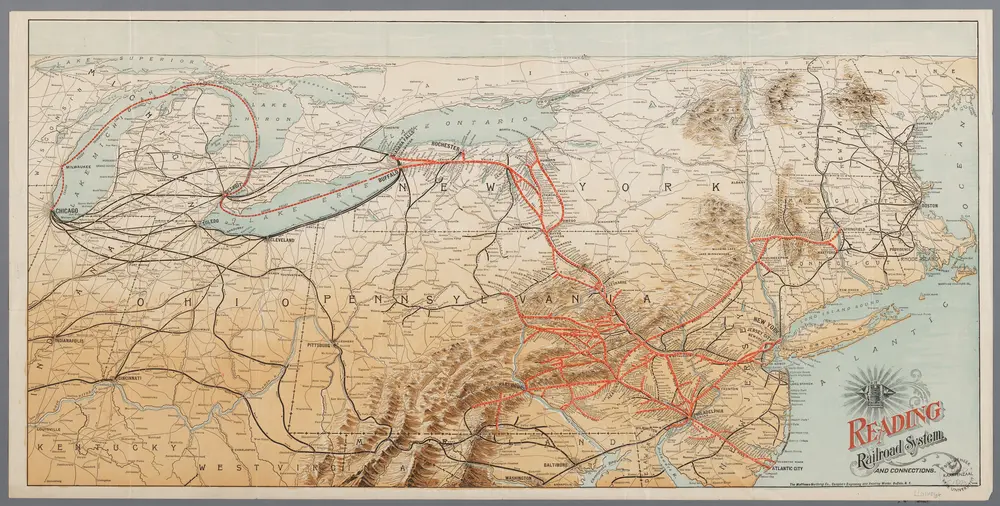
[Recto], uit: Reading railroad system and connections
1893
Buffalo, N.Y. : The Matthews-Northrup Co.
n/a
1858
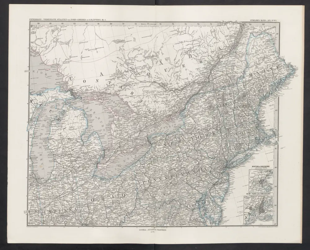
[Die Vereinigten Staaten von Nord-Amerika, Blatt 3]
1876
Stieler, Adolf
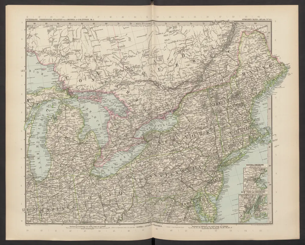
[Die Vereinigten Staaten von Amerika in 6 Blättern, Blatt 3]
1892
Stieler, Adolf