Maps of Czech Republic

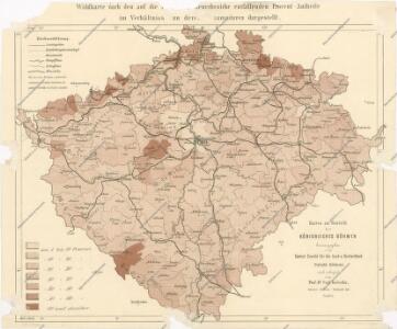
Karten zur Statistik des Königreiches Böhmen

General - Karte vom Königreich Böhmen

Přehled rozlohy krajin, podle kterých pořádají se hospodářské výstavy krajinské v Království českém
od c.k. vlastencké společnosti hospodářské v Království českém
Přehled rozlohy krajin, podle kterých pořádají se hospodářské výstavy krajinské v Království českém
od c.k. vlastencké společnosti hospodářské v Království českém
Mapa zalidněnosti Království českého dle sčítání obyvatelstva ze dne 31. prosince 1890
Čechy (Česko) Srb, Jan nákladem J. Otty
Hydrographische Karte des Königreiches Böhmen
1 : 500000 Česko Harlacher, A. R. Eigenthum und Verlag der hydrographischen Commision der Königreiches Böhmen
Statistisch-topographische Industrie Karte des Koenigreiches Boehmen...

Das Koenigreich Boehmen
1 : 860000 Siebert, A. Berg, Carl A. Siebert
Místopisná mapa Království českého
1 : 560000 Česko Brunclík, Josef Jos. L. Švíkal
Místopisná mapa Království českého
1 : 560000 Česko Brunclík, Josef Jos. L. Švíkal
Karte von dem Koenigreich Boeheim..

Post Charte vom Königreiche Böhmen
1 : 1200000 Česko
Post Charte vom Königreiche Böhmen
1 : 1200000 Česko
Post charte vom Königreiche Böhmen
1 : 1200000 Česko
Post charte vom Königreiche Böhmen
1 : 1200000 Česko
Post Charte vom Königreiche Böhmen
1 : 1200000 Česko
Post Charte vom Königreiche Böhmen
1 : 1200000 Česko
Post Charte vom Königreiche Böhmen
1 : 1200000 Česko
Post Charte vom Königreiche Böhmen
1 : 1200000 Česko
Post Charte vom Königreiche Böhmen
1 : 1200000 Česko
Post Charte vom Königreiche Böhmen
1 : 1200000 Česko
Příruční mapa Království českého
Čechy (Česko) Oberschall, Albin Schrober, Karel od c. a k. voj. zeměpisného ústavu
Příruční mapa Království českého
Čechy (Česko) Oberschall, Albin Schrober, Karel od c. a k. voj. zeměpisného ústavu
Handkarte des Königreiches Böhmen im Masze 1:1,000000
Čechy (Česko) Oberschall, Albin Schrober, Karel v. k.k. Milit. geograph. Institute
Bohemiae Regnum in XII. Circulos divisum ...

Karte vom Königreiche Böhmen
1 : 688000 Čechy (Česko) Röbling, August Medau, Karel Vilém von C.W. Medau
Generální mapa království českého

Karte des Königreiches Boehmen
1 : 875000 Česko Franz Raffelsperger
Železniční a silniční mapa království Českého