Maps of okres Praha-východ
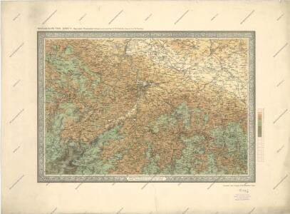
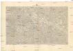
Prozkoumání Čech, sekce V.
Prozkoumání Čech, sekce V.
Prozkoumání Čech, sekce V.
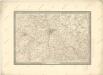
Prozkoumání Čech, sekce V.

Prozkoumání Čech sekce V.
Prozkoumání Čech, sekce V.

Prozkoumání Čech, sekce V.
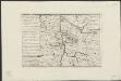
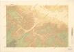
[Map of the battle near Prague, 1757]
[S.l.] : [s.n.]
[Střední Čechy]
1 : 220000 Čechy střední (Česko) Wagner, Jan Eduard F. Kytka
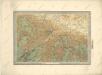
Střední Čechy
1 : 220000 Čechy střední (Česko) Wagner, Jan Eduard F. Kytka
[Mapa okolí pražského]
1 : 215000 Praha-oblast (Česko) Brož, Josef A. Storch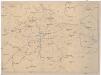
[Isochronická mapa okolí Prahy]
Praha (Česko : oblast) Pohl, J.
Isochronická a isochorická mapa okolí pražského
1 : 400000 Praha (Česko : oblast) Pohl, J.
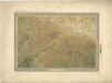
Střední Čechy

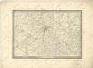
Special-Karte des Prager Kreis resp. politi. Karolinenthaler Verwaltungsbezirkes nach der politischen Eintheilung Böhmens v. Jahre 1868
1 : 204000 Karlín (Praha, Česko) Schmidt, Eduard
Special-Karte des Prager Kreis resp. politi. Karolinenthaler Verwaltungsbezirkes nach der politischen Eintheilung Böhmens v. Jahre 1868
Praha-oblast (Česko) Schmidt, Eduard Steyrer, Fr. C. Wend. Morauer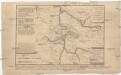
[Obléhání Prahy r. 1757]
1 : 400000 Praha (Česko)
Special-Karte des Prager Kreis resp. politi. Karolinenthaler Verwaltungsbezirkes
1 : 218000 Praha-oblast (Česko) Schmidt, Eduard Wend. Morauer
Special-Karte des Prager Kreis resp. politi. Karolinenthaler Verwaltungsbezirkes
1 : 218000 Karlín (Praha, Česko) Schmidt, Eduard Wend. Morauer
Special-Karte des Prager Kreis resp. politi. Karolinenthaler Verwaltungsbezirkes
1 : 218000 Praha-oblast (Česko) Schmidt, Eduard Wend. Morauer
Special-Karte des Prager Kreises
Praha-oblast (Česko) Schmidt, Eduard C.W. Medau
Special-Karte des Prager Kreises
Praha-oblast (Česko) Schmidt, Eduard C.W. Medau
Mapa Království českého
1 : 200000 Čechy střední (Česko) Kotyška, Václav Hanf, Norbert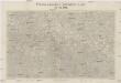
Příloha kalendáře "Národních listů" na rok 1909
1 : 200000 Praha-oblast (Česko) Kotyška, Václav Hanf, Norbert Julius Grérg
Nová mapa království Českého
Nová mapa království Českého
1 : 200000 Čechy střední (Česko) Kotyška, Václav Hanf, Norbert Bursík & Kohout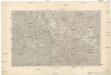
[Nová mapa království Českého
1 : 200000 Čechy střední (Česko) Kotyška, Václav Hanf, Norbert Bursík & Kohout
Elektrárenský svaz okresů středočeských
1 : 200000 Čechy střední (Česko) Vojenský zeměpisný ústav
Mapa okolí pražského se zvláštním zřetelem pro turisty a cyklisty
1 : 150000