Maps of Territoire-de-Belfort

Belfort

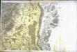
Blatt II: Belfort, Basel, uit: Topographische Karte der Schweiz / vermessen und hrsg. ... unter Aufsicht des Generals G.H. Dufour
1 : 100000 Annotatie: Met plaatsnamenregister (bl. V), bladwijzer (bl. XXI) en hoogteregister (bl. XXV); Voor aanwezige bladen zie overzichtsblad Dufour, G. H. [Bern : Eidg. Topogr. Bureau]
Le Flambeau de la Guerre Allumee au Rhin
Mollova mapová sbírka Delisle, Guillaume Schenk, Peter II
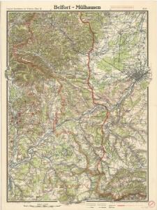
Meßtischblatt Hirsingen
1 : 250000 Hirsingen. - Aufn. 1885, hrsg. 1886, B. 08, N. 13, Aufldr. 1914. - 1:25000. - [Berlin]: Reichsamt für Landesaufnahme, 1914. - 1 Kt.
Meßtischblatt 3692/3696 : Friesen, 1914
1 : 250000 Friesen. - Aufn. 1885, hrsg. 1886, B. 08, N. 13, Aufldr. 1914. - 1:25000. - [Berlin]: Reichsamt für Landesaufnahme, 1914. - 1 Kt.
Meßtischblatt 3688 : Altkirch, 1914
1 : 250000 Altkirch. - Aufn. 1885, hrsg. 1887, B. 08, N. 13, Aufldr. 1914. - 1:25000. - [Berlin]: Reichsamt für Landesaufnahme, 1914. - 1 Kt.
Meßtischblatt 3687: Dammerkirch, 1887
1 : 250000 Dammerkirch. - Aufn. 1885. - 1:25000. - [Berlin]: Reichsamt für Landesaufnahme, 1887. - 1 Kt.
Meßtischblatt 3684 : Mülhausen (West), 1886
1 : 250000 Mülhausen (West). - Aufn. 1885. - 1:25000. - [Berlin]: Reichsamt für Landesaufnahme, 1886. - 1 Kt.
Meßtischblatt 3683 : Sentheim, 1887
1 : 250000 Sentheim. - Aufn. 1885. - 1:25000. - [Berlin]: Reichsamt für Landesaufnahme, 1887. - 1 Kt.
Meßtischblatt 3682 : Masmünster, 1886
1 : 250000 Masmünster. - Aufn. 1885. - 1:25000. - [Berlin]: Reichsamt für Landesaufnahme, 1886. - 1 Kt.
Meßtischblatt 3677 : Sennheim, 1887
1 : 250000 Sennheim. - Aufn. 1885. - 1:25000. - [Berlin]: Reichsamt für Landesaufnahme, 1887. - 1 Kt.
Meßtischblatt 3676 : Thann, 1897
1 : 250000 Thann. - Aufn. 1895. - 1:25000. - [Berlin]: Reichsamt für Landesaufnahme, 1897. - 1 Kt.
Meßtischblatt 3675 : Urbis, 1887
1 : 250000 Urbis. - Aufn. 1885. - 1:25000. - [Berlin]: Reichsamt für Landesaufnahme, 1887. - 1 Kt.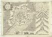
Besfort
1 : 2800 Belfort (Francie) Du Chaffat, Antoine par du Chaffat
Topographische Karte der Schweiz
1 : 100000 25 Karten vermessen und hrsg. auf Befehl der Eidgenössischen Behörden ; aufgenommen unter der Aufsicht des Generals G.H. Dufour Eidg. Topographisches Bureau, [Genève], [später: Bern]
Le cours du Rhin de Bâle à Hert près Philisbourg contenant l'Alsace et partie du Brisgau, 1
1 Blatt : 76 x 52 cm Le Rouge
Belfort, Basel
1 : 100000 1 Karte par Aug. Jaccard et Alb. Muller [i.e. Müller] [Wurster & Randegger], [Winterthur]
Le Theatre de la Guerre Sur le Haut Rhein
1 : 142000 Mollova mapová sbírka Sanson, Guillaume
Alasatia superior et inferior III. tabulis delineata, 1
1 Blatt : 62 x 62 cm s.n.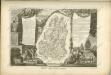

Departement du Haut Rhin
1 Karte : Kupferdruck ; 16 x 14 cm au dépot de l'Atlas national rue de la Monnoye no. 5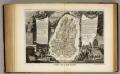
Dept. Du Haut Rhin.
1 : 571000 Levasseur, Victor.
Partie de la Haute Alsace le Suntgaw, et le Brisgaw Partie du Canton de Basle et du Cours du Rhein ou sont les Valles de Brisac Fribourg, Colmars Huningue Befort et Basle
1 : 160000 Mollova mapová sbírka Baillieul, Gaspard Bailleul, Gaspard
Freiburg
1 : 200000 Herder, Bartholomew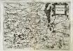
Svnggoia
1 Karte : Kupferdruck ; 15 x 20 cm Lambert Andreae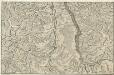
Le Cours du Rhein, depuis Spire jusqu'a Mayence
1 : 180000 Mollova mapová sbírka Fer, Nicolas de Starckman, P. Fer, Nicolas de
184. Gebweiler, uit: Topographische Uebersichtskarte des Deutschen Reiches / herausgegeben v. d. Kartogr. Abt. d. Königl. Preuß. Landesaufnahme
1 : 200000 titelvariant: Topogr. Übersichtskarte des Deutschen Reiches; Annotatie: Titel boven bladen ook: Topogr. Übersichtskarte des Deutschen Reiches; Annotatie geografische gegevens: Op elk blad twee maatstokken: 10 Kilometer = 5,5 cm; 1 geogr. Meile = 3,6 cm; Legenda onder op elk blad Königlich Preußische Landesaufnahme. Kartographische Abtheilung [S.l : Königlich Preußische Landesaufnahme, Kartographische Abtheilung]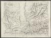
Le Canton de Basle, et parties des cantons d'Argauvie et Soleure du Frikthal et frontières
1 : 108000 Weiss, Johann Heinrich ; Scheuermann, Johann Jakob ; Meyer, Johann Rudolf J. R. Meyer