Maps of Sud
Bez titulu: Übersichts Karte von Mittel Europa: Bucuresti
Uibersichts Karte der k.k. Militair Grenze
1 : 1410000 Rakousko (1804-1867) Höllnstein, E.
Karte des Oesterreichisch - ungarischen Reiches

Iustissimae causae heroica virtute propugnatae gloriosiß: triumphi praemium sive accurata delineatio provinciarum et urbium quae duibus celeberrimis expeditionibus iuste domino ac victori restitutae et pace Passarowiziensi A. 1718 d. 21 Iulii u. dobellatis Turc. concellae et assignatae sunt
Serbien, Banat, Požarevac / Friede Seutter, Matthäus
Nr. 11a. Österreichs Erwerbungen im Frieden von Passarowitz 1718
Österreich Expansion, Požarevac / Friede
Mappa der zu Carlovitz geschlossenen und hernach durch zwey gevollmächtigte Commissarios vollzogenen Kaiserlich-Türkischen Grantz-Schneidung
1 : 1900000 Mollova mapová sbírka Weigel, Christoph
[Österreich-Ungarn, Blatt 4]
Adolf Stieler's Handatlas über alle Theile der Erde und über das Weltgebäude Stieler, Adolf Justus Perthes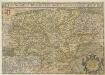
Hvngariae Descriptio
1 : 1400000 Mollova mapová sbírka Lazius, Wolfgang
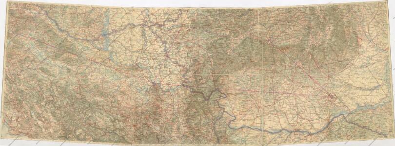
XI, uit: General-Karte von Mittel-Europa in 12 Blättern, im Masse 1:1.200.000 / entworfen, bearb. und hrsg. von Josef Schlacher
1 : 1200000 Annotatie: Blad 6 ontbreekt; Annotatie geografische gegevens: 21 maatstokken op blad 9; Legenda op blad 9 Wien : K.K. Militär Geografisches Institut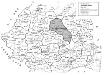
Die Autonome Madjarische Region
Rumänien, Szeklerland, ethnische Gruppe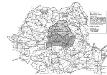
Die Autonome Madjarische Region 1960-1968
Rumänien ethnische Gruppe, Magyaren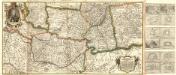
Neu Eröffnetes Kriegs Theatrum das ist Gantz Neue und Accurate Special Landkarten
Mollova mapová sbírka
Tabula Bannatus Temesiensis
1 : 407000 Banát Griselini, Francesco Cipps, Augustin Johann Paul Krauss
Orsova
1 : 750000 Oršava (Rumunsko) Kotrtsch, F. K. u. k. Militärgeographisches Institut
Die Walachei im 18./19. Jahrhundert
Walachei Städtenetz, Siedlung Zwick, J.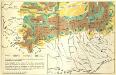
[Siebenbürgen : Weidewirtschaft]
Siebenbürgen Transhumanz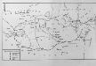
Die Walachei (14.-18. Jahrhundert)
Walachei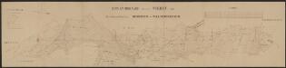
Sclavonia, Croatia, Bosnia Cum Dalmatiae Parte. [Karte], in: Gerardi Mercatoris et I. Hondii Newer Atlas, oder, Grosses Weltbuch, Bd. 1, S. 352.
1 Karte aus Atlas Mercator, Gerhard und Hondius, Jodocus Jansson, Jan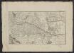
Théatre de la guerre actuelle, en Allemagne, en Pologne et en Turquie. n18, Bellegrade, Sziget ou Ziget
1 : 900000 Chanlaire, Pierre Grégoire 1758-1817 Paris : chez l'auteur P. G. Chanlaire
[Bosnien, Herzegowina, Serbien und Montenegro]
1 : 1200000 Bosna a Hercegovina J. Schlacher
Sclavonia, Croatia, Bosnia cvm Dalmatiae parte
1 Karte : Kupferdruck ; 34 x 44 cm Mercator; Hondius Henricus Hondius
Sclavonia, Croatia, Bosnia cvm Dalmatiae parte
1 Karte : Kupferdruck ; 34 x 44 cm Mercator s.n.
Die Kriegsschauplatz in Ungarn
1 : 864000 Evropa jihovýchodní K.k. Generalstabes
Die Kriegsschauplatz in Ungarn
1 : 864000 Evropa jihovýchodní K.k. Generalstabes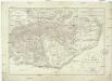
Generalcharte der Walachey
1 : 740000 Rumunsko Fried, Franz Kunst und Industrie Comptoir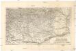
Die Walachei
1 : 800000 Valašsko (Rumunsko) Kiepert, Heinrich Hanemann, August Geographisches Institut

Sclavonia, Croatia, Bosnia cum Dalmatiae Parte. [Karte], in: Novus Atlas, das ist, Weltbeschreibung, Bd. 1, S. 210.
1 Karte aus Atlas Blaeu, Joan Blaeu, Willem Janszoon
Bez titulu: Bosna, Srbsko a Černá hora