Maps of Northeast
Hydrografische Uibersichtskarte der Flüsse, Bäche und sonstigen Gewässer im Königreiche Boehmen

[Česko]
Česko
Koenigreich Boehmen...

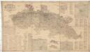
General-Karte des Königreiches Böhmen...

Übersichtskarte der Aerarialstrassen, Eisenbahnen, dann der floss... in Böhmen
Detail-Operations-Karte für den Krieg in Böhmen 1866
1 : 290000 Česko
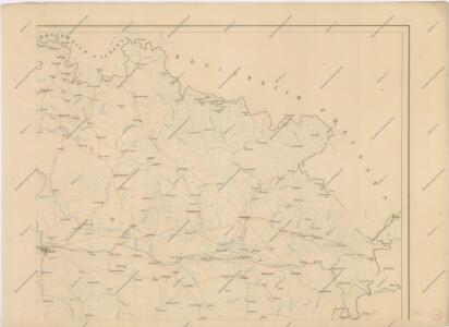
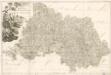
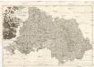
Karte des Bunzlauer- Jičiner- und Königgrätzer Kreises im oestreichischen Kronlande Boehmen
1 : 287000 Hradec Králové-oblast (Česko) Obentraut, Maxmilian Friedrich Kretzschmar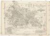
Karte des Bunzlauer- Jičiner- und Königgrätzer Kreises im oestreichischen Kronlande Boehmen
1 : 287000 Hradec Králové-oblast (Česko) Obentraut, Maxmilian Friedrich Kretzschmar
Partie de la Boheme du nord est
Chrudim-oblast (Česko) Kindermann, Joseph Karl Benedict, Ant. im Verlage des Kunst- und Industrie Comptoirs
Nordöstlicher Theil von Boehmen enthaltend den Bunzlauer, Bidschower, Königgrätzer, Chrudimer, Czaslauer und Kaurzimer Kreis
1 : 540000 Chrudim-oblast (Česko) Kindermann, Joseph Karl Benedict, Ant. Kunst und Industrie Comptoir
Královehradecká dieceze
1 : 250000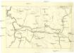
[Nordostböhmen]
1 : 750000 Čechy severovýchodní (Česko)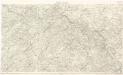
Detail - Karte des nordöstlichen Böhmens

Regni Bohemiae Circuli Biczoviensis et Regionhradecensis...

Uebesichts Karte des Eisenbahnzuges...Pardubitz nach Reichenberg
Spezial Karte für Verkehr, landwirtschaftliche, Montan u. gewerbliche Industrie des Bezirkes der Handels und Gewerbekammer Reichenberg
1 : 150000 Liberec-oblast (Česko) Daniel, N. N. Daniel
Atlas Bohemiae
M. Provincia Reginohradecensis et Comitatus Glacensis

Region Královehradecký
1 : 350000
Uebersichts-Karte des Eisenbahnzuges der Süd-Norddeutschen Verbindungsbahn von Pardubitz nach Reichenberg
Liberec (Česko : oblast)
Region Královehradecký
1 : 350000
Kriegsschauplatz Nordböhmen 1866
1 : 200000 Čechy severní (Česko) K. u. k. militär-geographisches Institut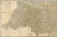
Bidschower und Konigrätzer Kreis...

Sect. 20: Görlitz, uit: Geologische Karte des Deutschen Reichs in 27 Blaettern / [von] Richard Lepsius ; Red. von C. Vogel
1 : 500000 Annotatie: Blad 18 ontbreekt; Een aantal bladen op linnen; Een aantal bladen gereviseerd 1913-1914; Annotatie geografische gegevens: Met schaalstokken o.a. in kilometers; Legenda Carl Vogel 1828-1897 Gotha : Justus Perthes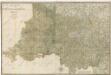
Bidschower und Konigrätzer Kreis...
PROVINCIA REGINOHRADECENSIS et COMITATUS GLACENSIS
Hradec Králové-oblast (Česko) Bernardi, Augustin Augustin Bernardi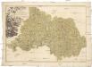
Provincia Reginohradecensis et comitatus Glacensis
Kladsko-oblast (Polsko) Müller, Johann Christoph Winkler
Církevní mapa biskupství Králové-Hradeckého

Königgrätz (Schweidnitz)
1 : 300000 Čechy východní (Česko) Hübl Frokr