Maps of Janské Lázně
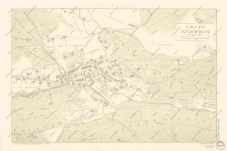
Situationsplan von Johannisbad

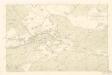
Johannesbrunn - c2766-1-001 - Kaiserpflichtexemplar der Landkarten des stabilen Katasters
1 : 2880
Johannesbrunn - c2766-1-002 - Kaiserpflichtexemplar der Landkarten des stabilen Katasters
1 : 2880
Johannesbrunn - c2766-1-003 - Kaiserpflichtexemplar der Landkarten des stabilen Katasters
1 : 2880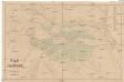
Plan von Johannisbad mit nächster Umgebung
Janské Lázně (Česko) Lang, Heinrich A. Haase
Marschendorf I.ter Theil - c4491-1-002 - Kaiserpflichtexemplar der Landkarten des stabilen Katasters
1 : 2880
Marschendorf I.ter Theil - c4491-1-001 - Kaiserpflichtexemplar der Landkarten des stabilen Katasters
1 : 2880
Riesengebirge
1 : 40000 Janské Lázně-oblast (Česko) Klimesch, F. Alexius Kiessling
[Gradkartenblatt]
1 : 25000 Krkonoše (Česko a Polsko) Vojenský zeměpisný ústav
III. vojenské mapování 3755/2
1 : 25000
Gustava Steinera plastická mapa Krkonoš
1 : 35000 Krkonoše-oblast (Česko a Polsko) Steiner, Gustav Marx, Maxmilian Český menšinový podnik knihkupecký a papírnický
[Kartenblatt]
1 : 25000 Krkonoše (Česko a Polsko : pohoří) Reichsamt für Landesaufnahme
[Kartenblatt]
1 : 25000 Krkonoše (Česko a Polsko : pohoří) Reichsamt für Landesaufnahme
Vertretungsbezirk Arnau

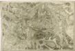
Petrographische Charte eines Theils des Böhmischen Riesengebirges an der Schlesischen Gränze


Übersichts- und Terrainkarte der gräflich Czernin-Morzin'schen Domainen Hohenelbe und Marschendorf im Riesengebirge
1 : 50000 Horní Maršov (Česko) R. Mittelbach
Lyžařská mapa Krkonoš
1 : 116000 Krkonoše-oblast (Česko a Polsko) Macháček, Vil. Svaz lyžařů RČS
Mittelbach ́s neueste Spezialkarte des Riesengebirskammes mit näheren Umgebung

Mapka Krkonošů
1 : 160000 Krkonoše-oblast (Česko a Polsko)
Neueste Wegekarte vom Riesengebirge und Situationsplan von Johannsbad
1 : 75000 Janské Lázně (Česko : oblast) Vatter, Alfred Alfred Vatter
Podrobné mapy zemí Koruny české v měřítku 1:75.000 a mapa vzdáleností všech míst při silnici ležících - Krkonoše - Vrchlabí - Žacléř. Průvodce statisticko-historický po všech místech na těchto mapách uvedených a rejstřík věcný názvů hor, potoků, řek, rybníků atd. Sešit 9. List 88,
1 : 75000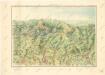
Krkonoše
Topographische und Militairische Carte desienigen Theils von Boehmen...

Petrographische Charte eines Theils des böhmischen Riesengebirges an der schlesischen Gränze
1 : 82600 Krkonoše (Česko a Polsko) Jirasek, Johann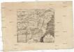
Petrographische Charte eines Theils des böhmischen Riesengebirges an der schlesischen Gränze
1 : 82600 Krkonoše (Česko a Polsko) Jirasek, Johann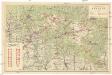
Turistická mapa Krkonoš
1 : 60000 Krkonoše-oblast (Česko a Polsko) Josef Uher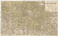
Turistická mapa Krkonoš
1 : 56000 Krkonoše (Česko a Polsko) Dvořák, Karel Klub československých turistů