Maps of Czech Republic

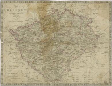
Charte von Boehmen

Charte von Boehmen
1 : 1000000 Česko Kipferling, Karl Joseph in J. Riedl's Kunsthandlung
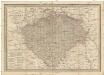
Karte fon Königreiche Böhmen...

Charte des Königreiches Böhmen...

Charte von Boehmen
1 : 1000000 Čechy (Česko) Kipferling, Karl Joseph Schönberg, Johann Johann Schönberg
Charte von Boehmen
1 : 1000000 Čechy (Česko) Kipferling, Karl Joseph Schönberg, Johann Johann Schönberg
Charte von Boehmen
1 : 1000000 Čechy (Česko) Kipferling, Karl Joseph im Verlage des Kunst u. Industrie Comptoirs
Special-Karte des Königreiches Boehmen
1 : 890000 Česko
Mapa Čech
1 : 500000
Charte der älteren und neueren Bergbaue in Böhmen
1 : 960000 Česko Hamernik, J.
Hydrographische Karte des Königreiches Böhmen

Topographische Landkarte von Böhmen
1 : 560000 Čechy (Česko) V. Klement's Nachfolger
Theatre de la guerre en Boheme...
Karte der kohlenführenden Gebirgsformationen von Böhmen
Česko Zippe, Franz X. Maxmilian Kočzy
Carta del regno di Boemia
1 : 530000 Čechy (Česko) Raffelsperger, Franz Raffaelle
Carte du royaume de Boheme
1 : 530000 Čechy (Česko) Raffelsperger, Franz Rumpold, F. François Raffelsperger
Bohemia [Karte], in: Le théâtre du monde, ou, Nouvel atlas contenant les chartes et descriptions de tous les païs de la terre, Bd. 1, S. 204.
1 Karte aus Atlas Blaeu, Willem Janszoon und Blaeu, Joan Blaeu, Willem Janszoon
Strassenkarte des Koenigreiches Boehmen

Bez titulu: Soubor statistických map Čech

Karte vom Königreiche Böhmen
1 : 690000 Česko Carl Wilhelm Medau
Karte vom Königreiche Böhmen
1 : 690000 Česko Carl Wilhelm Medau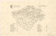
Eisenbahn-Uebersichtskarte des Königreiches Böhmen

Das Königreich Böhmen : nach der neuesten politischen Eintheilungen berichtigt / entw. und gez. von C.F. Weiland
1 : 600000 Weiland, C. F. Weimar : Geograph. Institut
Bez titulu: Statistické mapky Čech

Special-Karte des Königreiches Böhmen

Charte von Boehmen
General-Post & Strassen-Karte des Königreichs Boehmen
1 : 650000 Čechy (Česko) Fried, Franz Artaria & Comp.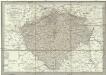
Neueste General-Post & Strassen-Karte des Königreichs Boehmen
1 : 650000 Česko Fried, Franz Artaria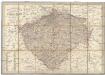
Neueste General-Post & Strassen-Karte des Königreichs Boehmen
Čechy (Česko) Fried, Franz Sartorius, Johann Christoph Artaria