Maps of Praha

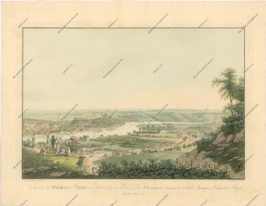
Bez titulu: Čechy – kolekce vedut
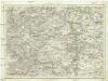
Umgebung von Prag
Praha-oblast (Česko) Biller, Bernhardt Marco Berra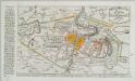
Plan der Battaille welche d. 6. Maj zwischen den Kayserl. Königl. Ungarische[n] u. Königlich Preusische[n] Armee bey Prag geliefert worden. 1757
1 : 90000
[Umgebungen der königl. Hauptstadt Prag]
1 : 45000 Praha-oblast (Česko) Basdar
Belagerung der Königl. Haupt-Stadt Prag
1 : 57000 Berounka (Česko) Werner, Bedřich Bernard Strahowsky, B.
Plan der Battaille welche d. 6. Maj zwischen der kayserlich-königlich-ungarischen und königlich preussischen Armée bey Prag geliefert worden, 1757
Praha (Česko)
Praha a okolí
Praha (Česko : oblast) Kuchař, Karel
Belagerung der königlicher Haupt-Stadt Prag...

Praha - městská hromadná doprava
1 : 40000
Podrobné mapy zemí Koruny české v měřítku 1:75.000 - Praha - Brandýs n. L. Průvodce statisticko-historický po všech místech na těchto mapách uvedených a rejstřík věcný názvů hor, potoků, řek, rybníků atd. a mapa vzdáleností všech míst při silnici ležících Sešit 1. List 55,
1 : 75000
Regulační plán Velké Prahy s okolím
1 : 50000
Výškopisný plán hlavního města Prahy s okolím
1 : 20000 Praha (Česko) obec Pražská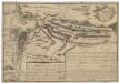
Recht wahrhaffte Vorstellung der den 6ten May A.no 1757 zwischen der kaisserl. und könig. preüss. Armée bey Prag vorgefallenen Bataille
Praha (Česko) Salzer, Ignác
Recht wahrhaffte Vorstellung der den 6ten May A.no 1757 zwischen der kasserl. und könig. preüss. Armée bey Prag vorgefallenen Bataille
Praha (Česko) Salzer, Ignác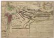
Recht wahrhaffte Vorstellung der den 6ten May A.no 1757 zwischen der kaisserl. und könig. preüss. Armée bey Prag vorgefallenen Bataille
Praha (Česko) Salzer, Ignác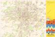
Jižní Město. - Opatov Orientační plán 2. souboru
1 : 2500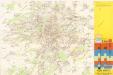
Jižní Město. - Háje Orientační plán 1. souboru
1 : 3500
Bez titulu: Jihovýchodní okolí Prahy

Plan van de stadt en de beleegering van Praag, 1757 = Plan de la ville & du siege de Prague, en 1757
T. Otten sc. ['s-Gravenhage] : P. Gosse excudit
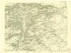
Okolí Prahy
1 : 25000 Praha (Česko : oblast) Hurtig, Alfred Stát. komise
Verbesserter Grundriß der königl. bohmischen Haupt Stadt Prag mit der königl. ungarschen Belagerung und Attaquen A 1742
Praha (Česko) Riegel, Christoph bey Christoph Riegel
Grundriß der königl. bohmischen Haupt Stadt Prag mit der königl ungarschen Belagerung und Attaquen A 1742
Praha (Česko)
[Gradkartenblatt]
1 : 25000 Praha (Česko : oblast) Vojenský zeměpisný ústav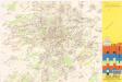
Jižní Město. - Litochleby Orientační plán 3. souboru
1 : 2500
Městské podniky Pražské
III. vojenské mapování 3953/3
1 : 25000
Nový, úředně schválený plán Velké Prahy
1 : 25000
Přehledná mapa Velké Prahy
1 : 35000 Praha (Česko : oblast) Brož, Josef A. Storch syn
Gradkartenblatt
1 : 25000 Unhošť-oblast (Česko) Albrecht, Julius