Maps of Mnichovo Hradiště

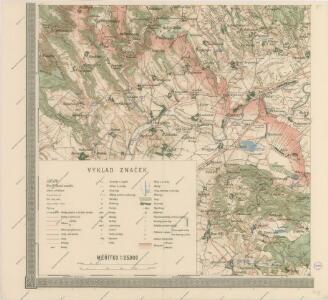
Mapa politického okresu Turnovského

[Kartenblatt]
1 : 25000 Mnichovo Hradiště (Česko : oblast) Reichsamt für Landesaufnahme
Gradkartenblatt
1 : 25000 Mnichovo Hradiště-oblast (Česko) Guggenberg zu Riedhofen, Athanasius von
Plan zu den Gefechten bei Münchengrätz

III. vojenské mapování 3754/3
1 : 25000
Plan der Gefechtsfelder von Podol am 26. Juni, und der 7. und 8. Division bei Münchengrätz am 28. Juni 1866
1 : 25000 Mnichovo Hradiště-oblast (Česko) Bothe

Plan zu den Gefechten bei Münchengrätz 28. Juni 1866
1 : 28880 Mnichovo Hradiště (Česko) Ditfurth, Moritz von des K. u. k. Militärgeographischen Instituts
Plan zu den Gefechten bei Münchengrätz 28. Juni 1866
1 : 28880 Mnichovo Hradiště-oblast (Česko)
Plan der Gefechtsfelder von Podol am 26. Juni, und der 7. und 8. Division bei Münchengrätz am 28. Juni 1866
1 : 25000 Mnichovo Hradiště-oblast (Česko) Bothe
Plan zum Gefechte bei Podol 26. Juni 1866
1 : 28860 Podolí (Svijany, Česko)
Zdiar - c9360-1-004 - Kaiserpflichtexemplar der Landkarten des stabilen Katasters
1 : 2880
Zdiar - c9360-1-001 - Kaiserpflichtexemplar der Landkarten des stabilen Katasters
1 : 2880
Zdiar - c9360-1-003 - Kaiserpflichtexemplar der Landkarten des stabilen Katasters
1 : 2880
Zdiar - c9360-1-008 - Kaiserpflichtexemplar der Landkarten des stabilen Katasters
1 : 2880
Zdiar - c9360-1-005 - Kaiserpflichtexemplar der Landkarten des stabilen Katasters
1 : 2880
Zdiar - c9360-1-007 - Kaiserpflichtexemplar der Landkarten des stabilen Katasters
1 : 2880
Zdiar - c9360-1-002 - Kaiserpflichtexemplar der Landkarten des stabilen Katasters
1 : 2880
Zdiar - c9360-1-006 - Kaiserpflichtexemplar der Landkarten des stabilen Katasters
1 : 2880
Gefechtsfeld der Elb-Armee bei Münchengrätz 28. Juni 1866
1 : 25000 Mnichovo Hradiště-oblast (Česko) Gnügge
Gefechtsfeld der Elb-Armee bei Münchengrätz 28. Juni 1866
1 : 25000 Mnichovo Hradiště-oblast (Česko) Gnügge
Laukow - c4252-1-004 - Kaiserpflichtexemplar der Landkarten des stabilen Katasters
1 : 2880
Laukow - c4252-1-002 - Kaiserpflichtexemplar der Landkarten des stabilen Katasters
1 : 2880
Laukow - c4252-1-001 - Kaiserpflichtexemplar der Landkarten des stabilen Katasters
1 : 2880
Laukow - c4252-1-003 - Kaiserpflichtexemplar der Landkarten des stabilen Katasters
1 : 2880
Mukařow - c4897-1-004 - Kaiserpflichtexemplar der Landkarten des stabilen Katasters
1 : 2880
Mukařow - c4897-1-006 - Kaiserpflichtexemplar der Landkarten des stabilen Katasters
1 : 2880
Mukařow - c4897-1-003 - Kaiserpflichtexemplar der Landkarten des stabilen Katasters
1 : 2880
Mukařow - c4897-1-001 - Kaiserpflichtexemplar der Landkarten des stabilen Katasters
1 : 2880
Mukařow - c4897-1-005 - Kaiserpflichtexemplar der Landkarten des stabilen Katasters
1 : 2880