Maps of okres Děčín
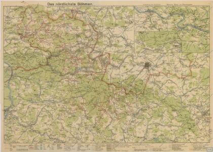
Das nördlichste Böhmen
Das nördlichste Böhmen
1 : 75000 Čechy severní (Česko) Richter, A. Oesfeld, C. W.
Neue Karte von Nordböhmen, der Oberlausitz und der Sächsischen Schweiz
1 : 75000 Horní Lužice (Německo) Heinrich Pfeifer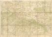
Wanderkarte durch Nordböhmen

Rumburg und Warnsdorf.
from Spezialkarte der osterreichisch-ungarischen Monarchie.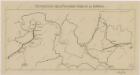
Sbírka map a diagramů použitých na mírových konferencích v Paříži v letech 1919 - 1920

Spezial-Karte der Sächsischen u Böhmischen Schweiz so wie der Umgegend von Dresden und dem Plauenschen Grunde
České Švýcarsko (Česko) Schmidt, Eduard Fort, L. L. Fort
Soubor přehledných map pro plánování a statistiku: 3553 – Šluknov

Landkreise Schluckenau, Warnsdorf, Rumburg
1 : 75000 Protektorát Čechy a Morava Dienststelle für Raumordnung und Landesplanung beim Regierungspräsidenten
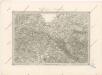
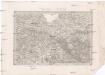
Generalkarte der Bezirkshauptmannschaft Rumburg
1 : 220000 Rumburk-oblast (Česko) Wagner, Jan Eduard F. Kytka
Děčínsko

II. vojenské mapování 3
1 : 144000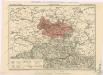
Generální mapa okresních hejtmanství
Special - Karte des Koenigreiches Boehmen

II. vojenské mapování 3
1 : 144000
Soubor přehledných map pro plánování a statistiku: Šluknov 3553
Umgebungen von Reichenberg
1 : 144000 Liberec-oblast (Česko) Baur, A. K. u. k. Militärgeographisches Institut
Varnsdorf
1 : 75000 Varnsdorf-oblast (Česko) Vojenský zeměpisný ústav
III. vojenské mapování 3653
1 : 75000
Karte des Bezirkes Deutsch-Gabel
1 : 75000 Jablonné v Podještědí-oblast (Česko) Stelzig, Heinrich Freier Lehrervereinim Schulbezirke Deutsch-Gabel
Rumburg und Warnsdorf
1 : 75000 Rumburk (Česko : oblast) Lampe K. u. k. militär-geographisches Institut
Rumburg und Warnsdorf
1 : 75000 Rumburk (Česko : oblast) Lampe K. u. k. Militärgeographisches Institut
Rumburg und Warnsdorf
1 : 75000 Rumburk (Česko : oblast) K. u. k. Militärgeographisches Institut
Varnsdorf
1 : 75000 Cvikov (Česko : oblast) Vojenský zeměpisný ústav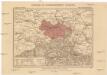
Generalkarte der Bezirkshauptmannschaft Schluckenau
1 : 220000 Šluknov-oblast (Česko) Wagner, Jan Eduard F. Kytka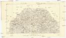
Podrobná mapa Království českého
1 : 100000 Rumburk (Česko : oblast) Srp, Jan Jos. R. Vilímek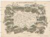
Das böhmisch-sächsische Grenzgebirge
Lužická Nisa-oblast lith. Kunstanstalt von Ed. Strache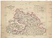
Charte des Rumburger Bezirk-Strafgerichtes
1 : 65000 Rumburk-oblast (Česko) Medau, Karel Vilém Lehrpersonale der Leitmeritzer Diöcesan- und Kreis-Hauptschule
Section Zittau