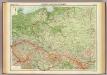
Maps of Poland

Sbírka map a diagramů použitých na mírových konferencích v Paříži v letech 1919 - 1920
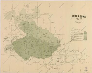
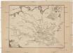
Mapa historického vývoje Československého státu (od XIV. do XIX. století)

Czechoslovakia.
From Czechoslovakia
Ideal Postcharte von Boehmen
Evropa střední Berka, Jan Wenzel Schwarz
Ideal Postcharte von Boehmen
Evropa střední Berka, Jan Wenzel Schwarz
[XIII], uit: Geognostische Karte des Oesterreichischen Kaiserstaates mit einem grossen Theile Deutschland's u. Italien / hauptsachlich nach ... Haidinger's geognostischer Karte dieses Staates bearb. von Josef Scheda
1 : 3000000 titelvariant: General-Karte von Europa in 25 Blättern; Annotatie: Bijlage bij: General-Karte von Europa in 25 Blättern. - 1:2.592.000. - 1845-1847 Scheda, Joseph Wien : K.K. Militär. Geografisch. Institut
Allemagne, Pologne, Tchecoslovaquie.
1 : 2500000 Vivien St Martin, L.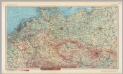
Central Europe. Pergamon World Atlas.
1 : 2500000 Polish Army Topography Service
Mapa vývoje České koruny od XIV. století
1 : 3900000 Česko Hocke, Jan Kapras, Jan
Letecká navigační mapa

Das allmälige Wachsthum des preussischen Staates. No. 44 Preussen in seiner gegenwärtigen Gestalt
Preußen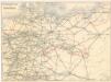
Eisenbahnverbindungen in Deutschland

Germany : International frontiers 1937 : internal boundaries 1944
1 : 1600000 [London] : [War Office]
Partie, l'Allemagne. Europe 14.
1 : 1641836 Vandermaelen, Philippe, 1795-1869
Polen unter Boleslaw Chrobry und bis 1139
1 : 12000000 Polen Bolesław I., Polen, König
Polen u. Nachbarländer 963 bis 992
1 : 12000000 Polen
Eisenbahn- und Reise-Karte vom Deutschen Reiche
1 : 1750000 Německo E. Heckendorff's Verlag
Prussia, German States.
1 : 4400000 Mitchell, Samuel Augustus
Prussia, German States.
1 : 4400000 Mitchell, Samuel Augustus
Prussia, German States.
1 : 4400000 Mitchell, Samuel Augustus Jr.
Prussia, German States.
1 : 4400000 Mitchell, Samuel Augustus
Prussia, German States.
1 : 4400000 Mitchell, Samuel Augustus
Prussia, And The German States.
1 : 4400000 Mitchell, Samuel Augustus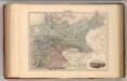
Allemagne.
1 : 3000000 Migeon, J.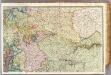
France 2.
1 : 1170000 Brue, Adrien Hubert, 1786-1832; Herisson, Eustache, b. 1759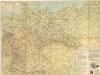
Strassenzustandskarte von Deutschland

Parte Orientale della Germania Diuisa Ne Suoi Stati
1 : 2100000 Mollova mapová sbírka Coronelli, Vincenzo Maria
Parte Orientale della Germania Diuisa Ne Suoi Stati
1 : 2100000 Mollova mapová sbírka Coronelli, Vincenzo Maria