Maps of Stredočeský

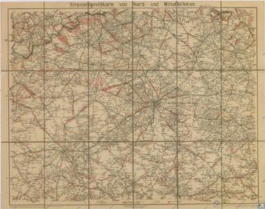
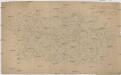
Strassenprofilkarte von Nord und Mittel Böhmen
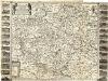
Charte von der Prager Erzbischöflichen Diöcese von fünf Kreisen des Königreichs Böhmen
Bohemia in suas partes geograph. distinc
1 : 512000 Mollova mapová sbírka Sandrart, Jakob von Sandrart, Jacob von
Nejstarší hroby v Čechách
Čechy (Česko)
Prag mit den Umgebungen
1 : 570000 Praha (Česko) Kettner, Carl C. W. Enders
Prag mit den Umgebungen
1 : 570000 Praha-oblast (Česko) Enders, C. W. C.W. Enders
Středočeský kraj

Středočeský kraj
Entwurf zur Prager Erzbischof Diocesan Charte verfertigt fuer [...] Erzbischof [Wen. Leop.] Chlumczansky
Karlovy Vary-oblast (Česko) Kreibich, František Jakub Jindřich
Kraj pražský
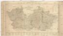
Charte von der Prager erzbischöflichen Diöcese von fünf Kreisen des Königreichs Böhmen
1 : 210000 Karlovarský kraj (Česko)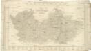
Charte von der Prager Erzbischöflichen Diöcese von fünf Kreisen des Königreichs Böhmen
1 : 210000 Praha-oblast (Česko)
Budweis - Prag - Badenbach, Budweis - Pilsen- Komotau
Chomutov (Česko) K. k. Österreichische Staatsbahnen
Naleziště nejstarší keramiky v Čechách jako stopa prvního osídlení
Čechy (Česko)
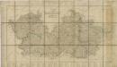
Nordwestlicher Theil von Boehmen, enthaltend den Pilsner, Ellbogner, Saazer, Leutmeritzer und Rakonitzer Kreis
1 : 540000 Litoměřice-oblast (Česko) Kindermann, Joseph Karl Kunst und Industrie Comptoir
[Karte vom Preussische Staate und den angränzenden Ländern, östlich von Berlin]
1 : 280000 Čechy severní (Česko) Engelhardt, F. B. Bembé Simon Schropp und Comp.
Charte ehemaliger Burgen & Vesten im Rakonitzer, Kauřimer und Berauner Kreise Böhmens
1 : 550000 Beroun-oblast (Česko) Heber, Franz Alexander C. W. Medau
Charte ehemaliger Burgen & Vesten im Rakonitzer, Kauřimer und Berauner Kreise Böhmens
Rakovník-oblast (Česko) Heber, Franz Alexander Netopil, Fr. C.W. Medau
Umgegend von Prag
1 : 325000 Praha-oblast (Česko) Engelhardt, Friedrich Bernhard Simon Schropp'sche Hof-Landkartenhandlung
Umgegend von Prag
1 : 325000 Praha-oblast (Česko) Engelhardt, Friedrich Bernhard Simon Schropp'sche Hof-Landkartenhandlung
Umgegend von Prag

Církevní mapa biskupství Litoměřického

Carte Topographique D ́Allemagne

[Střední Čechy]
1 : 220000 Čechy střední (Česko) Wagner, Jan Eduard F. Kytka
Střední Čechy
1 : 220000 Čechy střední (Česko) Wagner, Jan Eduard F. Kytka
Special-Karte des Prager Kreises
Praha-oblast (Česko) Schmidt, Eduard C.W. Medau
Special-Karte des Prager Kreises
Praha-oblast (Česko) Schmidt, Eduard C.W. Medau
Special-Karte des Prager Kreis resp. politi. Karolinenthaler Verwaltungsbezirkes
1 : 218000 Praha-oblast (Česko) Schmidt, Eduard Wend. Morauer
Special-Karte des Prager Kreis resp. politi. Karolinenthaler Verwaltungsbezirkes
1 : 218000 Karlín (Praha, Česko) Schmidt, Eduard Wend. Morauer