Maps of Baja California
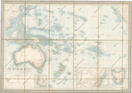
Australien

Stille Zuidzee 2 / [getekend door] R. van Wijk ; [naar schetsen van R.G. Bennet en J. van Wijk Roelandsz.]
Dordrecht : J. de Vos
Mexico 1.
1 : 2500000 Humboldt, Alexander von, 1769-1859
Die untere oder südliche Halbkugel der Erde
země světa Ecker, Johann Anton Benedicti, Hieronymus von J.A. Ecker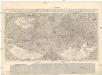
Orbis terrae compendiosa descriptio
země světa Mercator, Rumold Garth, Richard Rumoldus Mercator
Die obere oder nordliche Halbkugel der Erde
země světa Ecker, Johann Anton Benedicti, Hieronymus von J.A. Ecker
U.S. West of Mississippi R. 4.
1 : 2000000 Freyhold, Edward; Warren, Gouverneur Kemble, 1830-1882; United States. Army. Corps of Engineers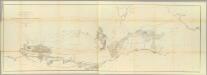
General Map of Explorations and Surveys in California.
1 : 600000 Williamson, R.S.
Cote NO, l'Amerique 1.
1 : 1500000 Vancouver, George, 1757-1798
The Coast of N.W. America.
1 : 1290000 Vancouver, George, 1757-1798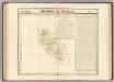
Archipel de Mendana. Oceanique no. 34.
1 : 1641836 Vandermaelen, Philippe, 1795-1869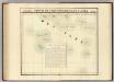
Partie, Iles Basses. Oceanique no. 48.
1 : 1641836 Vandermaelen, Philippe, 1795-1869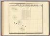
Partie, Iles Basses. Oceanique no. 49.
1 : 1641836 Vandermaelen, Philippe, 1795-1869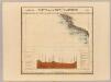
Partie, Nouvle. Californie. Amer. Sep. 52.
1 : 1641836 Vandermaelen, Philippe, 1795-1869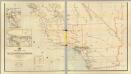
California, Nevada (lower)
1 : 696960 Von Haake, A.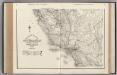
California. Nevada.
1 : 1341000 Rand McNally and Company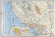
Shell Highway Map of California (southern portion).
1 : 1330560 Shell Oil Company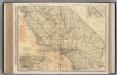
California (Southern Section).
1 : 1140000 Rand McNally and Company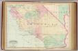
Calif., Nev. south.
1 : 1267200 Asher & Adams
From San Francisco Bay to Plains of Los Angeles.
1 : 760320 Parke, John G.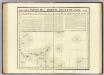
Iles Basses. Oceanique no. 43.
1 : 1641836 Vandermaelen, Philippe, 1795-1869
Ocean, Bodega, and Analy Townships.
1 : 47520 Thompson, Thos. H.
Topographic map of the Los Angeles Aqueduct and adjacent territory
1 : 1316800 Relief shown by contours and hachures. Blue line print. Includes "Key to index system." Map Library copy annotated in colored pen. [California? : s.n.]
Composite: Geologic map sheets XX-XXIII.
1 : 250000 Dutton, Clarence E. (Clarence Edward), 1841-1912
Coast Ranges showing San Andreas Rift.
1 : 760320 California. State Earthquake Investigation Commission
Map No. 2 of the El Paso & Fort Yuma Wagon Road.
1 : 6000000 Campbell, Albert
San Benito, Fresno, Monterey, San Luis Obispo, Kings, Kern, and Santa Barbara Counties.
1 : 950400 Blum, George W.
Map of Inyo County, California : showing locations of principal mines
1 : 135000 Includes indexes of mines and mineral monuments. "Accompanying State Mineralogist's Report XXXIV. October 1938." Tucker W.B., Sampson R.J. [Sacramento] : Division of Mines
73. Part Of Southern California.
1 : 506880 Wheeler, G.M.
Rio Colorado of the West.
1 : 380160 Ives, J.C.