Maps of Czech Republic

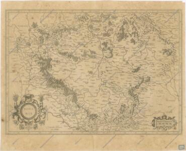
Bohemia
Bohemia
Bohemia [Karte], in: Gerardi Mercatoris Atlas, sive, Cosmographicae meditationes de fabrica mundi et fabricati figura, S. 397.
1 Karte aus Atlas Mercator, Gerhard Montanus, Petrus
Bohemia
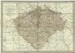
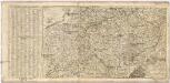
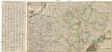
Neueste General-Post & Strassen-Karte des Königreichs Boehmen
1 : 650000 Čechy (Česko) Fried, Franz Artaria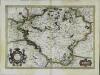
Bohemia
1 Karte : Kupferdruck ; 33 x 48 cm Mercator; Hondius Henricus Hondius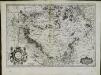
Bohemia
1 Karte : Kupferdruck ; 33 x 47 cm Mercator s.n.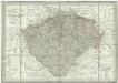
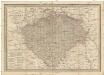
Neueste General-Post & Strassen-Karte des Königreichs Boehmen
1 : 650000 Česko Fried, Franz Artaria & Comp.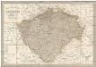
Neueste General-Post & Strassen-Karte des Königreichs Boehmen
1 : 650000 Česko Fried, Franz Artaria & Comp.
Bohemia
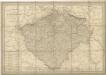
General-Post & Strassen-Karte des Königreichs Boehmen
1 : 650000 Čechy (Česko) Fried, Franz Artaria & Comp.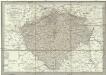
Neueste General-Post & Strassen-Karte des Königreichs Boehmen
1 : 650000 Česko Fried, Franz Artaria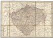
Neueste General-Post & Strassen-Karte des Königreichs Boehmen
Čechy (Česko) Fried, Franz Sartorius, Johann Christoph Artaria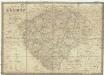
Karte von Böhmen
1 : 660000 Čechy (Česko) Schmitfeldt, Georg Tranquillo Mollo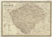
Karte von Böhmen
1 : 660000 Česko Schmitfeldt, Georg Mollo, Tranquillo Tranquillo Mollo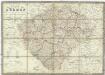
Karte von Böhmen
1 : 660000 Česko Schmitfeldt, Georg Mollo, Tranquillo Tranquillo Mollo
Regni Bohemiae Nova descriptio
General Post & Strassen Karte des Königreichs Boehmen

Přehledná hydrografická mapa povodí Labe, Odry a Dunaje v Čechách
1 : 750000 Dunaj (řeka : povodí) Vojenský zeměpisný ústav
Přehledná hydrografická mapa povodí Labe, Odry a Dunaje v Čechách
1 : 750000 Dunaj (řeka : povodí) Vojenský zeměpisný ústav
Přehledná hydrografická mapa povodí Labe, Odry a Dunaje v Čechách
1 : 750000 Dunaj-povodí Vojenský zeměpisný ústav
Karte des Königreiches Böhmen
1 : 650000 Česko Raffelsperger, Franz in dem k. k. a. p. Civil-Geograpischen Institut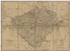
Königreich Böhmen
Česko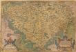
Regni Bohemiae Descriptio. [Karte], in: Theatrum orbis terrarum, S. 63.
1 Karte aus Atlas Ortelius, Abraham
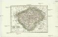
Das Königreich Böhmen
Čechy (Česko) Weiland, Karl Ferdinand Jungmann, Carl im Verlage des Geograph. Instituts
Das Königreich Böhmen
Čechy (Česko) Weiland, Karl Ferdinand Jungmann, Carl im Verlage des Geograph. Instituts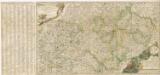
Nova et accurata Descriptio Geographica Totius Regni Bohemiae...
Čechy
1 : 2850000 Čechy (Česko) Merklas, Václav Václav Merklas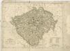
Königreich Böhmen
Nova et accurata descriptio geographica totius regni Bohemiae
1 : 731000 Bavorsko (Německo) Lidl, Johann Jakob J.J. Lidl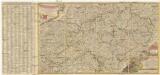
Nova et accurata descriptio geographica totius Regni Bohemiae
1 : 690000 Německo Lidl, Johann Jakob J. J. Lidl