Maps of Czech Republic

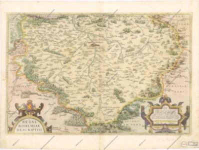
Regni Bohemiae Descriptio
Regni Bohemiae Descriptio. [Karte], in: Theatrum orbis terrarum, S. 156.
1 Karte aus Atlas Ortelius, Abraham
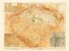
Bohemia
Regni Bohemiae Descriptio. [Karte], in: Theatrum orbis terrarum, S. 248.
1 Karte aus Atlas Ortelius, Abraham Vrients, Jan Baptista
Regni Bohemiae Descriptio. [Karte], in: Theatrum orbis terrarum, S. 63.
1 Karte aus Atlas Ortelius, Abraham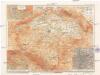
Země česká
1 : 1000000 Krkonoše (Česko a Polsko) Machát, František V. Neubert a synové
Mappa totius regni Bohemiae
1 : 700000 Čechy (Česko) Bock-Polach, Josef Ferdinand Müller, Johann Christoph
Mappa totius regni Bohemiae
1 : 700000 Čechy (Česko) Bock-Polach, Josef Ferdinand Ponheimer, Kilian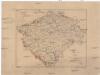
Karte der Verbreitung der Torfmoore in Böhmen
Česko Sitenský, František Ladislav Kořistka, Karel František Edvard
Kreis-, Gerichts-, Völker-, Telegrafen-, Eisenbahn- und Post- Karte des Königreiches Böhmen
1 : 950000 Česko Raffelsperger, Franz Graben
Regni Bohemiae Nova descriptio
Země Česká
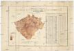
Uebersichts-Karte und statistische Darstellung der Area und der Grundsteuer-Vorschreibung des landtäflichen Grossgrundbesitzes dann des Grundbesitzes überhaupt im Königreiche Böhmen
České království Procházka, Johann F. Joh. F. Procházka
Automobil-Karte von Böhmen
1 : 560000 Čechy (Česko) Bayer, J. L Klement's Nachfolger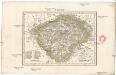
Čechy
1 : 2775000 Čechy (Česko)
Karte des Königreiches Boehmen
1 : 880000 Čechy (Česko) Raffelsperger, Franz Rumpold, F. im Typographischen Landkarten-Verlage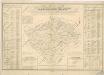
Orientirungs - Karte in der neuen gerichtlichen und politischen Eintheilung des Königreichs Böhmen

Místopisná mapa království českého

Schulkarte von Böhmen

Mappa geographica totius Regni Bohemiae in 12. circulos divisae, annexis comitatu Glacensi et districtu Egerano nec non aliis principatib. finitimis
1 : 730000 Kladsko-oblast (Polsko) Lotter, Tobias Conrad T. C. Lotter

Carta del regno di Boemia
1 : 530000 Čechy (Česko) Raffelsperger, Franz Raffaelle
Carte du royaume de Boheme
1 : 530000 Čechy (Česko) Raffelsperger, Franz Rumpold, F. François Raffelsperger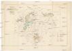
Karte der kohlenführenden Gebirgsformationen von Böhmen
Česko Zippe, Franz X. Maxmilian Kočzy
Charte vom Königreiche Böheim
1 : 550000 Česko Kreibich, František Jakub Jindřich David, Martin Alois in der A.G. Schneider u. Weigelschen Kunst- u. Landkartenhandlung
Charte vom Königreiche Böheim
1 : 569000 Česko Kreibich, František Jakub Jindřich David, Martin Alois in der A.G. Schneider u. Weigelschen Kunst- u. Landkartenhandlung
Charte vom Königreiche Böheim
1 : 569000 Česko Kreibich, František Jakub Jindřich David, Martin Alois A.G. Schneider u. Weigelschen Kunst u. Landkartenhandlung
Bohemia in XVI circulos divisa, notitiis plurimis illustrata
1 : 350000 Česko Bock-Polach, Josef Ferdinand Müller, Johann Christoph Artaria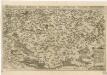
Chogragraphia Insignis Regni Bohemiae