Maps of Council of the City of Sydney

City of Sydney, Sheet O3, 1888
New South Wales. Department of Lands
City of Sydney, Sheet O3, revised 1892
New South Wales. Department of Lands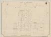
City of Sydney, Sheet N3, 1888
New South Wales. Department of Lands
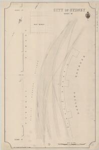
City of Sydney, Sheet Q3, 1888
New South Wales. Department of Lands
City of Sydney, Sheet L3, 1892
New South Wales. Department of Lands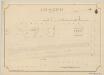
City of Sydney, Sheet L3, 1888
New South Wales. Department of Lands
City of Sydney, Sheet R3, 1888
New South Wales. Department of Lands
City of Sydney, Sheet K3, 1888
New South Wales. Department of Lands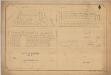
City of Sydney, Sheet H3, 1888
New South Wales. Department of Lands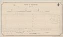
City of Sydney, Sheet P3, 1888
New South Wales. Department of Lands
City of Sydney ~ City of Sydney, Section 1, Sheet 1, 1887
New South Wales. Department of Lands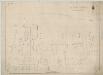
City of Sydney, Sections 21 & part of 30, 1887
New South Wales. Department of Lands
Darling Harbour Free Stores Block No.162, 13.7.23 (b&w)
Fire and Accident Underwriters Association of New South Wales
Darling Harbour Free Stores Block No.162, 13.7.23 (col)
Fire and Accident Underwriters Association of New South Wales
Harper's Block No.175, 11.6.23 (b&w)
Fire and Accident Underwriters Association of New South Wales
Harper's Block No.175, 11.6.23 (col) (updated)
Fire and Accident Underwriters Association of New South Wales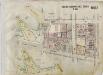
Darling Harbour Free Stores Block No.162, 13.7.23 (col) (updated)
Fire and Accident Underwriters Association of New South Wales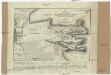
Plan von Sydney
1 : 18000 Sydney (Nový Jižní Wales) Lesieur Boullanger
Balmain, 1st ed. 5.11.37, sheet 2(2) (col)
New South Wales. Department of Lands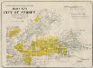
Index map
Fire and Accident Underwriters Association of New South Wales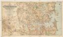
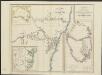
Map of Sydney harbour and surrounding districts, New South Wales
1 : 30000 Sydney (Nový Jižní Wales) Black, J. M. Department of Lands
Index map
New South Wales. Department of Lands
City of Sydney, Sheet W3, 1888
New South Wales. Department of Lands
Carte internationale du monde au 1,000,000 E
1 : 1000000 Austrálie Works & Railways Dept.
New South Wales, Sydney.
1 : 1750000 Society for the Diffusion of Useful Knowledge (Great Britain)
New South Wales.
1 : 1774080 Letts, Son & Co.
Neu Sud-Wales.
1 : 1750000 Flemming, Carl
Das Innere von Neu-Süd-Wales
Stieler's Hand-Atlas Stieler, Adolf bei Justus Perthes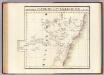
Partie, Nlle. Galles du Sud. Oceanique no. 55.
1 : 1641836 Vandermaelen, Philippe, 1795-1869