Maps of Yateley
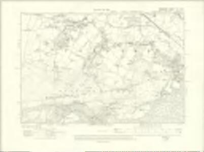
Berkshire XLIX.NE - OS Six-Inch Map
1 : 10560 Topographic maps Ordnance Survey Ordnance Survey
Berkshire XLIX.NE - OS Six-Inch Map
1 : 10560 Topographic maps Ordnance Survey Ordnance Survey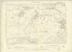
Berkshire XLIX.NE - OS Six-Inch Map
1 : 10560 Topographic maps Ordnance Survey Ordnance Survey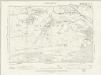
Hampshire & Isle of Wight XII.NE - OS Six-Inch Map
1 : 10560 Topographic maps Ordnance Survey Ordnance Survey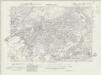
Surrey XV.NW & XV.NE - OS Six-Inch Map
1 : 10560 Topographic maps Ordnance Survey Ordnance Survey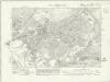
Surrey XV.NW & XV.NE - OS Six-Inch Map
1 : 10560 Topographic maps Ordnance Survey Ordnance Survey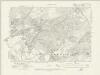
Surrey XV.NW & XV.NE - OS Six-Inch Map
1 : 10560 Topographic maps Ordnance Survey Ordnance Survey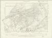
Surrey XV.NW & XV.NE - OS Six-Inch Map
1 : 10560 Topographic maps Ordnance Survey Ordnance Survey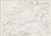
Hampshire and Isle of Wight XII.8 (includes: Hawley; Yateley) - 25 Inch Map
1 : 2500 Topographic maps Ordnance Survey Ordnance Survey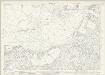
Hampshire and Isle of Wight XII.8 (includes: Hawley; Yateley) - 25 Inch Map
1 : 2500 Topographic maps Ordnance Survey Ordnance Survey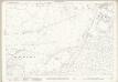
Hampshire and Isle of Wight XII.8 (includes: Hawley; Yateley) - 25 Inch Map
1 : 2500 Topographic maps Ordnance Survey Ordnance Survey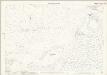
Hampshire and Isle of Wight XII.8 (includes: Hawley; Yateley) - 25 Inch Map
1 : 2500 Topographic maps Ordnance Survey Ordnance Survey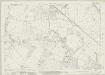
Berkshire XLIX.4 (includes: Sandhurst; Yateley) - 25 Inch Map
1 : 2500 Topographic maps Ordnance Survey Ordnance Survey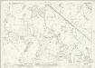
Berkshire XLIX.4 (includes: Sandhurst; Yateley) - 25 Inch Map
1 : 2500 Topographic maps Ordnance Survey Ordnance Survey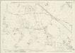
Berkshire XLIX.4 (includes: Sandhurst; Yateley) - 25 Inch Map
1 : 2500 Topographic maps Ordnance Survey Ordnance Survey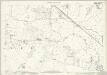
Berkshire XLIX.4 (includes: Sandhurst; Yateley) - 25 Inch Map
1 : 2500 Topographic maps Ordnance Survey Ordnance Survey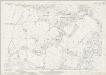
Hampshire and Isle of Wight XII.3 (includes: Eversley; Yateley) - 25 Inch Map
1 : 2500 Topographic maps Ordnance Survey Ordnance Survey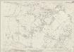
Hampshire and Isle of Wight XII.3 (includes: Eversley; Yateley) - 25 Inch Map
1 : 2500 Topographic maps Ordnance Survey Ordnance Survey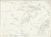
Hampshire and Isle of Wight XII.3 (includes: Eversley; Yateley) - 25 Inch Map
1 : 2500 Topographic maps Ordnance Survey Ordnance Survey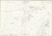
Hampshire and Isle of Wight XII.3 (includes: Eversley; Yateley) - 25 Inch Map
1 : 2500 Topographic maps Ordnance Survey Ordnance Survey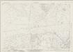
Hampshire and Isle of Wight XII.7 (includes: Eversley; Hartley Wintney; Hawley; Yateley) - 25 Inch Map
1 : 2500 Topographic maps Ordnance Survey Ordnance Survey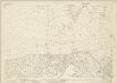
Hampshire and Isle of Wight XII.7 (includes: Eversley; Hartley Wintney; Hawley; Yateley) - 25 Inch Map
1 : 2500 Topographic maps Ordnance Survey Ordnance Survey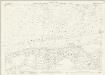
Hampshire and Isle of Wight XII.7 (includes: Eversley; Hartley Wintney; Hawley; Yateley) - 25 Inch Map
1 : 2500 Topographic maps Ordnance Survey Ordnance Survey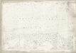
Hampshire and Isle of Wight XII.7 (includes: Eversley; Hartley Wintney; Hawley; Yateley) - 25 Inch Map
1 : 2500 Topographic maps Ordnance Survey Ordnance Survey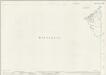
Surrey XV.6 (includes: Hawley; Sandhurst; Yateley) - 25 Inch Map
1 : 2500 Topographic maps Ordnance Survey Ordnance Survey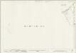
Surrey XV.6 (includes: Hawley; Sandhurst; Yateley) - 25 Inch Map
1 : 2500 Topographic maps Ordnance Survey Ordnance Survey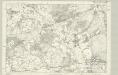
Surrey XV - OS Six-Inch Map
1 : 10560 Topographic maps Ordnance Survey Ordnance Survey
SU85 - OS 1:25,000 Provisional Series Map
1 : 25000 Topographic maps Ordnance Survey Ordnance Survey
SU86 - OS 1:25,000 Provisional Series Map
1 : 25000 Topographic maps Ordnance Survey Ordnance Survey