Maps of Mortimer West End
Berkshire XLIV.NE - OS Six-Inch Map
1 : 10560 Topographic maps Ordnance Survey Ordnance Survey
Berkshire XLIV.NE - OS Six-Inch Map
1 : 10560 Topographic maps Ordnance Survey Ordnance Survey
Hampshire & Isle of Wight IV.NE - OS Six-Inch Map
1 : 10560 Topographic maps Ordnance Survey Ordnance Survey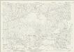
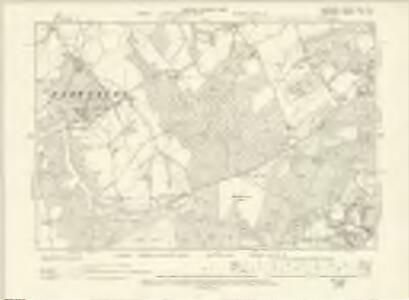
Berkshire XLIV.8 (includes: Mortimer West End; Stratford Mortimer; Sulhamstead; Ufton Nervet; Wokefield) - 25 Inch Map
1 : 2500 Topographic maps Ordnance Survey Ordnance Survey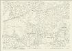
Berkshire XLIV.8 (includes: Mortimer West End; Stratford Mortimer; Sulhamstead; Ufton Nervet; Wokefield) - 25 Inch Map
1 : 2500 Topographic maps Ordnance Survey Ordnance Survey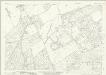
Berkshire XLIV.4 (includes: Burghfield; Stratford Mortimer; Sulhamstead; Ufton Nervet; Wokefield) - 25 Inch Map
1 : 2500 Topographic maps Ordnance Survey Ordnance Survey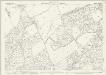
Berkshire XLIV.4 (includes: Burghfield; Stratford Mortimer; Sulhamstead; Ufton Nervet; Wokefield) - 25 Inch Map
1 : 2500 Topographic maps Ordnance Survey Ordnance Survey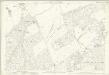
Berkshire XLIV.4 (includes: Burghfield; Stratford Mortimer; Sulhamstead; Ufton Nervet; Wokefield) - 25 Inch Map
1 : 2500 Topographic maps Ordnance Survey Ordnance Survey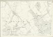
Berkshire XLIV.3 (includes: Aldermaston; Beenham; Padworth; Ufton Nervet) - 25 Inch Map
1 : 2500 Topographic maps Ordnance Survey Ordnance Survey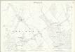
Berkshire XLIV.3 (includes: Aldermaston; Beenham; Padworth; Ufton Nervet) - 25 Inch Map
1 : 2500 Topographic maps Ordnance Survey Ordnance Survey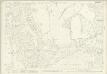
Berkshire XLIV.7 (includes: Aldermaston; Mortimer West End; Padworth; Ufton Nervet) - 25 Inch Map
1 : 2500 Topographic maps Ordnance Survey Ordnance Survey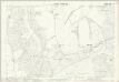
Berkshire XLIV.7 (includes: Aldermaston; Mortimer West End; Padworth; Ufton Nervet) - 25 Inch Map
1 : 2500 Topographic maps Ordnance Survey Ordnance Survey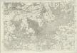
Berkshire XLIV - OS Six-Inch Map
1 : 10560 Topographic maps Ordnance Survey Ordnance Survey
SU66 - OS 1:25,000 Provisional Series Map
1 : 25000 Topographic maps Ordnance Survey Ordnance Survey
The third sheet of an actual survey of Berkshire
1 Blatt : 68 x 52 cm John Rocque
Reading (Hills) - OS One-Inch Revised New Series
1 : 63360 Topographic maps Ordnance Survey Ordnance Survey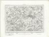
Reading (Outline) - OS One-Inch Revised New Series
1 : 63360 Topographic maps Ordnance Survey Ordnance Survey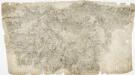
Odiham
1 : 31680 The most striking feature of this drawing is the triangulation web covering a large area around the East Hampstead Plain. According to manuscript sources, the different ground levels in this region made it an ideal case study for assistant engineers training for the Ordnance Survey under the tuition of Robert Dawson, the surveyor of this plan. Two circles on the main road through Hartford Bridge Flats represent triangulation points. Dawson, Robert
Map of Hampshire, including the Isle of Wight, 2
1 Blatt : 55 x 70 cm s.n.
Winchester - OS One-Inch Map
1 : 63360 Topographic maps Ordnance Survey Ordnance Survey
Oxford and Newbury - OS One-Inch Map
1 : 63360 Topographic maps Ordnance Survey Ordnance Survey
Aldershot - OS One-Inch Map
1 : 63360 Topographic maps Ordnance Survey Ordnance Survey
Hamp Shire ; Berk Shire ; Wilt Shire
1 : 330000 Berkshire (Anglie) Moll, Herman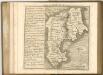
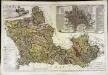
A map of the county of Berks
1 Karte : Kupferdruck ; 43 x 66 cm Rocque; Rocque published according to act of parliament by Mary Ann Rocque near old Round Court in the Strand
An accurate map of Berkshire
1 Karte : Kupferdruck ; 52 x 68 cm Bowen; Tinney; Bowles; Sayer; Bowles; Bowles sold by I. Bowles and son in Cornhill T. Bowles in St. Pauls church yard I. Tinney at the Golden Lion and R. Sayer at the Golden Buck in Fleet street
Bercheria vernacule Bark Shire
1 Karte : Kupferdruck ; 37 x 48 cm Blaeu Joan Blaeu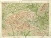
Berkshire, Sheet 29 - Bartholomew's "Half Inch to the Mile Maps" of England & Wales
1 : 126720 Topographic maps Bartholomew, John George John Bartholomew & Co
BERCHERIA | Vernacule | BARK SHIRE.
[Amsterdam : Joan Blaeu]