Maps of Swindon
Berkshire XVIII.SE - OS Six-Inch Map
1 : 10560 Topographic maps Ordnance Survey Ordnance Survey
Berkshire XVIII.SE - OS Six-Inch Map
1 : 10560 Topographic maps Ordnance Survey Ordnance Survey
Berkshire XVIII.SE - OS Six-Inch Map
1 : 10560 Topographic maps Ordnance Survey Ordnance Survey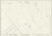
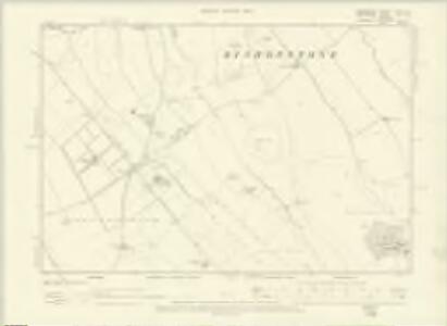
Wiltshire XVI.11 (includes: Bishopstone; Wanborough) - 25 Inch Map
1 : 2500 Topographic maps Ordnance Survey Ordnance Survey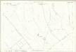
Wiltshire XVI.11 (includes: Bishopstone; Wanborough) - 25 Inch Map
1 : 2500 Topographic maps Ordnance Survey Ordnance Survey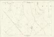
Wiltshire XVI.11 (includes: Bishopstone; Wanborough) - 25 Inch Map
1 : 2500 Topographic maps Ordnance Survey Ordnance Survey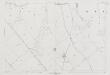
Wiltshire XVI.11 (includes: Bishopstone; Wanborough) - 25 Inch Map
1 : 2500 Topographic maps Ordnance Survey Ordnance Survey
Wiltshire XVI.15 (includes: Bishopstone; Liddington; Wanborough) - 25 Inch Map
1 : 2500 Topographic maps Ordnance Survey Ordnance Survey
Wiltshire XVI.15 (includes: Bishopstone; Liddington; Wanborough) - 25 Inch Map
1 : 2500 Topographic maps Ordnance Survey Ordnance Survey
Wiltshire XVI.15 (includes: Bishopstone; Liddington; Wanborough) - 25 Inch Map
1 : 2500 Topographic maps Ordnance Survey Ordnance Survey
Wiltshire XVI.15 (includes: Bishopstone; Liddington; Wanborough) - 25 Inch Map
1 : 2500 Topographic maps Ordnance Survey Ordnance Survey
Wiltshire XVI.12 (includes: Ashbury; Bishopstone) - 25 Inch Map
1 : 2500 Topographic maps Ordnance Survey Ordnance Survey
Berkshire XVIII.12 (includes: Ashbury; Bishopstone) - 25 Inch Map
1 : 2500 Topographic maps Ordnance Survey Ordnance Survey
Wiltshire XVI.12 (includes: Ashbury; Bishopstone) - 25 Inch Map
1 : 2500 Topographic maps Ordnance Survey Ordnance Survey
Wiltshire XVI.12 (includes: Ashbury; Bishopstone) - 25 Inch Map
1 : 2500 Topographic maps Ordnance Survey Ordnance Survey
Wiltshire XVI.12 (includes: Ashbury; Bishopstone) - 25 Inch Map
1 : 2500 Topographic maps Ordnance Survey Ordnance Survey
Wiltshire XVI.16 (includes: Bishopstone; Wanborough) - 25 Inch Map
1 : 2500 Topographic maps Ordnance Survey Ordnance Survey
Wiltshire XVI.16 (includes: Bishopstone; Wanborough) - 25 Inch Map
1 : 2500 Topographic maps Ordnance Survey Ordnance Survey
Wiltshire XVI.16 (includes: Bishopstone; Wanborough) - 25 Inch Map
1 : 2500 Topographic maps Ordnance Survey Ordnance Survey
Wiltshire XVI.16 (includes: Bishopstone; Wanborough) - 25 Inch Map
1 : 2500 Topographic maps Ordnance Survey Ordnance Survey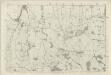
Berkshire XVIII - OS Six-Inch Map
1 : 10560 Topographic maps Ordnance Survey Ordnance Survey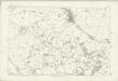
Wiltshire XVI - OS Six-Inch Map
1 : 10560 Topographic maps Ordnance Survey Ordnance Survey
SU28 - OS 1:25,000 Provisional Series Map
1 : 25000 Topographic maps Ordnance Survey Ordnance Survey
A topographical map, of the county, of Berks, Blatt XII und XVIII
2 Blätter : 99 x 51 cm John Rocque
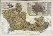
Swindon
1 : 31680 The author of this drawing, William Stanley, was listed as a 'first class' Military draughtsman and surveyor at the Tower of London Drawing Room. His elaborate hill shading technique for describing relief and the attention he pays to communications routes reinforce the military emphasis of these maps. Archaeological details are documented even though this did not become obligatory until 1816. The iron-age hillfort at Barbury Castle is described, along with numerous barrows and earthworks. Stanley, William
Swindon - OS One-Inch Map
1 : 63360 Topographic maps Ordnance Survey Ordnance Survey
Ordnance Survey of England. Sheet 256, North London
1 : 63360 Ordnance survey. GB Southampton : Ordnance Survey Office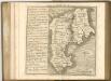
A map of the county of Berks
1 Karte : Kupferdruck ; 43 x 66 cm Rocque; Rocque published according to act of parliament by Mary Ann Rocque near old Round Court in the Strand
An accurate map of Berkshire
1 Karte : Kupferdruck ; 52 x 68 cm Bowen; Tinney; Bowles; Sayer; Bowles; Bowles sold by I. Bowles and son in Cornhill T. Bowles in St. Pauls church yard I. Tinney at the Golden Lion and R. Sayer at the Golden Buck in Fleet street