Maps of West Dorset

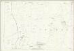
SY69 - OS 1:25,000 Provisional Series Map
1 : 25000 Topographic maps Ordnance Survey Ordnance Survey
Dorset XXXI.SW - OS Six-Inch Map
1 : 10560 Topographic maps Ordnance Survey Ordnance Survey
Dorset XXXI.SW - OS Six-Inch Map
1 : 10560 Topographic maps Ordnance Survey Ordnance Survey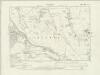
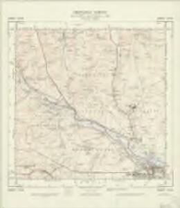
Dorset XL.NW - OS Six-Inch Map
1 : 10560 Topographic maps Ordnance Survey Ordnance Survey
Dorset XL.NW - OS Six-Inch Map
1 : 10560 Topographic maps Ordnance Survey Ordnance Survey
Dorset XL.NW - OS Six-Inch Map
1 : 10560 Topographic maps Ordnance Survey Ordnance Survey
Dorset XL.SW - OS Six-Inch Map
1 : 10560 Topographic maps Ordnance Survey Ordnance Survey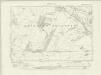
Dorset XL.SW - OS Six-Inch Map
1 : 10560 Topographic maps Ordnance Survey Ordnance Survey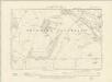
Dorset XL.SW - OS Six-Inch Map
1 : 10560 Topographic maps Ordnance Survey Ordnance Survey
Dorset XL.SW - OS Six-Inch Map
1 : 10560 Topographic maps Ordnance Survey Ordnance Survey
Dorset XXXIX.NE - OS Six-Inch Map
1 : 10560 Topographic maps Ordnance Survey Ordnance Survey
Dorset XXXIX.NE - OS Six-Inch Map
1 : 10560 Topographic maps Ordnance Survey Ordnance Survey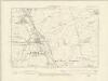
Dorset XXX.SE - OS Six-Inch Map
1 : 10560 Topographic maps Ordnance Survey Ordnance Survey
Dorset XXX.SE - OS Six-Inch Map
1 : 10560 Topographic maps Ordnance Survey Ordnance Survey
Dorset XXXIX.SE - OS Six-Inch Map
1 : 10560 Topographic maps Ordnance Survey Ordnance Survey
Dorset XXXIX.SE - OS Six-Inch Map
1 : 10560 Topographic maps Ordnance Survey Ordnance Survey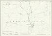
Dorset XXXI.10 (includes: Cerne Abbas; Nether Cerne; Piddletrenthide) - 25 Inch Map
1 : 2500 Topographic maps Ordnance Survey Ordnance Survey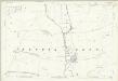
Dorset XXXI.10 (includes: Cerne Abbas; Nether Cerne; Piddletrenthide) - 25 Inch Map
1 : 2500 Topographic maps Ordnance Survey Ordnance Survey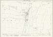
Dorset XXXI.14 (includes: Charminster; Godmanstone; Nether Cerne) - 25 Inch Map
1 : 2500 Topographic maps Ordnance Survey Ordnance Survey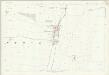
Dorset XXXI.14 (includes: Charminster; Godmanstone; Nether Cerne) - 25 Inch Map
1 : 2500 Topographic maps Ordnance Survey Ordnance Survey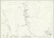
Dorset XL.2 (includes: Charminster; Godmanstone) - 25 Inch Map
1 : 2500 Topographic maps Ordnance Survey Ordnance Survey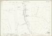
Dorset XL.2 (includes: Charminster; Godmanstone) - 25 Inch Map
1 : 2500 Topographic maps Ordnance Survey Ordnance Survey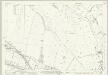
Dorset XL.6 (includes: Charminster; Stratton) - 25 Inch Map
1 : 2500 Topographic maps Ordnance Survey Ordnance Survey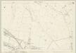
Dorset XL.6 (includes: Charminster; Stratton) - 25 Inch Map
1 : 2500 Topographic maps Ordnance Survey Ordnance Survey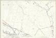
Dorset XL.6 (includes: Charminster; Stratton) - 25 Inch Map
1 : 2500 Topographic maps Ordnance Survey Ordnance Survey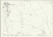
Dorset XXXI.9 (includes: Cerne Abbas; Godmanstone; Nether Cerne; Sydling St Nicholas) - 25 Inch Map
1 : 2500 Topographic maps Ordnance Survey Ordnance Survey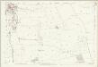
Dorset XXXI.9 (includes: Cerne Abbas; Godmanstone; Nether Cerne; Sydling St Nicholas) - 25 Inch Map
1 : 2500 Topographic maps Ordnance Survey Ordnance Survey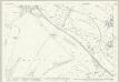
Dorset XL.10 (includes: Bradford Peverell; Charminster; Dorchester; Stratton) - 25 Inch Map
1 : 2500 Topographic maps Ordnance Survey Ordnance Survey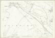
Dorset XL.10 (includes: Bradford Peverell; Charminster; Dorchester; Stratton) - 25 Inch Map
1 : 2500 Topographic maps Ordnance Survey Ordnance Survey
Dorset XXXI.13 (includes: Frampton; Godmanstone; Nether Cerne; Stratton; Sydling St Nicholas) - 25 Inch Map
1 : 2500 Topographic maps Ordnance Survey Ordnance Survey