Maps of St. Goran

SW94 & Parts of SW93 - OS 1:25,000 Provisional Series Map
1 : 25000 Topographic maps Ordnance Survey Ordnance Survey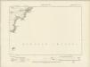
Cornwall LXVI.SW - OS Six-Inch Map
1 : 10560 Topographic maps Ordnance Survey Ordnance Survey
Cornwall LXVI.SW - OS Six-Inch Map
1 : 10560 Topographic maps Ordnance Survey Ordnance Survey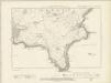
Cornwall LXVI.NE, SE & LXVIA.SW - OS Six-Inch Map
1 : 10560 Topographic maps Ordnance Survey Ordnance Survey
Cornwall LXVI.NE & SE - OS Six-Inch Map
1 : 10560 Topographic maps Ordnance Survey Ordnance Survey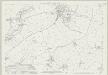
Cornwall LXV.12 (includes: Veryan) - 25 Inch Map
1 : 2500 Topographic maps Ordnance Survey Ordnance Survey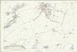
Cornwall LXV.12 (includes: Veryan) - 25 Inch Map
1 : 2500 Topographic maps Ordnance Survey Ordnance Survey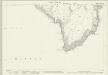
Cornwall LXV.16 (includes: Veryan) - 25 Inch Map
1 : 2500 Topographic maps Ordnance Survey Ordnance Survey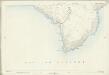
Cornwall LXV.16 (includes: Veryan) - 25 Inch Map
1 : 2500 Topographic maps Ordnance Survey Ordnance Survey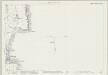
Cornwall LXXII.3 & 4 & LXXIIA.1 (includes: Gerrans) - 25 Inch Map
1 : 2500 Topographic maps Ordnance Survey Ordnance Survey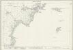
Cornwall LXVI.9 & 13 (includes: Veryan) - 25 Inch Map
1 : 2500 Topographic maps Ordnance Survey Ordnance Survey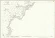
Cornwall LXVI.9 (includes: Veryan) - 25 Inch Map
1 : 2500 Topographic maps Ordnance Survey Ordnance Survey
Cornwall LXVI.9 & 13 (includes: Veryan) - 25 Inch Map
1 : 2500 Topographic maps Ordnance Survey Ordnance Survey
Cornwall LXVI.13 (includes: Veryan) - 25 Inch Map
1 : 2500 Topographic maps Ordnance Survey Ordnance Survey
Cornwall LXXII.3 & 4 & LXXIIA.1 (includes: Gerrans) - 25 Inch Map
1 : 2500 Topographic maps Ordnance Survey Ordnance Survey
Cornwall LXXII.NE & LXIIA.NW - OS Six-Inch Map
1 : 10560 Topographic maps Ordnance Survey Ordnance Survey
Cornwall LXXII.NE & LXIIA.NW - OS Six-Inch Map
1 : 10560 Topographic maps Ordnance Survey Ordnance Survey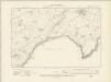
Cornwall LXV.SE - OS Six-Inch Map
1 : 10560 Topographic maps Ordnance Survey Ordnance Survey
Cornwall LXV.SE - OS Six-Inch Map
1 : 10560 Topographic maps Ordnance Survey Ordnance Survey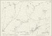
Cornwall LXV.8 (includes: Ruan Lanihorne; Veryan) - 25 Inch Map
1 : 2500 Topographic maps Ordnance Survey Ordnance Survey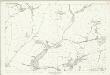
Cornwall LXV.8 (includes: Ruan Lanihorne; Veryan) - 25 Inch Map
1 : 2500 Topographic maps Ordnance Survey Ordnance Survey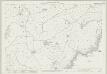
Cornwall LXVI.5 (includes: Veryan) - 25 Inch Map
1 : 2500 Topographic maps Ordnance Survey Ordnance Survey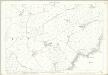
Cornwall LXVI.5 (includes: Veryan) - 25 Inch Map
1 : 2500 Topographic maps Ordnance Survey Ordnance Survey
Cornwall LXVI.6 (includes: Gorran; St Michael Carhays; Veryan) - 25 Inch Map
1 : 2500 Topographic maps Ordnance Survey Ordnance Survey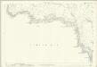
Cornwall LXVI.6 (includes: Gorran; St Michael Carhays; Veryan) - 25 Inch Map
1 : 2500 Topographic maps Ordnance Survey Ordnance Survey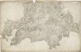
Grampound, Cornwall
1 : 31680 Military batteries are marked along the coastline in this drawing. The profusion of defensive castles in this area is testimony to the perceived vulnerability of coastal regions. Red blocks indicate individual structures within the complex of Pendennis Castle, built by Henry VIII after his divorce from Catherine of Aragon aroused the hostility of Catholic France and Spain. The nearby castle of St Mawes acted as a seaward deterrent, protecting the anchorage of Falmouth. Half Moon Battery is indicated, as are signal seats along the extreme edge of the coast. Budgen, Charles
Mevagissey (Hills) - OS One-Inch Revised New Series
1 : 63360 Topographic maps Ordnance Survey Ordnance Survey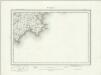
Mevagissey (Outline) - OS One-Inch Revised New Series
1 : 63360 Topographic maps Ordnance Survey Ordnance Survey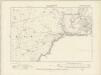
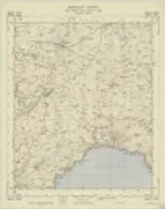
Cornwall LXVI.NW - OS Six-Inch Map
1 : 10560 Topographic maps Ordnance Survey Ordnance Survey