Mappa catalogata
TQ28 - OS 1:25,000 Provisional Series Map

Titolo completo:TQ28 - OS 1:25,000 Provisional Series Map
Anno di illustrazione:1938
Data di pubblicazione:1957
Editore:Ordnance Survey
Dimensione fisica:20 x 30 cm
Scala della mappa:1:25 000
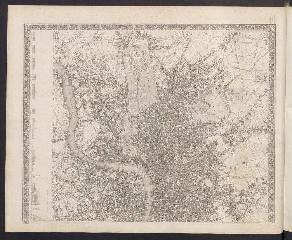
London
1860
Meyer, J.
London VII.NW - OS Six-Inch Map
1893
Ordnance Survey
1:11k
Central London : Recto
1890
G.W. Bacon & Co
1:16k
Central London : Verso
1890
G.W. Bacon & Co
1:16k
Illustrated map of London, or, Stranger's guide to the public buildings, theatres, music halls, & and all places of interest
1877
Bartlett, G. Warren
A plan of London, Westminster, and Southwark
1807
1:27k
TQ28 - OS 1:25,000 Provisional Series Map
1938
Ordnance Survey
1:25k
Bacon's map of London : with railways in operation and constructing corrected to date
1868
Bacon & Co
Vrbium Londini et West-Monasterii nec non suburbii Southwark accurata ichnographia, 1
1818
Homännische Erben
Whitbread's new plan of London
1853
Whitbread, J
1:22k