Maps of Barnardiston

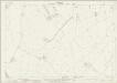
TL74 - OS 1:25,000 Provisional Series Map
1 : 25000 Topographic maps Ordnance Survey Ordnance Survey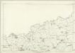
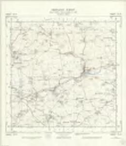
Essex V - OS Six-Inch Map
1 : 10560 Topographic maps Ordnance Survey Ordnance Survey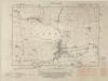
Essex nIV.SW - OS Six-Inch Map
1 : 10560 Topographic maps Ordnance Survey Ordnance Survey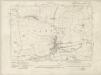
Essex nIV.SW - OS Six-Inch Map
1 : 10560 Topographic maps Ordnance Survey Ordnance Survey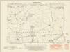
Suffolk LXXI.NW - OS Six-Inch Map
1 : 10560 Topographic maps Ordnance Survey Ordnance Survey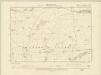
Suffolk LXXI.NW - OS Six-Inch Map
1 : 10560 Topographic maps Ordnance Survey Ordnance Survey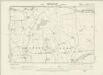
Suffolk LXXI.NW - OS Six-Inch Map
1 : 10560 Topographic maps Ordnance Survey Ordnance Survey
Suffolk LXXI.NW - OS Six-Inch Map
1 : 10560 Topographic maps Ordnance Survey Ordnance Survey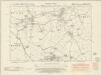
Suffolk LXXI.SW - OS Six-Inch Map
1 : 10560 Topographic maps Ordnance Survey Ordnance Survey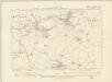
Suffolk LXXI.SW - OS Six-Inch Map
1 : 10560 Topographic maps Ordnance Survey Ordnance Survey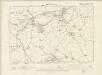
Essex V.SW - OS Six-Inch Map
1 : 10560 Topographic maps Ordnance Survey Ordnance Survey
Suffolk LXXI.SW - OS Six-Inch Map
1 : 10560 Topographic maps Ordnance Survey Ordnance Survey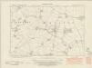
Suffolk LXII.SW - OS Six-Inch Map
1 : 10560 Topographic maps Ordnance Survey Ordnance Survey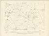
Suffolk LXII.SW - OS Six-Inch Map
1 : 10560 Topographic maps Ordnance Survey Ordnance Survey
Suffolk LXII.SW - OS Six-Inch Map
1 : 10560 Topographic maps Ordnance Survey Ordnance Survey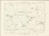
Essex V.SE - OS Six-Inch Map
1 : 10560 Topographic maps Ordnance Survey Ordnance Survey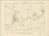
Essex V.NE - OS Six-Inch Map
1 : 10560 Topographic maps Ordnance Survey Ordnance Survey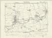
Suffolk LXXI.NE - OS Six-Inch Map
1 : 10560 Topographic maps Ordnance Survey Ordnance Survey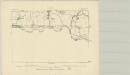
Suffolk LXXI.NE - OS Six-Inch Map
1 : 10560 Topographic maps Ordnance Survey Ordnance Survey
Suffolk LXII.SE - OS Six-Inch Map
1 : 10560 Topographic maps Ordnance Survey Ordnance Survey
Suffolk LXII.SE - OS Six-Inch Map
1 : 10560 Topographic maps Ordnance Survey Ordnance Survey
Tilbury, Essex
This is a map of lands at Tilbury in Essex by Israel Ames. Ames produced several land surveys during the later half of the 16th century. The divisions of the land are recorded with the names of the interested parties, tenants or owners. Woodland is indicated by a stippled ground. Roads are annotated by information about where they lead to and the number of miles to their destination. In common with other maps by Ames these are annotated with a distinctive hand and feature representations of dwellings with unusually tall chimney stacks. Ames, Israel
Essex (New Series 1913-) n IV.14 (includes: Belchamp St Paul; Clare) - 25 Inch Map
1 : 2500 Topographic maps Ordnance Survey Ordnance Survey
Essex (New Series 1913-) n X.2 (includes: Ashen; Belchamp St Paul; Ovington) - 25 Inch Map
1 : 2500 Topographic maps Ordnance Survey Ordnance Survey
Essex (New Series 1913-) n X.6 (includes: Belchamp St Paul; Ovington) - 25 Inch Map
1 : 2500 Topographic maps Ordnance Survey Ordnance Survey
Essex (New Series 1913-) n IV.13 (includes: Ashen; Clare; Stoke By Clare) - 25 Inch Map
1 : 2500 Topographic maps Ordnance Survey Ordnance Survey
Essex (New Series 1913-) n X.1 (includes: Ashen; Ovington; Stoke By Clare) - 25 Inch Map
1 : 2500 Topographic maps Ordnance Survey Ordnance Survey
Essex (New Series 1913-) n X.5 (includes: Ashen; Ovington; Ridgewell; Tilbury Juxta Clare) - 25 Inch Map
1 : 2500 Topographic maps Ordnance Survey Ordnance Survey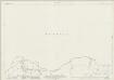
Essex (New Series 1913-) n IX.4 (includes: Ashen; Birdbrook; Stoke By Clare; Wixoe) - 25 Inch Map
1 : 2500 Topographic maps Ordnance Survey Ordnance Survey