Maps of Fencott and Murcott

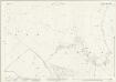
SP51 - OS 1:25,000 Provisional Series Map
1 : 25000 Topographic maps Ordnance Survey Ordnance Survey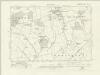
Oxfordshire XXVII.NE - OS Six-Inch Map
1 : 10560 Topographic maps Ordnance Survey Ordnance Survey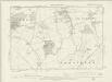
Oxfordshire XXVII.NE - OS Six-Inch Map
1 : 10560 Topographic maps Ordnance Survey Ordnance Survey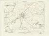
Oxfordshire XXVII.SE - OS Six-Inch Map
1 : 10560 Topographic maps Ordnance Survey Ordnance Survey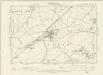
Oxfordshire XXVII.SE - OS Six-Inch Map
1 : 10560 Topographic maps Ordnance Survey Ordnance Survey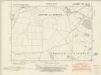
Buckinghamshire XXVI.SW - OS Six-Inch Map
1 : 10560 Topographic maps Ordnance Survey Ordnance Survey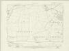
Buckinghamshire XXVI.SW - OS Six-Inch Map
1 : 10560 Topographic maps Ordnance Survey Ordnance Survey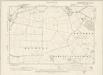
Buckinghamshire XXVI.SW - OS Six-Inch Map
1 : 10560 Topographic maps Ordnance Survey Ordnance Survey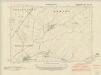
Buckinghamshire XXVI.NW - OS Six-Inch Map
1 : 10560 Topographic maps Ordnance Survey Ordnance Survey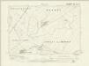
Buckinghamshire XXVI.NW - OS Six-Inch Map
1 : 10560 Topographic maps Ordnance Survey Ordnance Survey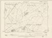
Buckinghamshire XXVI.NW - OS Six-Inch Map
1 : 10560 Topographic maps Ordnance Survey Ordnance Survey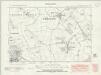
Oxfordshire XXXIII.NE - OS Six-Inch Map
1 : 10560 Topographic maps Ordnance Survey Ordnance Survey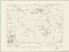
Oxfordshire XXXIII.NE - OS Six-Inch Map
1 : 10560 Topographic maps Ordnance Survey Ordnance Survey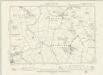
Oxfordshire XXXIII.NE - OS Six-Inch Map
1 : 10560 Topographic maps Ordnance Survey Ordnance Survey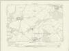
Oxfordshire XXXIV.NW - OS Six-Inch Map
1 : 10560 Topographic maps Ordnance Survey Ordnance Survey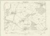
Oxfordshire XXXIV.NW - OS Six-Inch Map
1 : 10560 Topographic maps Ordnance Survey Ordnance Survey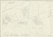
Oxfordshire XXVII.3 (includes: Bletchingdon; Kirtlington; Weston on the Green) - 25 Inch Map
1 : 2500 Topographic maps Ordnance Survey Ordnance Survey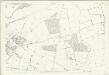
Oxfordshire XXVII.3 (includes: Bletchingdon; Kirtlington; Weston on the Green) - 25 Inch Map
1 : 2500 Topographic maps Ordnance Survey Ordnance Survey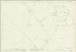
Oxfordshire XXVII.7 (includes: Bletchingdon; Hampton Gay and Poyle; Islip; Weston on the Green) - 25 Inch Map
1 : 2500 Topographic maps Ordnance Survey Ordnance Survey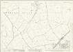
Oxfordshire XXVII.11 (includes: Bletchingdon; Hampton Gay and Poyle; Islip; Kidlington) - 25 Inch Map
1 : 2500 Topographic maps Ordnance Survey Ordnance Survey
Oxfordshire XXVII.15 (includes: Gosford and Water Eaton; Hampton Gay and Poyle; Islip; Kidlington; Woodeaton) - 25 Inch Map
1 : 2500 Topographic maps Ordnance Survey Ordnance Survey
Oxfordshire XXXIII.3 (includes: Elsfield; Gosford and Water Eaton; Oxford; Woodeaton) - 25 Inch Map
1 : 2500 Topographic maps Ordnance Survey Ordnance Survey
Oxfordshire XXVII.4 (includes: Bletchingdon; Charlton on Otmoor; Oddington; Wendlebury; Weston on the Green) - 25 Inch Map
1 : 2500 Topographic maps Ordnance Survey Ordnance Survey
Oxfordshire XXVII.4 (includes: Bletchingdon; Charlton on Otmoor; Oddington; Wendlebury; Weston on the Green) - 25 Inch Map
1 : 2500 Topographic maps Ordnance Survey Ordnance Survey
Oxfordshire XXVIII.1 (includes: Charlton on Otmoor; Merton; Wendlebury; Weston on the Green) - 25 Inch Map
1 : 2500 Topographic maps Ordnance Survey Ordnance Survey
Oxfordshire XXVII.8 (includes: Bletchingdon; Charlton on Otmoor; Islip; Oddington; Weston on the Green) - 25 Inch Map
1 : 2500 Topographic maps Ordnance Survey Ordnance Survey
Oxfordshire XXVIII.5 (includes: Charlton on Otmoor; Fencott and Murcott; Merton; Oddington; Wendlebury) - 25 Inch Map
1 : 2500 Topographic maps Ordnance Survey Ordnance Survey
Oxfordshire XXVII.12 (includes: Fencott and Murcott; Islip; Noke; Oddington) - 25 Inch Map
1 : 2500 Topographic maps Ordnance Survey Ordnance Survey
Oxfordshire XXVIII.9 (includes: Charlton on Otmoor; Fencott and Murcott; Oddington) - 25 Inch Map
1 : 2500 Topographic maps Ordnance Survey Ordnance Survey