Maps of Kiddington with Asterleigh

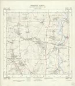
SP42 - OS 1:25,000 Provisional Series Map
1 : 25000 Topographic maps Ordnance Survey Ordnance Survey
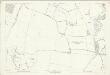
Oxfordshire XV.SE - OS Six-Inch Map
1 : 10560 Topographic maps Ordnance Survey Ordnance Survey
Oxfordshire XXI.NE - OS Six-Inch Map
1 : 10560 Topographic maps Ordnance Survey Ordnance Survey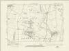
Oxfordshire XVI.SW - OS Six-Inch Map
1 : 10560 Topographic maps Ordnance Survey Ordnance Survey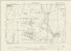
Oxfordshire XVI.SW - OS Six-Inch Map
1 : 10560 Topographic maps Ordnance Survey Ordnance Survey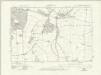
Oxfordshire XXII.NW - OS Six-Inch Map
1 : 10560 Topographic maps Ordnance Survey Ordnance Survey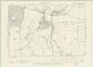
Oxfordshire XXII.NW - OS Six-Inch Map
1 : 10560 Topographic maps Ordnance Survey Ordnance Survey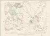
Oxfordshire XXI.SE - OS Six-Inch Map
1 : 10560 Topographic maps Ordnance Survey Ordnance Survey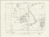
Oxfordshire XXII.SW - OS Six-Inch Map
1 : 10560 Topographic maps Ordnance Survey Ordnance Survey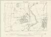
Oxfordshire XXII.SW - OS Six-Inch Map
1 : 10560 Topographic maps Ordnance Survey Ordnance Survey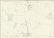
Oxfordshire XV.11 (includes: Great Tew; Sandford St Martin; Westcott Barton; Worton) - 25 Inch Map
1 : 2500 Topographic maps Ordnance Survey Ordnance Survey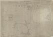
Oxfordshire XV.11 (includes: Great Tew; Sandford St Martin; Westcott Barton; Worton) - 25 Inch Map
1 : 2500 Topographic maps Ordnance Survey Ordnance Survey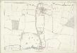
Oxfordshire XV.11 (includes: Great Tew; Sandford St Martin; Westcott Barton; Worton) - 25 Inch Map
1 : 2500 Topographic maps Ordnance Survey Ordnance Survey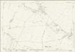
Oxfordshire XV.15 (includes: Enstone; Great Tew; Sandford St Martin; Westcott Barton) - 25 Inch Map
1 : 2500 Topographic maps Ordnance Survey Ordnance Survey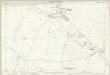
Oxfordshire XV.15 (includes: Enstone; Great Tew; Sandford St Martin; Westcott Barton) - 25 Inch Map
1 : 2500 Topographic maps Ordnance Survey Ordnance Survey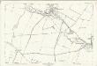
Oxfordshire XV.15 (includes: Enstone; Great Tew; Sandford St Martin; Westcott Barton) - 25 Inch Map
1 : 2500 Topographic maps Ordnance Survey Ordnance Survey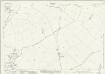
Oxfordshire XXI.3 (includes: Enstone; Glympton; Kiddington with Asterleigh; Sandford St Martin; Westcott Barton) - 25 Inch Map
1 : 2500 Topographic maps Ordnance Survey Ordnance Survey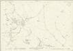
Oxfordshire XXI.7 (includes: Enstone; Glympton; Kiddington with Asterleigh; Wootton) - 25 Inch Map
1 : 2500 Topographic maps Ordnance Survey Ordnance Survey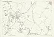
Oxfordshire XXI.7 (includes: Enstone; Glympton; Kiddington with Asterleigh; Wootton) - 25 Inch Map
1 : 2500 Topographic maps Ordnance Survey Ordnance Survey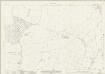
Oxfordshire XV.12 (includes: Duns Tew; Sandford St Martin; Steeple Barton; Westcott Barton; Worton) - 25 Inch Map
1 : 2500 Topographic maps Ordnance Survey Ordnance Survey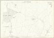
Oxfordshire XV.12 (includes: Duns Tew; Sandford St Martin; Steeple Barton; Westcott Barton; Worton) - 25 Inch Map
1 : 2500 Topographic maps Ordnance Survey Ordnance Survey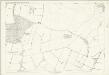
Oxfordshire XV.12 (includes: Duns Tew; Sandford St Martin; Steeple Barton; Westcott Barton; Worton) - 25 Inch Map
1 : 2500 Topographic maps Ordnance Survey Ordnance Survey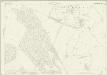
Oxfordshire XXI.11 (includes: Glympton; Kiddington with Asterleigh; Wootton) - 25 Inch Map
1 : 2500 Topographic maps Ordnance Survey Ordnance Survey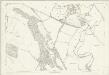
Oxfordshire XXI.11 (includes: Glympton; Kiddington with Asterleigh; Wootton) - 25 Inch Map
1 : 2500 Topographic maps Ordnance Survey Ordnance Survey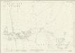
Oxfordshire XV.16 (includes: Steeple Aston; Steeple Barton; Westcott Barton) - 25 Inch Map
1 : 2500 Topographic maps Ordnance Survey Ordnance Survey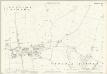
Oxfordshire XV.16 (includes: Steeple Aston; Steeple Barton; Westcott Barton) - 25 Inch Map
1 : 2500 Topographic maps Ordnance Survey Ordnance Survey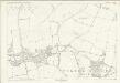
Oxfordshire XV.16 (includes: Steeple Aston; Steeple Barton; Westcott Barton) - 25 Inch Map
1 : 2500 Topographic maps Ordnance Survey Ordnance Survey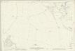
Oxfordshire XXI.4 (includes: Glympton; Kiddington with Asterleigh; Steeple Barton; Westcott Barton) - 25 Inch Map
1 : 2500 Topographic maps Ordnance Survey Ordnance Survey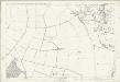
Oxfordshire XXI.4 (includes: Glympton; Kiddington with Asterleigh; Steeple Barton; Westcott Barton) - 25 Inch Map
1 : 2500 Topographic maps Ordnance Survey Ordnance Survey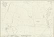
Oxfordshire XXI.8 (includes: Glympton; Steeple Barton; Wootton) - 25 Inch Map
1 : 2500 Topographic maps Ordnance Survey Ordnance Survey