Maps of Spernall

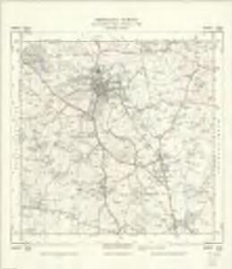
SP06 - OS 1:25,000 Provisional Series Map
1 : 25000 Topographic maps Ordnance Survey Ordnance Survey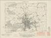
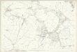
Worcestershire XXIII.NE - OS Six-Inch Map
1 : 10560 Topographic maps Ordnance Survey Ordnance Survey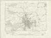
Warwickshire XXX.NE - OS Six-Inch Map
1 : 10560 Topographic maps Ordnance Survey Ordnance Survey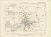
Warwickshire XXX.NE - OS Six-Inch Map
1 : 10560 Topographic maps Ordnance Survey Ordnance Survey
Worcestershire XXIII.NE - OS Six-Inch Map
1 : 10560 Topographic maps Ordnance Survey Ordnance Survey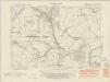
Warwickshire XXX.SE - OS Six-Inch Map
1 : 10560 Topographic maps Ordnance Survey Ordnance Survey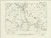
Warwickshire XXX.SE - OS Six-Inch Map
1 : 10560 Topographic maps Ordnance Survey Ordnance Survey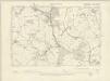
Warwickshire XXX.SE - OS Six-Inch Map
1 : 10560 Topographic maps Ordnance Survey Ordnance Survey
Warwickshire XXX.SE - OS Six-Inch Map
1 : 10560 Topographic maps Ordnance Survey Ordnance Survey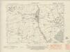
Warwickshire XXXVI.NE - OS Six-Inch Map
1 : 10560 Topographic maps Ordnance Survey Ordnance Survey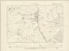
Warwickshire XXXVI.NE - OS Six-Inch Map
1 : 10560 Topographic maps Ordnance Survey Ordnance Survey
Worcestershire XXX.NE - OS Six-Inch Map
1 : 10560 Topographic maps Ordnance Survey Ordnance Survey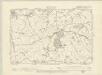
Warwickshire XXXI.NW - OS Six-Inch Map
1 : 10560 Topographic maps Ordnance Survey Ordnance Survey
Worcestershire XXIV.NW - OS Six-Inch Map
1 : 10560 Topographic maps Ordnance Survey Ordnance Survey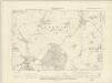
Warwickshire XXXI.SW - OS Six-Inch Map
1 : 10560 Topographic maps Ordnance Survey Ordnance Survey
Warwickshire XXXI.SW - OS Six-Inch Map
1 : 10560 Topographic maps Ordnance Survey Ordnance Survey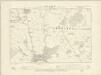
Warwickshire XXXVII.NW - OS Six-Inch Map
1 : 10560 Topographic maps Ordnance Survey Ordnance Survey
Warwickshire XXXVII.NW - OS Six-Inch Map
1 : 10560 Topographic maps Ordnance Survey Ordnance Survey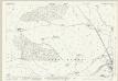
Worcestershire XXIII.3 (includes: Alvechurch; Redditch; Tutnall and Cobley) - 25 Inch Map
1 : 2500 Topographic maps Ordnance Survey Ordnance Survey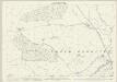
Worcestershire XXIII.3 (includes: Alvechurch; Redditch; Tutnall and Cobley) - 25 Inch Map
1 : 2500 Topographic maps Ordnance Survey Ordnance Survey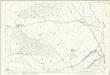
Worcestershire XXIII.3 (includes: Alvechurch; Redditch; Tutnall and Cobley) - 25 Inch Map
1 : 2500 Topographic maps Ordnance Survey Ordnance Survey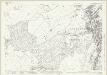
Worcestershire XXIII.7 (includes: Feckenham; Ipsley; Redditch; Tutnall and Cobley; Upper Ipsley) - 25 Inch Map
1 : 2500 Topographic maps Ordnance Survey Ordnance Survey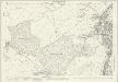
Worcestershire XXIII.7 (includes: Feckenham; Ipsley; Redditch; Tutnall and Cobley; Upper Ipsley) - 25 Inch Map
1 : 2500 Topographic maps Ordnance Survey Ordnance Survey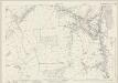
Worcestershire XXIII.11 (includes: Feckenham Urban; Feckenham; Ipsley; Redditch; Upper Ipsley) - 25 Inch Map
1 : 2500 Topographic maps Ordnance Survey Ordnance Survey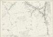
Worcestershire XXIII.11 (includes: Feckenham Urban; Feckenham; Ipsley; Redditch; Upper Ipsley) - 25 Inch Map
1 : 2500 Topographic maps Ordnance Survey Ordnance Survey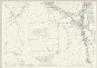
Worcestershire XXIII.11 (includes: Feckenham Urban; Feckenham; Ipsley; Redditch; Upper Ipsley) - 25 Inch Map
1 : 2500 Topographic maps Ordnance Survey Ordnance Survey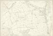
Worcestershire XXIII.11 (includes: Feckenham Urban; Feckenham; Ipsley; Redditch; Upper Ipsley) - 25 Inch Map
1 : 2500 Topographic maps Ordnance Survey Ordnance Survey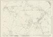
Worcestershire XXIII.15 (includes: Feckenham; Ipsley) - 25 Inch Map
1 : 2500 Topographic maps Ordnance Survey Ordnance Survey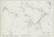
Warwickshire XXX.15 (includes: Feckenham; Ipsley) - 25 Inch Map
1 : 2500 Topographic maps Ordnance Survey Ordnance Survey
Worcestershire XXIII.15 (includes: Feckenham; Ipsley) - 25 Inch Map
1 : 2500 Topographic maps Ordnance Survey Ordnance Survey