Maps of Worcestershire

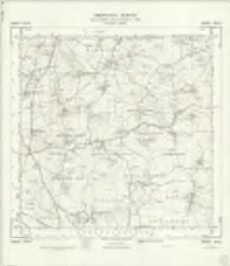
SO95 - OS 1:25,000 Provisional Series Map
1 : 25000 Topographic maps Ordnance Survey Ordnance Survey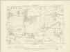
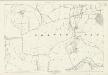
Worcestershire XXXIV.NE - OS Six-Inch Map
1 : 10560 Topographic maps Ordnance Survey Ordnance Survey
Worcestershire XXXIV.NE - OS Six-Inch Map
1 : 10560 Topographic maps Ordnance Survey Ordnance Survey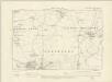
Worcestershire XXXIV.SE - OS Six-Inch Map
1 : 10560 Topographic maps Ordnance Survey Ordnance Survey
Worcestershire XXXIV.SE - OS Six-Inch Map
1 : 10560 Topographic maps Ordnance Survey Ordnance Survey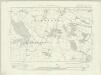
Worcestershire XXIX.SE - OS Six-Inch Map
1 : 10560 Topographic maps Ordnance Survey Ordnance Survey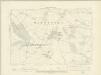
Worcestershire XXIX.SE - OS Six-Inch Map
1 : 10560 Topographic maps Ordnance Survey Ordnance Survey
Worcestershire XXIX.SE - OS Six-Inch Map
1 : 10560 Topographic maps Ordnance Survey Ordnance Survey
Worcestershire XXXV.NW - OS Six-Inch Map
1 : 10560 Topographic maps Ordnance Survey Ordnance Survey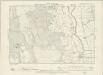
Warwickshire XLII.NW - OS Six-Inch Map
1 : 10560 Topographic maps Ordnance Survey Ordnance Survey
Worcestershire XXXV.NW - OS Six-Inch Map
1 : 10560 Topographic maps Ordnance Survey Ordnance Survey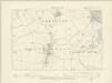
Worcestershire XXXV.SW - OS Six-Inch Map
1 : 10560 Topographic maps Ordnance Survey Ordnance Survey
Worcestershire XXXV.SW - OS Six-Inch Map
1 : 10560 Topographic maps Ordnance Survey Ordnance Survey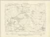
Worcestershire XXX.SW - OS Six-Inch Map
1 : 10560 Topographic maps Ordnance Survey Ordnance Survey
Worcestershire XXX.SW - OS Six-Inch Map
1 : 10560 Topographic maps Ordnance Survey Ordnance Survey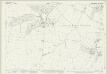
Worcestershire XXIX.15 (includes: Crowle; Himbleton; Huddington; Oddingley) - 25 Inch Map
1 : 2500 Topographic maps Ordnance Survey Ordnance Survey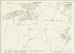
Worcestershire XXIX.15 (includes: Crowle; Himbleton; Huddington; Oddingley) - 25 Inch Map
1 : 2500 Topographic maps Ordnance Survey Ordnance Survey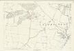
Worcestershire XXIX.15 (includes: Crowle; Himbleton; Huddington; Oddingley) - 25 Inch Map
1 : 2500 Topographic maps Ordnance Survey Ordnance Survey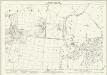
Worcestershire XXXIV.3 (includes: Broughton Hackett; Crowle; Grafton Flyford; Huddington; Upton Snodbury) - 25 Inch Map
1 : 2500 Topographic maps Ordnance Survey Ordnance Survey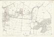
Worcestershire XXXIV.3 (includes: Broughton Hackett; Crowle; Grafton Flyford; Huddington; Upton Snodbury) - 25 Inch Map
1 : 2500 Topographic maps Ordnance Survey Ordnance Survey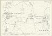
Worcestershire XXXIV.7 (includes: Broughton Hackett; Churchill; Crowle; Grafton Flyford; Upton Snodbury) - 25 Inch Map
1 : 2500 Topographic maps Ordnance Survey Ordnance Survey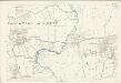
Worcestershire XXXIV.7 (includes: Broughton Hackett; Churchill; Crowle; Grafton Flyford; Upton Snodbury) - 25 Inch Map
1 : 2500 Topographic maps Ordnance Survey Ordnance Survey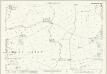
Worcestershire XXXIV.11 (includes: Churchill; Peopleton; Upton Snodbury; White Ladies Aston) - 25 Inch Map
1 : 2500 Topographic maps Ordnance Survey Ordnance Survey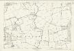
Worcestershire XXXIV.11 (includes: Churchill; Peopleton; Upton Snodbury; White Ladies Aston) - 25 Inch Map
1 : 2500 Topographic maps Ordnance Survey Ordnance Survey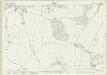
Worcestershire XXIX.16 (includes: Grafton Flyford; Hanbury; Himbleton; Huddington) - 25 Inch Map
1 : 2500 Topographic maps Ordnance Survey Ordnance Survey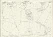
Worcestershire XXIX.16 (includes: Grafton Flyford; Hanbury; Himbleton; Huddington) - 25 Inch Map
1 : 2500 Topographic maps Ordnance Survey Ordnance Survey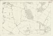
Worcestershire XXIX.16 (includes: Grafton Flyford; Hanbury; Himbleton; Huddington) - 25 Inch Map
1 : 2500 Topographic maps Ordnance Survey Ordnance Survey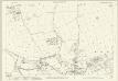
Worcestershire XXXIV.15 (includes: Peopleton; Stoulton; White Ladies Aston) - 25 Inch Map
1 : 2500 Topographic maps Ordnance Survey Ordnance Survey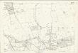
Worcestershire XXXIV.15 (includes: Peopleton; Stoulton; White Ladies Aston) - 25 Inch Map
1 : 2500 Topographic maps Ordnance Survey Ordnance Survey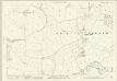
Worcestershire XXXIV.4 (includes: Crowle; Grafton Flyford; Huddington; North Piddle; Upton Snodbury) - 25 Inch Map
1 : 2500 Topographic maps Ordnance Survey Ordnance Survey