Maps of Birley with Upper Hill

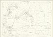
SO45 - OS 1:25,000 Provisional Series Map
1 : 25000 Topographic maps Ordnance Survey Ordnance Survey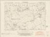
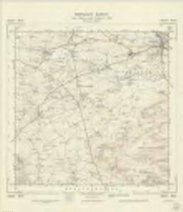
Herefordshire XIX.NW - OS Six-Inch Map
1 : 10560 Topographic maps Ordnance Survey Ordnance Survey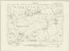
Herefordshire XIX.NW - OS Six-Inch Map
1 : 10560 Topographic maps Ordnance Survey Ordnance Survey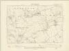
Herefordshire XIX.NW - OS Six-Inch Map
1 : 10560 Topographic maps Ordnance Survey Ordnance Survey
Herefordshire XIX.NW - OS Six-Inch Map
1 : 10560 Topographic maps Ordnance Survey Ordnance Survey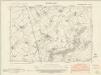
Herefordshire XIX.SW - OS Six-Inch Map
1 : 10560 Topographic maps Ordnance Survey Ordnance Survey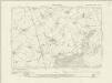
Herefordshire XIX.SW - OS Six-Inch Map
1 : 10560 Topographic maps Ordnance Survey Ordnance Survey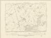
Herefordshire XIX.SW - OS Six-Inch Map
1 : 10560 Topographic maps Ordnance Survey Ordnance Survey
Herefordshire XIX.SW - OS Six-Inch Map
1 : 10560 Topographic maps Ordnance Survey Ordnance Survey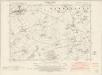
Herefordshire XVIII.NE - OS Six-Inch Map
1 : 10560 Topographic maps Ordnance Survey Ordnance Survey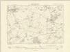
Herefordshire XVIII.NE - OS Six-Inch Map
1 : 10560 Topographic maps Ordnance Survey Ordnance Survey
Herefordshire XVIII.NE - OS Six-Inch Map
1 : 10560 Topographic maps Ordnance Survey Ordnance Survey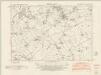
Herefordshire XVIII.SE - OS Six-Inch Map
1 : 10560 Topographic maps Ordnance Survey Ordnance Survey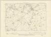
Herefordshire XVIII.SE - OS Six-Inch Map
1 : 10560 Topographic maps Ordnance Survey Ordnance Survey
Herefordshire XVIII.SE - OS Six-Inch Map
1 : 10560 Topographic maps Ordnance Survey Ordnance Survey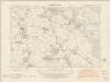
Herefordshire XXVI.NW - OS Six-Inch Map
1 : 10560 Topographic maps Ordnance Survey Ordnance Survey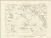
Herefordshire XXVI.NW - OS Six-Inch Map
1 : 10560 Topographic maps Ordnance Survey Ordnance Survey
Herefordshire XXVI.NW - OS Six-Inch Map
1 : 10560 Topographic maps Ordnance Survey Ordnance Survey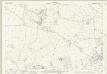
Herefordshire XII.14 (includes: Kingsland; Leominster Out; Monkland) - 25 Inch Map
1 : 2500 Topographic maps Ordnance Survey Ordnance Survey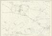
Herefordshire XII.14 (includes: Kingsland; Leominster Out; Monkland) - 25 Inch Map
1 : 2500 Topographic maps Ordnance Survey Ordnance Survey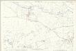
Herefordshire XII.14 (includes: Kingsland; Leominster Out; Monkland) - 25 Inch Map
1 : 2500 Topographic maps Ordnance Survey Ordnance Survey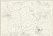
Herefordshire XIX.2 (includes: Leominster Out; Monkland) - 25 Inch Map
1 : 2500 Topographic maps Ordnance Survey Ordnance Survey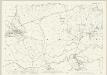
Herefordshire XIX.2 (includes: Leominster Out; Monkland) - 25 Inch Map
1 : 2500 Topographic maps Ordnance Survey Ordnance Survey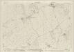
Herefordshire XIX.6 (includes: Leominster Out; Monkland) - 25 Inch Map
1 : 2500 Topographic maps Ordnance Survey Ordnance Survey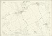
Herefordshire XIX.6 (includes: Leominster Out; Monkland) - 25 Inch Map
1 : 2500 Topographic maps Ordnance Survey Ordnance Survey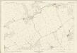
Herefordshire XIX.6 (includes: Leominster Out; Monkland) - 25 Inch Map
1 : 2500 Topographic maps Ordnance Survey Ordnance Survey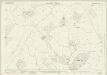
Herefordshire XIX.10 (includes: Birley; Hope Under Dinmore; Leominster Out) - 25 Inch Map
1 : 2500 Topographic maps Ordnance Survey Ordnance Survey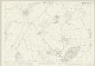
Herefordshire XIX.10 (includes: Birley; Hope Under Dinmore; Leominster Out) - 25 Inch Map
1 : 2500 Topographic maps Ordnance Survey Ordnance Survey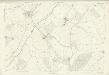
Herefordshire XIX.10 (includes: Birley; Hope Under Dinmore; Leominster Out) - 25 Inch Map
1 : 2500 Topographic maps Ordnance Survey Ordnance Survey
Herefordshire XII.13 (includes: Eardisland; Kingsland; Leominster Out; Monkland) - 25 Inch Map
1 : 2500 Topographic maps Ordnance Survey Ordnance Survey