Maps of Wales

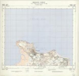
SH78 & Parts of SH88 - OS 1:25,000 Provisional Series Map
1 : 25000 Topographic maps Ordnance Survey Ordnance Survey
Caernarvonshire I.SE - OS Six-Inch Map
1 : 10560 Topographic maps Ordnance Survey Ordnance Survey
Caernarvonshire I.SE - OS Six-Inch Map
1 : 10560 Topographic maps Ordnance Survey Ordnance Survey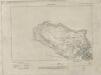
Caernarvonshire I.SE - OS Six-Inch Map
1 : 10560 Topographic maps Ordnance Survey Ordnance Survey
Caernarvonshire I.SE - OS Six-Inch Map
1 : 10560 Topographic maps Ordnance Survey Ordnance Survey
Caernarvonshire I.SE - OS Six-Inch Map
1 : 10560 Topographic maps Ordnance Survey Ordnance Survey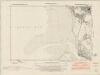
Caernarvonshire IV.NE - OS Six-Inch Map
1 : 10560 Topographic maps Ordnance Survey Ordnance Survey
Caernarvonshire IV.NE - OS Six-Inch Map
1 : 10560 Topographic maps Ordnance Survey Ordnance Survey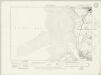
Caernarvonshire IV.NE - OS Six-Inch Map
1 : 10560 Topographic maps Ordnance Survey Ordnance Survey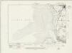
Caernarvonshire IV.NE - OS Six-Inch Map
1 : 10560 Topographic maps Ordnance Survey Ordnance Survey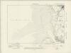
Caernarvonshire IV.NE - OS Six-Inch Map
1 : 10560 Topographic maps Ordnance Survey Ordnance Survey
Caernarvonshire IV.NE - OS Six-Inch Map
1 : 10560 Topographic maps Ordnance Survey Ordnance Survey
Caernarvonshire IV.NE - OS Six-Inch Map
1 : 10560 Topographic maps Ordnance Survey Ordnance Survey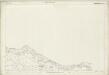
Caernarvonshire I.12 (includes: Llandudno Cum Eglwys Rhos) - 25 Inch Map
1 : 2500 Topographic maps Ordnance Survey Ordnance Survey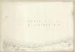
Caernarvonshire II.13 (includes: Llandudno Cum Eglwys Rhos) - 25 Inch Map
1 : 2500 Topographic maps Ordnance Survey Ordnance Survey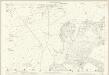
Caernarvonshire V.1 (includes: Llandudno Cum Eglwys Rhos) - 25 Inch Map
1 : 2500 Topographic maps Ordnance Survey Ordnance Survey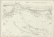
Caernarvonshire IV.5 & 1 (includes: Llandrillo Yn Rhos) - 25 Inch Map
1 : 2500 Topographic maps Ordnance Survey Ordnance Survey
Denbighshire I.SW & SE - OS Six-Inch Map
1 : 10560 Topographic maps Ordnance Survey Ordnance Survey
Denbighshire I.SW & SE - OS Six-Inch Map
1 : 10560 Topographic maps Ordnance Survey Ordnance Survey
Denbighshire I.SW & SE - OS Six-Inch Map
1 : 10560 Topographic maps Ordnance Survey Ordnance Survey
Denbighshire I.SW & SE - OS Six-Inch Map
1 : 10560 Topographic maps Ordnance Survey Ordnance Survey
Caernarvonshire II.SW - OS Six-Inch Map
1 : 10560 Topographic maps Ordnance Survey Ordnance Survey
Caernarvonshire II.SW - OS Six-Inch Map
1 : 10560 Topographic maps Ordnance Survey Ordnance Survey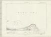
Caernarvonshire II.SW - OS Six-Inch Map
1 : 10560 Topographic maps Ordnance Survey Ordnance Survey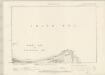
Caernarvonshire II.SW - OS Six-Inch Map
1 : 10560 Topographic maps Ordnance Survey Ordnance Survey
Caernarvonshire II.SW - OS Six-Inch Map
1 : 10560 Topographic maps Ordnance Survey Ordnance Survey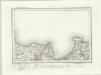
Beaumaris (Outline) - OS One-Inch Revised New Series
1 : 63360 Topographic maps Ordnance Survey Ordnance Survey
Beaumaris (Hills) - OS One-Inch Revised New Series
1 : 63360 Topographic maps Ordnance Survey Ordnance Survey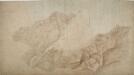
Conway
1 : 31680 This plan of the Menai Strait extends along the coastline of Conway Bay from Penmaenmawr to Conway. Triangles are ruled in ink and pencil across the map, allowing the location of individual topographical features to be plotted. Colour washes depicting relief are combined with numerical annotations ('spot heights') indicating the heights of the hills. The brown ink used for place names and heights has smudged, making legibility poor overall. An area calculation table survives in black ink in the top left margin, below the formal title. Dawson, Robert