Maps of Wales

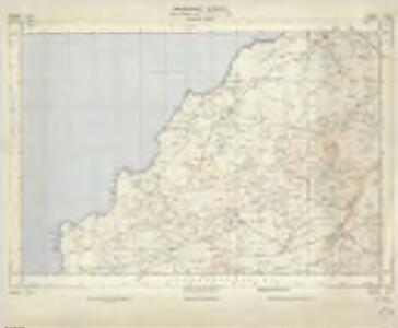
SH23 & Parts of SH13 - OS 1:25,000 Provisional Series Map
1 : 25000 Topographic maps Ordnance Survey Ordnance Survey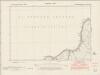
Caernarvonshire XXXVIII.SE - OS Six-Inch Map
1 : 10560 Topographic maps Ordnance Survey Ordnance Survey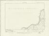
Caernarvonshire XXXVIII.SE - OS Six-Inch Map
1 : 10560 Topographic maps Ordnance Survey Ordnance Survey
Caernarvonshire XXXVIII.SE - OS Six-Inch Map
1 : 10560 Topographic maps Ordnance Survey Ordnance Survey
Caernarvonshire XXXVIII.SE - OS Six-Inch Map
1 : 10560 Topographic maps Ordnance Survey Ordnance Survey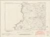
Caernarvonshire XLIII.NE - OS Six-Inch Map
1 : 10560 Topographic maps Ordnance Survey Ordnance Survey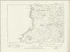
Caernarvonshire XLIII.NE - OS Six-Inch Map
1 : 10560 Topographic maps Ordnance Survey Ordnance Survey
Caernarvonshire XLIII.NE - OS Six-Inch Map
1 : 10560 Topographic maps Ordnance Survey Ordnance Survey
Caernarvonshire XLIII.NE - OS Six-Inch Map
1 : 10560 Topographic maps Ordnance Survey Ordnance Survey
Caernarvonshire XXXVIII.15 (includes: Aberdaron) - 25 Inch Map
1 : 2500 Topographic maps Ordnance Survey Ordnance Survey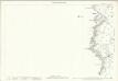
Caernarvonshire XLIII.3 (includes: Aberdaron) - 25 Inch Map
1 : 2500 Topographic maps Ordnance Survey Ordnance Survey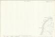
Caernarvonshire XXXVIII.12 (includes: Tudweiliog) - 25 Inch Map
1 : 2500 Topographic maps Ordnance Survey Ordnance Survey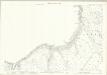
Caernarvonshire XXXVIII.16 (includes: Aberdaron; Tudweiliog) - 25 Inch Map
1 : 2500 Topographic maps Ordnance Survey Ordnance Survey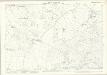
Caernarvonshire XLIII.4 (includes: Aberdaron; Botwnnog; Tudweiliog) - 25 Inch Map
1 : 2500 Topographic maps Ordnance Survey Ordnance Survey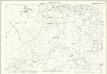
Caernarvonshire XLIII.8 (includes: Aberdaron) - 25 Inch Map
1 : 2500 Topographic maps Ordnance Survey Ordnance Survey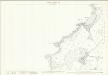
Caernarvonshire XLIII.7 (includes: Aberdaron) - 25 Inch Map
1 : 2500 Topographic maps Ordnance Survey Ordnance Survey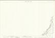
Caernarvonshire XXXIX.1 (includes: Tudweiliog) - 25 Inch Map
1 : 2500 Topographic maps Ordnance Survey Ordnance Survey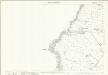
Caernarvonshire XXXIX.5 (includes: Tudweiliog) - 25 Inch Map
1 : 2500 Topographic maps Ordnance Survey Ordnance Survey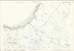
Caernarvonshire XXXIX.9 (includes: Botwnnog; Tudweiliog) - 25 Inch Map
1 : 2500 Topographic maps Ordnance Survey Ordnance Survey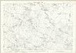
Caernarvonshire XXXIX.13 (includes: Botwnnog; Tudweiliog) - 25 Inch Map
1 : 2500 Topographic maps Ordnance Survey Ordnance Survey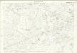
Caernarvonshire XLIV.1 (includes: Aberdaron; Botwnnog; Tudweiliog) - 25 Inch Map
1 : 2500 Topographic maps Ordnance Survey Ordnance Survey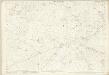
Caernarvonshire XLIV.1 (includes: Aberdaron; Botwnnog; Tudweiliog) - 25 Inch Map
1 : 2500 Topographic maps Ordnance Survey Ordnance Survey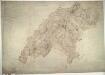
Pwllheli
1 : 31680 This is a plan,of a coastal section of the Lleyn Peninsula in,Wales., The numerical annotations, or spot heights, shown in red ink at the top of hills and eminences,are trigonometrically tested altitudes. This drawing is formally titled and the area of the land recorded,as 100.8 square miles. The manuscript paper carries a watermark from the James Whatman Turkey Mill, Kent, dated 1814. Dawson, Robert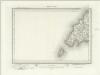
Bardsey Island (Outline) - OS One-Inch Revised New Series
1 : 63360 Topographic maps Ordnance Survey Ordnance Survey
Bardsey Island (Hills) - OS One-Inch Revised New Series
1 : 63360 Topographic maps Ordnance Survey Ordnance Survey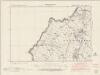
Caernarvonshire XXXIX.NW - OS Six-Inch Map
1 : 10560 Topographic maps Ordnance Survey Ordnance Survey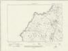
Caernarvonshire XXXIX.NW - OS Six-Inch Map
1 : 10560 Topographic maps Ordnance Survey Ordnance Survey
Caernarvonshire XXXIX.NW - OS Six-Inch Map
1 : 10560 Topographic maps Ordnance Survey Ordnance Survey
Caernarvonshire XXXIX.NW - OS Six-Inch Map
1 : 10560 Topographic maps Ordnance Survey Ordnance Survey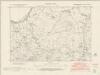
Caernarvonshire XXXIX.SW - OS Six-Inch Map
1 : 10560 Topographic maps Ordnance Survey Ordnance Survey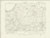
Caernarvonshire XXXIX.SW - OS Six-Inch Map
1 : 10560 Topographic maps Ordnance Survey Ordnance Survey
Caernarvonshire XXXIX.SW - OS Six-Inch Map
1 : 10560 Topographic maps Ordnance Survey Ordnance Survey