Maps of Anglesey

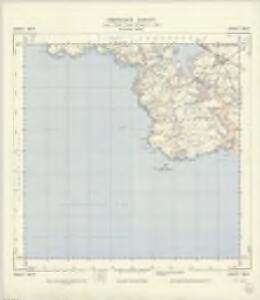
SH27 - OS 1:25,000 Provisional Series Map
1 : 25000 Topographic maps Ordnance Survey Ordnance Survey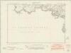
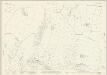
Anglesey XI.SW - OS Six-Inch Map
1 : 10560 Topographic maps Ordnance Survey Ordnance Survey
Anglesey XI.SW - OS Six-Inch Map
1 : 10560 Topographic maps Ordnance Survey Ordnance Survey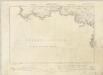
Anglesey XI.SW - OS Six-Inch Map
1 : 10560 Topographic maps Ordnance Survey Ordnance Survey
Anglesey XI.SW - OS Six-Inch Map
1 : 10560 Topographic maps Ordnance Survey Ordnance Survey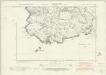
Anglesey XVI.NW & NE - OS Six-Inch Map
1 : 10560 Topographic maps Ordnance Survey Ordnance Survey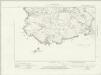
Anglesey XVI.NW & NE - OS Six-Inch Map
1 : 10560 Topographic maps Ordnance Survey Ordnance Survey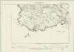
Anglesey XVI.NW & NE - OS Six-Inch Map
1 : 10560 Topographic maps Ordnance Survey Ordnance Survey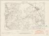
Anglesey XI.SE - OS Six-Inch Map
1 : 10560 Topographic maps Ordnance Survey Ordnance Survey
Anglesey XI.SE - OS Six-Inch Map
1 : 10560 Topographic maps Ordnance Survey Ordnance Survey
Anglesey XI.SE - OS Six-Inch Map
1 : 10560 Topographic maps Ordnance Survey Ordnance Survey
Anglesey XI.SE - OS Six-Inch Map
1 : 10560 Topographic maps Ordnance Survey Ordnance Survey
Anglesey XVI.NE - OS Six-Inch Map
1 : 10560 Topographic maps Ordnance Survey Ordnance Survey
Anglesey XI.9 (includes: Holyhead Rural) - 25 Inch Map
1 : 2500 Topographic maps Ordnance Survey Ordnance Survey
Anglesey XI.10 (includes: Holyhead Rural) - 25 Inch Map
1 : 2500 Topographic maps Ordnance Survey Ordnance Survey
Anglesey XI.14 (includes: Holyhead Rural) - 25 Inch Map
1 : 2500 Topographic maps Ordnance Survey Ordnance Survey
Anglesey XI.11 (includes: Holyhead Rural; Llanynghenedl; Rhoscolyn) - 25 Inch Map
1 : 2500 Topographic maps Ordnance Survey Ordnance Survey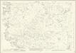
Anglesey XI.15 (includes: Holyhead Rural; Rhoscolyn) - 25 Inch Map
1 : 2500 Topographic maps Ordnance Survey Ordnance Survey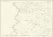
Anglesey XVI.3 (includes: Rhoscolyn) - 25 Inch Map
1 : 2500 Topographic maps Ordnance Survey Ordnance Survey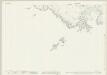
Anglesey XVI.7 (includes: Rhoscolyn) - 25 Inch Map
1 : 2500 Topographic maps Ordnance Survey Ordnance Survey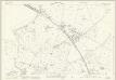
Anglesey XI.12 (includes: Holyhead Rural; Llanfair Yn Neubwll; Llanynghenedl; Rhoscolyn) - 25 Inch Map
1 : 2500 Topographic maps Ordnance Survey Ordnance Survey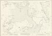
Anglesey XI.16 (includes: Llanfair Yn Neubwll; Llanynghenedl; Rhoscolyn) - 25 Inch Map
1 : 2500 Topographic maps Ordnance Survey Ordnance Survey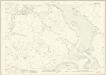
Anglesey XVI.4 (includes: Llanfair Yn Neubwll; Rhoscolyn) - 25 Inch Map
1 : 2500 Topographic maps Ordnance Survey Ordnance Survey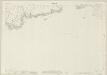
Anglesey XVI.8 (includes: Llanfair Yn Neubwll; Rhoscolyn) - 25 Inch Map
1 : 2500 Topographic maps Ordnance Survey Ordnance Survey
Llangefni
1 : 31680 .This plan of south Anglesey,extends from,Cymran Bay to the Menai Strait on the left of the map, and inland to Llangefni,on the right. ,Black-ink numbers, visible on high spots, indicate the,height of hills., Archaeological details are recorded in black gothic lettering., An area calculation table survives in black ink,in the top left margin. The circular hole in the top right-hand corner,shows an,'Ordnance Office Copy' blind stamp has been removed from the manuscript. Dawson, Robert
Carnarvon (Hills) - OS One-Inch Revised New Series
1 : 63360 Topographic maps Ordnance Survey Ordnance Survey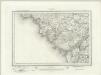
Carnarvon (Outline) - OS One-Inch Revised New Series
1 : 63360 Topographic maps Ordnance Survey Ordnance Survey
Holyhead
1 : 31680 .This plan of north Angelsey runs from Holyhead Bay,on the left, to Red Wharf Bay,on the right., Black-ink numbers,are visible on high spots, indicating the,heights of hills., Archaeological details are noted in black gothic lettering. An area calculation table survives in black ink,in the top left margin. Dawson, Robert
Anglesey XI.5 (includes: Holyhead Rural) - 25 Inch Map
1 : 2500 Topographic maps Ordnance Survey Ordnance Survey