Maps of North Yorkshire

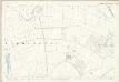
SE47 - OS 1:25,000 Provisional Series Map
1 : 25000 Topographic maps Ordnance Survey Ordnance Survey
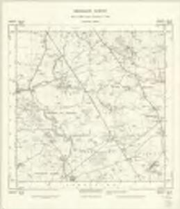
Yorkshire 103 - OS Six-Inch Map
1 : 10560 Topographic maps Ordnance Survey Ordnance Survey
Yorkshire CIII.SE - OS Six-Inch Map
1 : 10560 Topographic maps Ordnance Survey Ordnance Survey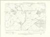
Yorkshire CXX.NE - OS Six-Inch Map
1 : 10560 Topographic maps Ordnance Survey Ordnance Survey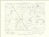
Yorkshire CIII.NE - OS Six-Inch Map
1 : 10560 Topographic maps Ordnance Survey Ordnance Survey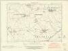
Yorkshire CIV.SW - OS Six-Inch Map
1 : 10560 Topographic maps Ordnance Survey Ordnance Survey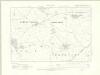
Yorkshire CIV.SW - OS Six-Inch Map
1 : 10560 Topographic maps Ordnance Survey Ordnance Survey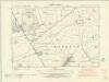
Yorkshire CXXI.NW - OS Six-Inch Map
1 : 10560 Topographic maps Ordnance Survey Ordnance Survey
Yorkshire CXXI.NW - OS Six-Inch Map
1 : 10560 Topographic maps Ordnance Survey Ordnance Survey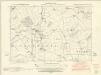
Yorkshire CIV.NW - OS Six-Inch Map
1 : 10560 Topographic maps Ordnance Survey Ordnance Survey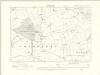
Yorkshire CIV.NW - OS Six-Inch Map
1 : 10560 Topographic maps Ordnance Survey Ordnance Survey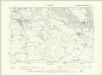
Yorkshire CIV.NW - OS Six-Inch Map
1 : 10560 Topographic maps Ordnance Survey Ordnance Survey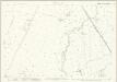
Yorkshire CIII.7 (includes: Dalton; Sowerby; Topcliffe) - 25 Inch Map
1 : 2500 Topographic maps Ordnance Survey Ordnance Survey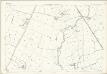
Yorkshire CIII.7 (includes: Dalton; Sowerby; Topcliffe) - 25 Inch Map
1 : 2500 Topographic maps Ordnance Survey Ordnance Survey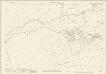
Yorkshire CIII.11 (includes: Dalton; Eldmire With Crakehill; Topcliffe) - 25 Inch Map
1 : 2500 Topographic maps Ordnance Survey Ordnance Survey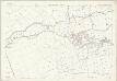
Yorkshire CIII.11 (includes: Dalton; Eldmire With Crakehill; Topcliffe) - 25 Inch Map
1 : 2500 Topographic maps Ordnance Survey Ordnance Survey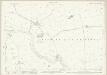
Yorkshire CIII.15 (includes: Asenby; Cundall With Leckby; Eldmire With Crakehill; Topcliffe) - 25 Inch Map
1 : 2500 Topographic maps Ordnance Survey Ordnance Survey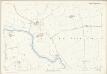
Yorkshire CIII.15 (includes: Asenby; Cundall With Leckby; Eldmire With Crakehill; Topcliffe) - 25 Inch Map
1 : 2500 Topographic maps Ordnance Survey Ordnance Survey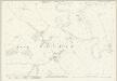
Yorkshire CXX.3 (includes: Cundall With Leckby; Eldmire With Crakehill; Fawdington) - 25 Inch Map
1 : 2500 Topographic maps Ordnance Survey Ordnance Survey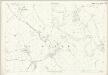
Yorkshire CXX.3 (includes: Cundall With Leckby; Eldmire With Crakehill; Fawdington) - 25 Inch Map
1 : 2500 Topographic maps Ordnance Survey Ordnance Survey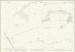
Yorkshire CIII.8 (includes: Bagby; Dalton; Sessay; Sowerby; Thirkleby) - 25 Inch Map
1 : 2500 Topographic maps Ordnance Survey Ordnance Survey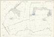
Yorkshire CIII.8 (includes: Bagby; Dalton; Sessay; Sowerby; Thirkleby) - 25 Inch Map
1 : 2500 Topographic maps Ordnance Survey Ordnance Survey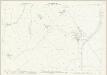
Yorkshire CXX.7 (includes: Brafferton; Cundall With Leckby; Norton Le Clay; Thornton Bridge) - 25 Inch Map
1 : 2500 Topographic maps Ordnance Survey Ordnance Survey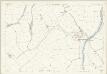
Yorkshire CXX.7 (includes: Brafferton; Cundall With Leckby; Norton Le Clay; Thornton Bridge) - 25 Inch Map
1 : 2500 Topographic maps Ordnance Survey Ordnance Survey
Yorkshire CIII.12 (includes: Dalton; Eldmire With Crakehill; Hutton Sessay; Sessay) - 25 Inch Map
1 : 2500 Topographic maps Ordnance Survey Ordnance Survey
Yorkshire CIII.12 (includes: Dalton; Eldmire With Crakehill; Hutton Sessay; Sessay) - 25 Inch Map
1 : 2500 Topographic maps Ordnance Survey Ordnance Survey
Yorkshire CIII.16 (includes: Dalton; Eldmire With Crakehill; Sessay) - 25 Inch Map
1 : 2500 Topographic maps Ordnance Survey Ordnance Survey
Yorkshire CIII.16 (includes: Dalton; Eldmire With Crakehill; Sessay) - 25 Inch Map
1 : 2500 Topographic maps Ordnance Survey Ordnance Survey
Yorkshire CXX.4 (includes: Brafferton; Cundall With Leckby; Eldmire With Crakehill; Fawdington; Sessay) - 25 Inch Map
1 : 2500 Topographic maps Ordnance Survey Ordnance Survey