Maps of North Yorkshire

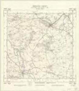
SE28 - OS 1:25,000 Provisional Series Map
1 : 25000 Topographic maps Ordnance Survey Ordnance Survey
Yorkshire 85 - OS Six-Inch Map
1 : 10560 Topographic maps Ordnance Survey Ordnance Survey
Yorkshire LXIX.SE - OS Six-Inch Map
1 : 10560 Topographic maps Ordnance Survey Ordnance Survey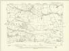
Yorkshire LXIX.SE - OS Six-Inch Map
1 : 10560 Topographic maps Ordnance Survey Ordnance Survey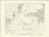
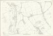
Yorkshire LXXXV.NE - OS Six-Inch Map
1 : 10560 Topographic maps Ordnance Survey Ordnance Survey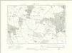
Yorkshire LXXXV.NE - OS Six-Inch Map
1 : 10560 Topographic maps Ordnance Survey Ordnance Survey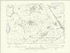
Yorkshire LXXXV.NE - OS Six-Inch Map
1 : 10560 Topographic maps Ordnance Survey Ordnance Survey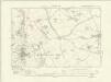
Yorkshire LXXXV.SE - OS Six-Inch Map
1 : 10560 Topographic maps Ordnance Survey Ordnance Survey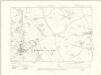
Yorkshire LXXXV.SE - OS Six-Inch Map
1 : 10560 Topographic maps Ordnance Survey Ordnance Survey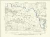
Yorkshire LXXXV.SE - OS Six-Inch Map
1 : 10560 Topographic maps Ordnance Survey Ordnance Survey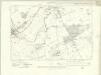
Yorkshire LXX.SW - OS Six-Inch Map
1 : 10560 Topographic maps Ordnance Survey Ordnance Survey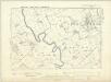
Yorkshire LXX.SW - OS Six-Inch Map
1 : 10560 Topographic maps Ordnance Survey Ordnance Survey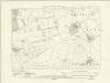
Yorkshire LXXXVI.NW - OS Six-Inch Map
1 : 10560 Topographic maps Ordnance Survey Ordnance Survey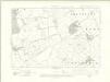
Yorkshire LXXXVI.NW - OS Six-Inch Map
1 : 10560 Topographic maps Ordnance Survey Ordnance Survey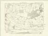
Yorkshire LXXXVI.SW - OS Six-Inch Map
1 : 10560 Topographic maps Ordnance Survey Ordnance Survey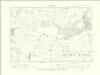
Yorkshire LXXXVI.SW - OS Six-Inch Map
1 : 10560 Topographic maps Ordnance Survey Ordnance Survey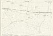
Yorkshire LXIX.11 (includes: Burrill With Cowling; Crakehall; Newton Le Willows) - 25 Inch Map
1 : 2500 Topographic maps Ordnance Survey Ordnance Survey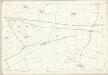
Yorkshire LXIX.11 (includes: Burrill With Cowling; Crakehall; Newton Le Willows) - 25 Inch Map
1 : 2500 Topographic maps Ordnance Survey Ordnance Survey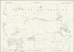
Yorkshire LXIX.15 (includes: Bedale; Burrill With Cowling; Thirn; Thornton Watlass) - 25 Inch Map
1 : 2500 Topographic maps Ordnance Survey Ordnance Survey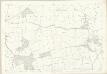
Yorkshire LXIX.15 (includes: Bedale; Burrill With Cowling; Thirn; Thornton Watlass) - 25 Inch Map
1 : 2500 Topographic maps Ordnance Survey Ordnance Survey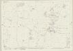
Yorkshire LXXXV.3 (includes: Burrill With Cowling; Clifton Upon Ure; Thirn; Thornton Watlass) - 25 Inch Map
1 : 2500 Topographic maps Ordnance Survey Ordnance Survey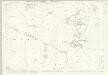
Yorkshire LXXXV.3 (includes: Burrill With Cowling; Clifton Upon Ure; Thirn; Thornton Watlass) - 25 Inch Map
1 : 2500 Topographic maps Ordnance Survey Ordnance Survey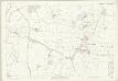
Yorkshire LXXXV.3 (includes: Burrill With Cowling; Clifton Upon Ure; Thirn; Thornton Watlass) - 25 Inch Map
1 : 2500 Topographic maps Ordnance Survey Ordnance Survey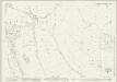
Yorkshire LXXXV.7 (includes: Burton Upon Ure; Clifton Upon Ure; Masham; Snape; Thirn; Thornton Watlass) - 25 Inch Map
1 : 2500 Topographic maps Ordnance Survey Ordnance Survey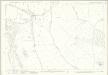
Yorkshire LXXXV.7 (includes: Burton Upon Ure; Clifton Upon Ure; Masham; Snape; Thirn; Thornton Watlass) - 25 Inch Map
1 : 2500 Topographic maps Ordnance Survey Ordnance Survey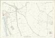
Yorkshire LXXXV.7 (includes: Burton Upon Ure; Clifton Upon Ure; Masham; Snape; Thirn; Thornton Watlass) - 25 Inch Map
1 : 2500 Topographic maps Ordnance Survey Ordnance Survey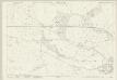
Yorkshire LXIX.12 (includes: Aiskew; Bedale; Burrill With Cowling; Crakehall; Rand Grange) - 25 Inch Map
1 : 2500 Topographic maps Ordnance Survey Ordnance Survey
Yorkshire LXIX.12 (includes: Aiskew; Bedale; Burrill With Cowling; Crakehall; Rand Grange) - 25 Inch Map
1 : 2500 Topographic maps Ordnance Survey Ordnance Survey
Yorkshire LXXXV.11 (includes: Burton Upon Ure; Masham; Snape) - 25 Inch Map
1 : 2500 Topographic maps Ordnance Survey Ordnance Survey
Yorkshire LXXXV.11 (includes: Burton Upon Ure; Masham; Snape) - 25 Inch Map
1 : 2500 Topographic maps Ordnance Survey Ordnance Survey